Property Record
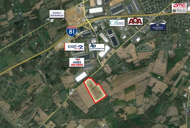
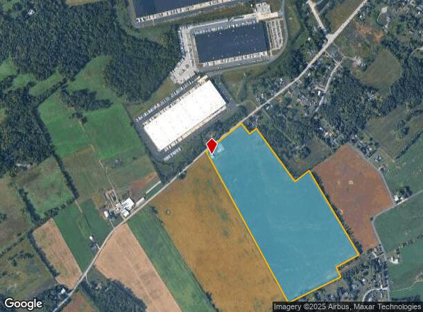
1744 Walnut Bottom Rd, Carlisle, PA 17015
NEARBY LISTINGS FOR SALE OR LEASE
Property Detail
1744 Walnut Bottom Rd
Harrisburg-Carlisle, PA
Almos L Jones
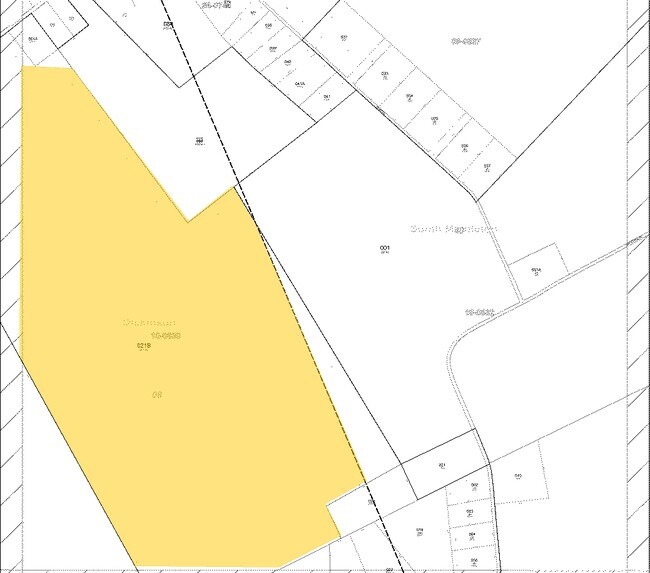
08-10-0630-021B
TR 1 PB 35 PG 7
Agriculturalnec
Cumberland
X
Pennsylvania
42041C0240F
87.10 AC
2025
Harrisburg Area West
2025
Philadelphia
012400
DEMOGRAPHICS near 1744 Walnut Bottom Rd
1 Mile
3 Mile
5 Mile
2024 Total Population
632
9,399
44,524
2029 Population
662
9,952
47,589
Pop Growth 2024-2029
+ 4.75%
+ 5.88%
+ 6.88%
Average Age
50
47
41
2024 Total Households
282
4,003
17,950
HH Growth 2024-2029
+ 4.61%
+ 5.82%
+ 6.99%
Median Household Inc
$121,093
$94,350
$74,849
Avg Household Size
2.20
2.20
2.30
2024 Avg HH Vehicles
2.00
2.00
2.00
Median Home Value
$346,875
$273,852
$231,840
Median Year Built
1994
1981
1970
Nearby Places
Map Layers
Map Styles
 Street
 Aerial
- Restaurants
- Banks
- Shops
- Fitness
- Groceries
PUBLIC TRANSPORTATION
AIRPORT
Harrisburg International
DRIVE
WALK
Distance
Harrisburg International
50 min
35.5 mi
Freight Ports
Port of Baltimore
DRIVE
WALK
Distance
Port of Baltimore
120 min
84.7 mi
SALE & LEASE HISTORY
LISTING DATE
SALE/LEASE

Mar 23, 2017
For Sale
Nearby Properties
Address
Land Use
TOTAL SIZE
Lot Size
Zoning
Address
Land Use
TOTAL SIZE
Lot Size
Zoning
Address
Land Use
TOTAL SIZE
Lot Size
Zoning
85.35 AC
Address
Land Use
TOTAL SIZE
Lot Size
Zoning
104.05 AC
Address
Land Use
TOTAL SIZE
Lot Size
Zoning
Address
Land Use
TOTAL SIZE
Lot Size
Zoning
61.67 AC
Address
Land Use
TOTAL SIZE
Lot Size
Zoning
75.75 AC
Address
Land Use
TOTAL SIZE
Lot Size
Zoning
68.59 AC
Address
Land Use
TOTAL SIZE
Lot Size
Zoning
73.72 AC
Address
Land Use
TOTAL SIZE
Lot Size
Zoning
49.12 AC
Address
Land Use
TOTAL SIZE
Lot Size
Zoning
69.54 AC
Address
Land Use
TOTAL SIZE
Lot Size
Zoning
54.41 AC
Address
Land Use
TOTAL SIZE
Lot Size
Zoning
42.01 AC
Address
Land Use
TOTAL SIZE
Lot Size
Zoning
50.39 AC
Address
Land Use
TOTAL SIZE
Lot Size
Zoning
51.73 AC
Address
Land Use
TOTAL SIZE
Lot Size
Zoning
38.95 AC
Address
Land Use
TOTAL SIZE
Lot Size
Zoning
32.83 AC
Address
Land Use
TOTAL SIZE
Lot Size
Zoning
45.20 AC
Address
Land Use
TOTAL SIZE
Lot Size
Zoning
41.39 AC
Address
Land Use
TOTAL SIZE
Lot Size
Zoning
53.17 AC
Address
Land Use
TOTAL SIZE
Lot Size
Zoning
31.85 AC
Address
Land Use
TOTAL SIZE
Lot Size
Zoning
36.48 AC
Address
Land Use
TOTAL SIZE
Lot Size
Zoning
34.08 AC
Address
Land Use
TOTAL SIZE
Lot Size
Zoning
37.16 AC
Address
Land Use
TOTAL SIZE
Lot Size
Zoning
26.65 AC
Address
Land Use
TOTAL SIZE
Lot Size
Zoning
28.72 AC
Address
Land Use
TOTAL SIZE
Lot Size
Zoning
40.05 AC
Address
Land Use
TOTAL SIZE
Lot Size
Zoning
21.96 AC
Address
Land Use
TOTAL SIZE
Lot Size
Zoning
31.12 AC
Address
Land Use
TOTAL SIZE
Lot Size
Zoning
Address
Land Use
TOTAL SIZE
Lot Size
Zoning
23.63 AC
The World's #1 Commercial Real Estate Marketplace
Connect with us
© 2025 CoStar Group
The information above has been obtained from sources believed reliable. While we do not doubt its accuracy we have not verified it and make no guarantee, warranty or representation about it. It is your responsibility to independently confirm its accuracy and completeness. Any projections, opinions, assumptions, or estimates used are for example only and do not represent the current or future performance of the property. The value of this transaction to you depends on tax and other factors which should be evaluated by your tax, financial, and legal advisors. You and your advisors should conduct a careful, independent investigation of the property to determine to your satisfaction the suitability of the property for your needs.