Property Record
17444 Fm 2920 Rd, Tomball, TX 77377

NEARBY LISTINGS FOR SALE OR LEASE
Property Detail
17444 Fm 2920 Rd
0402200000192
Rosehill Business Park At Fm 2920
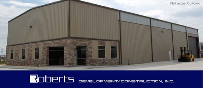
Warehouse
RES A BLK 1 ROSEHILL BUSINESS PARK AT FM 2920
X
Harris
48339C0675G
Texas
2024
0.97 AC
2025
Northwest Hwy 6
555501
Houston
12,000 SF
Houston-The Woodlands-Sugar Land, TX
DEMOGRAPHICS near 17444 Fm 2920 Rd
1 Mile
3 Mile
5 Mile
2024 Total Population
751
10,299
45,865
2029 Population
776
10,740
48,012
Pop Growth 2024-2029
+ 3.33%
+ 4.28%
+ 4.68%
Average Age
39
39
38
2024 Total Households
272
3,600
16,342
HH Growth 2024-2029
+ 3.31%
+ 4.44%
+ 4.61%
Median Household Inc
$79,091
$85,348
$84,546
Avg Household Size
2.80
2.90
2.80
2024 Avg HH Vehicles
3.00
2.00
2.00
Median Home Value
$387,499
$359,210
$292,196
Median Year Built
1995
1996
1998
Nearby Places
Map Layers
Map Styles
 Street
 Aerial
- Restaurants
- Banks
- Shops
- Fitness
- Groceries
PUBLIC TRANSPORTATION
AIRPORT
George Bush Intcntl/Houston
DRIVE
WALK
Distance
George Bush Intcntl/Houston
39 min
30.8 mi
Freight Ports
Port of Houston
DRIVE
WALK
Distance
Port of Houston
59 min
41.4 mi
SALE & LEASE HISTORY
LISTING DATE
SALE/LEASE

Jul 10, 2019
For Sale
Jul 10, 2019
For Lease
Nearby Properties
Address
Land Use
TOTAL SIZE
Lot Size
Zoning
Address
Land Use
TOTAL SIZE
Lot Size
Zoning
326,902 SF
15.45 AC
Address
Land Use
TOTAL SIZE
Lot Size
Zoning
123,400 SF
15.08 AC
Address
Land Use
TOTAL SIZE
Lot Size
Zoning
56,700 SF
10 AC
Address
Land Use
TOTAL SIZE
Lot Size
Zoning
66,960 SF
17.39 AC
Address
Land Use
TOTAL SIZE
Lot Size
Zoning
27,542 SF
4.44 AC
Address
Land Use
TOTAL SIZE
Lot Size
Zoning
74,400 SF
6.43 AC
Address
Land Use
TOTAL SIZE
Lot Size
Zoning
62,322 SF
15.82 AC
Address
Land Use
TOTAL SIZE
Lot Size
Zoning
83,930 SF
4.74 AC
Address
Land Use
TOTAL SIZE
Lot Size
Zoning
18,590 SF
15.24 AC
Address
Land Use
TOTAL SIZE
Lot Size
Zoning
76.78 AC
Address
Land Use
TOTAL SIZE
Lot Size
Zoning
73,040 SF
5.22 AC
Address
Land Use
TOTAL SIZE
Lot Size
Zoning
113,545 SF
8.24 AC
Address
Land Use
TOTAL SIZE
Lot Size
Zoning
1,184 SF
27.54 AC
Address
Land Use
TOTAL SIZE
Lot Size
Zoning
Address
Land Use
TOTAL SIZE
Lot Size
Zoning
25,063 SF
5 AC
Address
Land Use
TOTAL SIZE
Lot Size
Zoning
85,700 SF
6 AC
Address
Land Use
TOTAL SIZE
Lot Size
Zoning
6,729 SF
98.17 AC
Address
Land Use
TOTAL SIZE
Lot Size
Zoning
Address
Land Use
TOTAL SIZE
Lot Size
Zoning
104.87 AC
Address
Land Use
TOTAL SIZE
Lot Size
Zoning
20,581 SF
14.85 AC
Address
Land Use
TOTAL SIZE
Lot Size
Zoning
67,125 SF
10.41 AC
Address
Land Use
TOTAL SIZE
Lot Size
Zoning
3,428 SF
12.76 AC
Address
Land Use
TOTAL SIZE
Lot Size
Zoning
31.16 AC
Address
Land Use
TOTAL SIZE
Lot Size
Zoning
22.95 AC
Address
Land Use
TOTAL SIZE
Lot Size
Zoning
8,459 SF
2.50 AC
Address
Land Use
TOTAL SIZE
Lot Size
Zoning
23,930 SF
8.13 AC
Address
Land Use
TOTAL SIZE
Lot Size
Zoning
3,000 SF
16.95 AC
Address
Land Use
TOTAL SIZE
Lot Size
Zoning
43,000 SF
7.22 AC
Address
Land Use
TOTAL SIZE
Lot Size
Zoning
5.34 AC
Address
Land Use
TOTAL SIZE
Lot Size
Zoning
18.75 AC
The World's #1 Commercial Real Estate Marketplace
Connect with us
© 2026 CoStar Group
The information above has been obtained from sources believed reliable. While we do not doubt its accuracy we have not verified it and make no guarantee, warranty or representation about it. It is your responsibility to independently confirm its accuracy and completeness. Any projections, opinions, assumptions, or estimates used are for example only and do not represent the current or future performance of the property. The value of this transaction to you depends on tax and other factors which should be evaluated by your tax, financial, and legal advisors. You and your advisors should conduct a careful, independent investigation of the property to determine to your satisfaction the suitability of the property for your needs.