Property Record
1745 S 1St St, Rogers, AR 72756
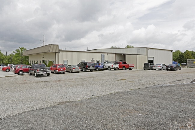

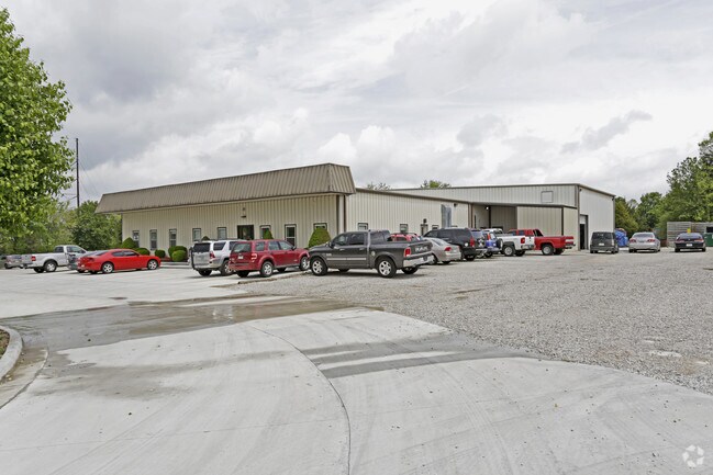

Property Detail
1745 S 1St St
02-00499-003
1745 SOUTH FIRST STREET PART OF THE FRACTIONAL WEST HALF (W1/2) OF THE SOUTHWEST QUARTER (SW1/4) QF SECTION 18, TOWNSHIP 19 NORTH, RANGE 29 WEST, BENTON COUNTY, ARKANSAS, MORE PARTICULARLY DESCRIBED AS BEGINNING AT THE SW CORNER OF THE FRACTIONAL NW1
Officebuilding
Benton
AE The base floodplain where base flood elevations are provided. AE Zones are now used on new format FIRMs instead of A1-A30 Zones.
Arkansas
2025
2.78 AC
2025
East Rogers
020205
Fayetteville/Springdale/Rogers
27,443 SF
Fayetteville-Springdale-Rogers, AR
NEARBY LISTINGS FOR SALE OR LEASE
DEMOGRAPHICS near 1745 S 1St St
1 mile
3 mile
5 mile
2025 Total Population
10,024
51,644
96,785
2030 Population
11,024
56,974
106,793
Pop Growth 2025-2030
+ 9.98%
+ 10.32%
+ 10.34%
Average Age
36
37
37
2025 Total Households
3,245
18,223
35,466
HH Growth 2025-2030
+ 10.29%
+ 10.73%
+ 10.73%
Median Household Inc
$67,359
$69,881
$81,567
Avg Household Size
3.00
2.70
2.60
2025 Avg HH Vehicles
2.00
2.00
2.00
Median Home Value
$241,507
$279,077
$333,118
Median Year Built
1991
1992
1996
Nearby Places
Map Layers
Map Styles
 Street
 Aerial
Layers
 Traffic
 Biking
Places
Listings with unknown addresses are not visible on the map
- Restaurants
- Banks
- Shops
- Fitness
- Groceries
PUBLIC TRANSPORTATION
AIRPORT
Northwest Arkansas Ntl
Drive
Walk
Distance
Northwest Arkansas Ntl
29 min
16.7 mi
Nearby Properties
Address
Land Use
TOTAL SIZE
Lot Size
Zoning
Address
Land Use
TOTAL SIZE
Lot Size
Zoning
52,778 SF
1.04 AC
Address
Land Use
TOTAL SIZE
Lot Size
Zoning
117,522 SF
0.12 AC
Address
Land Use
TOTAL SIZE
Lot Size
Zoning
405,394 SF
10.97 AC
Address
Land Use
TOTAL SIZE
Lot Size
Zoning
412,893 SF
11.51 AC
Address
Land Use
TOTAL SIZE
Lot Size
Zoning
305,450 SF
12.16 AC
Address
Land Use
TOTAL SIZE
Lot Size
Zoning
542,873 SF
16.52 AC
Address
Land Use
TOTAL SIZE
Lot Size
Zoning
84,890 SF
5.89 AC
Address
Land Use
TOTAL SIZE
Lot Size
Zoning
573,476 SF
57.80 AC
Address
Land Use
TOTAL SIZE
Lot Size
Zoning
401,143 SF
31.17 AC
Address
Land Use
TOTAL SIZE
Lot Size
Zoning
214,791 SF
9.13 AC
Address
Land Use
TOTAL SIZE
Lot Size
Zoning
156,100 SF
7.89 AC
Address
Land Use
TOTAL SIZE
Lot Size
Zoning
20,878 SF
24.78 AC
Address
Land Use
TOTAL SIZE
Lot Size
Zoning
152,759 SF
12.01 AC
Address
Land Use
TOTAL SIZE
Lot Size
Zoning
114,250 SF
7.54 AC
Address
Land Use
TOTAL SIZE
Lot Size
Zoning
117,522 SF
13.66 AC
Address
Land Use
TOTAL SIZE
Lot Size
Zoning
231,576 SF
15.18 AC
Address
Land Use
TOTAL SIZE
Lot Size
Zoning
102,477 SF
7.15 AC
Address
Land Use
TOTAL SIZE
Lot Size
Zoning
57,715 SF
7.60 AC
Address
Land Use
TOTAL SIZE
Lot Size
Zoning
87,465 SF
5 AC
Address
Land Use
TOTAL SIZE
Lot Size
Zoning
205,851 SF
20.13 AC
Address
Land Use
TOTAL SIZE
Lot Size
Zoning
263,095 SF
13.17 AC
Address
Land Use
TOTAL SIZE
Lot Size
Zoning
402,500 SF
19.54 AC
Address
Land Use
TOTAL SIZE
Lot Size
Zoning
53,503 SF
6.88 AC
Address
Land Use
TOTAL SIZE
Lot Size
Zoning
62,671 SF
4.07 AC
Address
Land Use
TOTAL SIZE
Lot Size
Zoning
39,793 SF
4.94 AC
Address
Land Use
TOTAL SIZE
Lot Size
Zoning
65,085 SF
8.07 AC
Address
Land Use
TOTAL SIZE
Lot Size
Zoning
101,690 SF
8.76 AC
Address
Land Use
TOTAL SIZE
Lot Size
Zoning
123,791 SF
5.64 AC
Address
Land Use
TOTAL SIZE
Lot Size
Zoning
123,879 SF
5.31 AC
Address
Land Use
TOTAL SIZE
Lot Size
Zoning
64,139 SF
9.34 AC
The World's #1 Commercial Real Estate Marketplace
Connect with us
© 2026 CoStar Group
The information above has been obtained from sources believed reliable. While we do not doubt its accuracy we have not verified it and make no guarantee, warranty or representation about it. It is your responsibility to independently confirm its accuracy and completeness. Any projections, opinions, assumptions, or estimates used are for example only and do not represent the current or future performance of the property. The value of this transaction to you depends on tax and other factors which should be evaluated by your tax, financial, and legal advisors. You and your advisors should conduct a careful, independent investigation of the property to determine to your satisfaction the suitability of the property for your needs.