Property Record
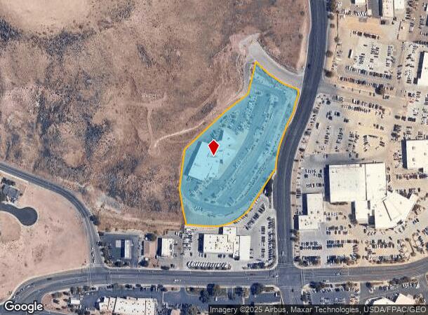
1746 S Black Ridge Dr, Saint George, UT 84770


NEARBY LISTINGS FOR SALE OR LEASE
Property Detail
1746 S Black Ridge Dr
Commercialnec
S: 1 T: 43S R: 16W BEG SWLY R/W/L AIRPORT RD BEING S0*4755 W 506.24 FT ALG SEC/L & W 773.13 FT FM NE COR SEC 1 T43S R16W POB BEING ON 380 FT RAD CUR LFT (RAD PT BEARS N51*3725 E); TH 214.58 FT ALG ARC CUR THRU CTL ANG 32*2116 TO PT RVSE CUR 20.00 FT
X
Washington
49053C1029G
Utah
2024
4.95 AC
2025
Other Market Areas
271501
St. George, UT
29,131 SF
0721400
DEMOGRAPHICS near 1746 S Black Ridge Dr
1 Mile
3 Mile
5 Mile
2024 Total Population
3,986
54,286
113,223
2029 Population
4,953
67,524
140,879
Pop Growth 2024-2029
+ 24.26%
+ 24.39%
+ 24.43%
Average Age
44
40
40
2024 Total Households
1,518
19,064
39,176
HH Growth 2024-2029
+ 24.90%
+ 25.05%
+ 25.08%
Median Household Inc
$67,105
$57,794
$63,180
Avg Household Size
2.60
2.70
2.80
2024 Avg HH Vehicles
2.00
2.00
2.00
Median Home Value
$385,513
$411,494
$430,538
Median Year Built
1996
1994
2000
Nearby Places
Map Layers
Map Styles
 Street
 Aerial
- Restaurants
- Banks
- Shops
- Fitness
- Groceries
PUBLIC TRANSPORTATION
AIRPORT
St George Regional
DRIVE
WALK
Distance
St George Regional
9 min
3.2 mi
Freight Ports
Port of Long Beach
DRIVE
WALK
Distance
Port of Long Beach
439 min
400.1 mi
SALE & LEASE HISTORY
LISTING DATE
SALE/LEASE

Sep 25, 2016
For Lease
Aug 08, 2017
For Sale
Nearby Properties
Address
Land Use
TOTAL SIZE
Lot Size
Zoning
Address
Land Use
TOTAL SIZE
Lot Size
Zoning
1,120,988 SF
52.22 AC
PDCOM
Address
Land Use
TOTAL SIZE
Lot Size
Zoning
163,605 SF
13.51 AC
C3
Address
Land Use
TOTAL SIZE
Lot Size
Zoning
252,737 SF
3.95 AC
C-4
Address
Land Use
TOTAL SIZE
Lot Size
Zoning
175,817 SF
30.20 AC
Address
Land Use
TOTAL SIZE
Lot Size
Zoning
118,603 SF
16.56 AC
Address
Land Use
TOTAL SIZE
Lot Size
Zoning
141,151 SF
15 AC
PDCOM
Address
Land Use
TOTAL SIZE
Lot Size
Zoning
206,801 SF
12.60 AC
PD
Address
Land Use
TOTAL SIZE
Lot Size
Zoning
9,037 SF
188.69 AC
C2
Address
Land Use
TOTAL SIZE
Lot Size
Zoning
141,567 SF
1.31 AC
C-4
Address
Land Use
TOTAL SIZE
Lot Size
Zoning
196,334 SF
22.87 AC
PDCOM
Address
Land Use
TOTAL SIZE
Lot Size
Zoning
280,428 SF
1.96 AC
C-4
Address
Land Use
TOTAL SIZE
Lot Size
Zoning
91,517 SF
8.96 AC
C2
Address
Land Use
TOTAL SIZE
Lot Size
Zoning
84,384 SF
6.34 AC
C2
Address
Land Use
TOTAL SIZE
Lot Size
Zoning
88,445 SF
3.28 AC
C2
Address
Land Use
TOTAL SIZE
Lot Size
Zoning
97,202 SF
2.92 AC
C3
Address
Land Use
TOTAL SIZE
Lot Size
Zoning
76,907 SF
4 AC
PDCOM
Address
Land Use
TOTAL SIZE
Lot Size
Zoning
94,810 SF
3.15 AC
C-3
Address
Land Use
TOTAL SIZE
Lot Size
Zoning
59,500 SF
4.93 AC
R110
Address
Land Use
TOTAL SIZE
Lot Size
Zoning
57,312 SF
3.14 AC
PDCOM
Address
Land Use
TOTAL SIZE
Lot Size
Zoning
67,139 SF
1.25 AC
Address
Land Use
TOTAL SIZE
Lot Size
Zoning
158,638 SF
4.67 AC
C-3
Address
Land Use
TOTAL SIZE
Lot Size
Zoning
69,421 SF
5.73 AC
PDCOM
Address
Land Use
TOTAL SIZE
Lot Size
Zoning
82,440 SF
2.88 AC
Address
Land Use
TOTAL SIZE
Lot Size
Zoning
125,208 SF
4.15 AC
PDCOM
Address
Land Use
TOTAL SIZE
Lot Size
Zoning
54,787 SF
4.30 AC
R110
Address
Land Use
TOTAL SIZE
Lot Size
Zoning
135,592 SF
11.24 AC
PDCOM
Address
Land Use
TOTAL SIZE
Lot Size
Zoning
68,433 SF
0.38 AC
Address
Land Use
TOTAL SIZE
Lot Size
Zoning
61,825 SF
5.20 AC
Address
Land Use
TOTAL SIZE
Lot Size
Zoning
76,560 SF
2.32 AC
Address
Land Use
TOTAL SIZE
Lot Size
Zoning
33,930 SF
11.65 AC
The World's #1 Commercial Real Estate Marketplace
Connect with us
© 2025 CoStar Group
The information above has been obtained from sources believed reliable. While we do not doubt its accuracy we have not verified it and make no guarantee, warranty or representation about it. It is your responsibility to independently confirm its accuracy and completeness. Any projections, opinions, assumptions, or estimates used are for example only and do not represent the current or future performance of the property. The value of this transaction to you depends on tax and other factors which should be evaluated by your tax, financial, and legal advisors. You and your advisors should conduct a careful, independent investigation of the property to determine to your satisfaction the suitability of the property for your needs.