Property Record
17490 Dugdale Dr, South Bend, IN 46635

NEARBY LISTINGS FOR SALE OR LEASE
Property Detail
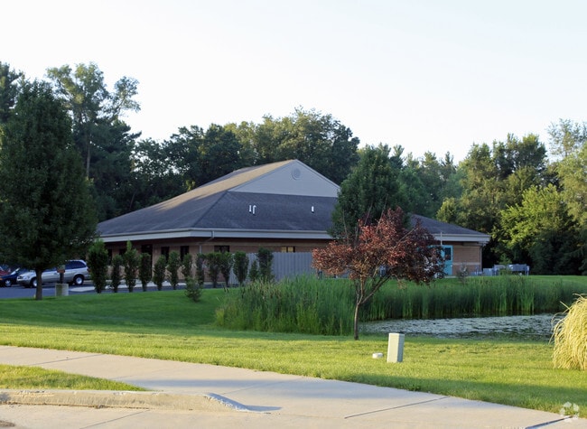
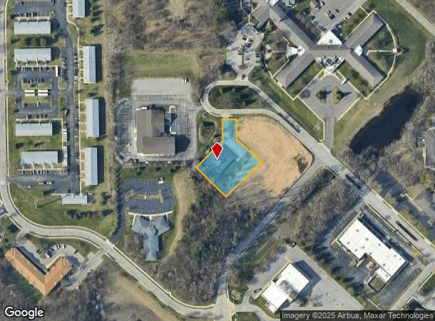
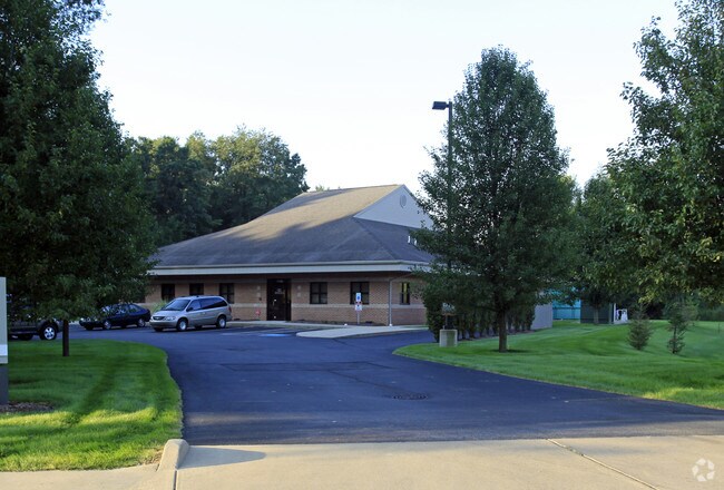
17490 Dugdale Dr
South Bend-Mishawaka, IN-MI
National Center For Sr Living
71-04-29-451-001.000-003
LOT 9B NATIONAL CENTER FOR SR LIVING SEC 8 03-04 NEW REPLAT TR 2228 5-2-2002 02-03 NEW REPLAT TR 1639 4-20-01
Medicalbuilding
St Joseph
X
Indiana
18141C0204D
9b
2023
1.09 AC
2024
Outlying St Joseph County
011309
South Bend/Mishawaka
6,261 SF
DEMOGRAPHICS near 17490 Dugdale Dr
1 Mile
3 Mile
5 Mile
2024 Total Population
6,114
71,355
171,517
2029 Population
6,057
71,396
171,825
Pop Growth 2024-2029
(0.93%)
+ 0.06%
+ 0.18%
Average Age
42
38
38
2024 Total Households
2,675
28,695
67,482
HH Growth 2024-2029
(1.12%)
+ 0.17%
+ 0.18%
Median Household Inc
$61,713
$59,900
$55,895
Avg Household Size
2.10
2.10
2.30
2024 Avg HH Vehicles
2.00
2.00
2.00
Median Home Value
$162,690
$186,559
$156,621
Median Year Built
1972
1975
1965
Nearby Places
Map Layers
Map Styles
 Street
 Aerial
- Restaurants
- Banks
- Shops
- Fitness
- Groceries
PUBLIC TRANSPORTATION
COMMUTER RAIL
DRIVE
WALK
Distance
15 min
6.1 mi
South Bend Airport Station (South Shore Line - Northern Indiana Commuter Transportation District (South Shore Line))
DRIVE
WALK
Distance
South Bend Airport Station (South Shore Line - Northern Indiana Commuter Transportation District (South Shore Line))
20 min
7.4 mi
AIRPORT
South Bend International
DRIVE
WALK
Distance
South Bend International
29 min
9.6 mi
Nearby Properties
Address
Land Use
TOTAL SIZE
Lot Size
Zoning
Address
Land Use
TOTAL SIZE
Lot Size
Zoning
3,879,729 SF
436.76 AC
Address
Land Use
TOTAL SIZE
Lot Size
Zoning
560,184 SF
0.01 AC
Address
Land Use
TOTAL SIZE
Lot Size
Zoning
808,463 SF
30.51 AC
Address
Land Use
TOTAL SIZE
Lot Size
Zoning
24,392 SF
48.07 AC
Address
Land Use
TOTAL SIZE
Lot Size
Zoning
966,201 SF
0.01 AC
Address
Land Use
TOTAL SIZE
Lot Size
Zoning
294,502 SF
87 SF
Address
Land Use
TOTAL SIZE
Lot Size
Zoning
369,116 SF
19.80 AC
Address
Land Use
TOTAL SIZE
Lot Size
Zoning
168,997 SF
9.62 AC
Address
Land Use
TOTAL SIZE
Lot Size
Zoning
529,154 SF
131 SF
Address
Land Use
TOTAL SIZE
Lot Size
Zoning
275,670 SF
44 SF
Address
Land Use
TOTAL SIZE
Lot Size
Zoning
262,392 SF
Address
Land Use
TOTAL SIZE
Lot Size
Zoning
599,502 SF
39.10 AC
Address
Land Use
TOTAL SIZE
Lot Size
Zoning
394,459 SF
44 SF
Address
Land Use
TOTAL SIZE
Lot Size
Zoning
538,338 SF
0.01 AC
Address
Land Use
TOTAL SIZE
Lot Size
Zoning
160,546 SF
Address
Land Use
TOTAL SIZE
Lot Size
Zoning
319,715 SF
2.57 AC
Address
Land Use
TOTAL SIZE
Lot Size
Zoning
66,297 SF
131 SF
Address
Land Use
TOTAL SIZE
Lot Size
Zoning
151,377 SF
0.01 AC
Address
Land Use
TOTAL SIZE
Lot Size
Zoning
239,419 SF
44 SF
Address
Land Use
TOTAL SIZE
Lot Size
Zoning
206,651 SF
1.68 AC
Address
Land Use
TOTAL SIZE
Lot Size
Zoning
770,407 SF
0.01 AC
Address
Land Use
TOTAL SIZE
Lot Size
Zoning
220,913 SF
29.14 AC
Address
Land Use
TOTAL SIZE
Lot Size
Zoning
18,028 SF
80.67 AC
Address
Land Use
TOTAL SIZE
Lot Size
Zoning
186,131 SF
87 SF
Address
Land Use
TOTAL SIZE
Lot Size
Zoning
207,846 SF
2.33 AC
Address
Land Use
TOTAL SIZE
Lot Size
Zoning
799,664 SF
0.01 AC
Address
Land Use
TOTAL SIZE
Lot Size
Zoning
331,913 SF
30 AC
Address
Land Use
TOTAL SIZE
Lot Size
Zoning
148,524 SF
1.66 AC
Address
Land Use
TOTAL SIZE
Lot Size
Zoning
25,756 SF
337.40 AC
Address
Land Use
TOTAL SIZE
Lot Size
Zoning
327,618 SF
39.65 AC
The World's #1 Commercial Real Estate Marketplace
Connect with us
© 2025 CoStar Group
The information above has been obtained from sources believed reliable. While we do not doubt its accuracy we have not verified it and make no guarantee, warranty or representation about it. It is your responsibility to independently confirm its accuracy and completeness. Any projections, opinions, assumptions, or estimates used are for example only and do not represent the current or future performance of the property. The value of this transaction to you depends on tax and other factors which should be evaluated by your tax, financial, and legal advisors. You and your advisors should conduct a careful, independent investigation of the property to determine to your satisfaction the suitability of the property for your needs.