Property Record
175 18Th St Sw, Owatonna, MN 55060
NEARBY LISTINGS FOR SALE OR LEASE
-
-
View all Owatonna listings for sale on LoopNet.com
Property Detail
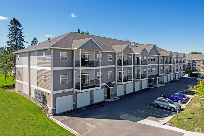
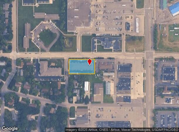
175 18Th St Sw
Owatonna, MN
Oakdale # 3
17-389-0101
OAKDALE # 3 ALL THAT PART BLK 1 LOT 1 OAKDALE 3RD ADDN LYING W FOLLOWING DESCRIBED LN COM NE COR LOT 1 W192' TO PT OF BEG S13
Apartment
Steele
X
Minnesota
27147C0153C
1
2025
0.84 AC
2025
Minnesota South Area
960600
Other Market Areas
4,800 SF
DEMOGRAPHICS near 175 18Th St Sw
1 Mile
3 Mile
5 Mile
2024 Total Population
5,957
24,581
28,241
2029 Population
5,952
24,585
28,242
Pop Growth 2024-2029
(0.08%)
+ 0.02%
0.00%
Average Age
42
40
40
2024 Total Households
2,592
10,037
11,322
HH Growth 2024-2029
0.00%
+ 0.05%
+ 0.03%
Median Household Inc
$70,199
$70,204
$74,435
Avg Household Size
2.20
2.40
2.40
2024 Avg HH Vehicles
2.00
2.00
2.00
Median Home Value
$190,351
$195,928
$207,410
Median Year Built
1970
1974
1975
Nearby Places
Map Layers
Map Styles
 Street
 Aerial
- Restaurants
- Banks
- Shops
- Fitness
- Groceries
Nearby Properties
Address
Land Use
TOTAL SIZE
Lot Size
Zoning
Address
Land Use
TOTAL SIZE
Lot Size
Zoning
107,134 SF
19.48 AC
Address
Land Use
TOTAL SIZE
Lot Size
Zoning
975,108 SF
54.99 AC
Address
Land Use
TOTAL SIZE
Lot Size
Zoning
134,234 SF
17.31 AC
Address
Land Use
TOTAL SIZE
Lot Size
Zoning
339,400 SF
148.03 AC
Address
Land Use
TOTAL SIZE
Lot Size
Zoning
56,981 SF
18.60 AC
Address
Land Use
TOTAL SIZE
Lot Size
Zoning
184,335 SF
13.81 AC
Address
Land Use
TOTAL SIZE
Lot Size
Zoning
489,600 SF
33.86 AC
Address
Land Use
TOTAL SIZE
Lot Size
Zoning
46,729 SF
4.88 AC
Address
Land Use
TOTAL SIZE
Lot Size
Zoning
186,713 SF
64.18 AC
Address
Land Use
TOTAL SIZE
Lot Size
Zoning
270,314 SF
18.82 AC
Address
Land Use
TOTAL SIZE
Lot Size
Zoning
2.21 AC
Address
Land Use
TOTAL SIZE
Lot Size
Zoning
59,195 SF
40 AC
Address
Land Use
TOTAL SIZE
Lot Size
Zoning
43,336 SF
46.29 AC
Address
Land Use
TOTAL SIZE
Lot Size
Zoning
52,792 SF
6.82 AC
Address
Land Use
TOTAL SIZE
Lot Size
Zoning
79,370 SF
2.66 AC
Address
Land Use
TOTAL SIZE
Lot Size
Zoning
265,824 SF
18.62 AC
Address
Land Use
TOTAL SIZE
Lot Size
Zoning
115,815 SF
21.06 AC
Address
Land Use
TOTAL SIZE
Lot Size
Zoning
194,250 SF
11.67 AC
Address
Land Use
TOTAL SIZE
Lot Size
Zoning
Address
Land Use
TOTAL SIZE
Lot Size
Zoning
37,840 SF
45 AC
Address
Land Use
TOTAL SIZE
Lot Size
Zoning
71,411 SF
3.22 AC
Address
Land Use
TOTAL SIZE
Lot Size
Zoning
69,676 SF
3.74 AC
Address
Land Use
TOTAL SIZE
Lot Size
Zoning
69,676 SF
2.93 AC
Address
Land Use
TOTAL SIZE
Lot Size
Zoning
66,747 SF
0.94 AC
Address
Land Use
TOTAL SIZE
Lot Size
Zoning
54,395 SF
8.34 AC
Address
Land Use
TOTAL SIZE
Lot Size
Zoning
159,102 SF
15.96 AC
Address
Land Use
TOTAL SIZE
Lot Size
Zoning
150,400 SF
10.68 AC
Address
Land Use
TOTAL SIZE
Lot Size
Zoning
178,962 SF
10.63 AC
Address
Land Use
TOTAL SIZE
Lot Size
Zoning
298,876 SF
22.04 AC
Address
Land Use
TOTAL SIZE
Lot Size
Zoning
14,554 SF
0.25 AC
The World's #1 Commercial Real Estate Marketplace
Connect with us
© 2026 CoStar Group
The information above has been obtained from sources believed reliable. While we do not doubt its accuracy we have not verified it and make no guarantee, warranty or representation about it. It is your responsibility to independently confirm its accuracy and completeness. Any projections, opinions, assumptions, or estimates used are for example only and do not represent the current or future performance of the property. The value of this transaction to you depends on tax and other factors which should be evaluated by your tax, financial, and legal advisors. You and your advisors should conduct a careful, independent investigation of the property to determine to your satisfaction the suitability of the property for your needs.