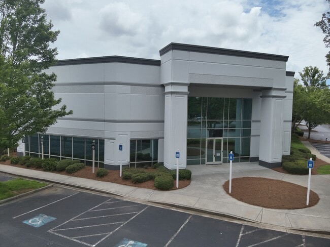
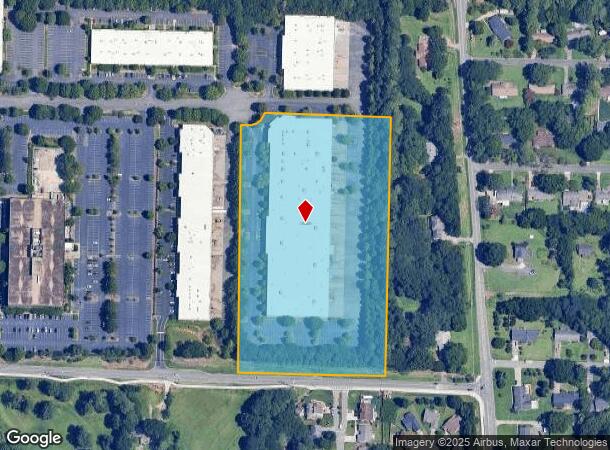
Property Record
175 Chastain Meadows Ct Nw, Kennesaw, GA 30144
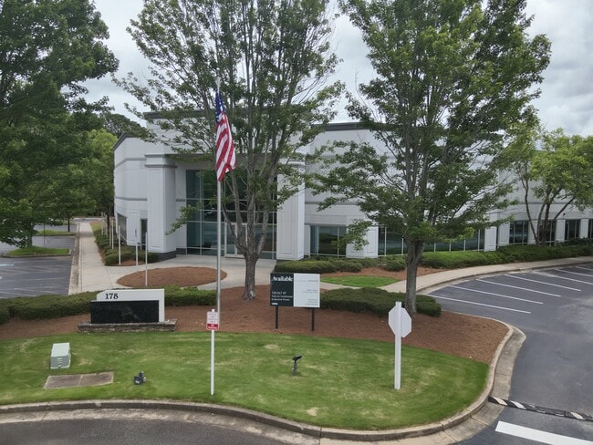
Current Lease Availabilities
NEARBY LISTINGS FOR SALE OR LEASE
Property Detail
175 Chastain Meadows Ct Nw
16-0438-0-008-0
Cobb
Industrialgeneral
Georgia
X
438
13057C0350E
9.37 AC
2025
Kennesaw/Acworth
2025
Atlanta
030248
Atlanta-Sandy Springs-Roswell, GA
127,049 SF
DEMOGRAPHICS near 175 Chastain Meadows Ct Nw
1 Mile
3 Mile
5 Mile
2024 Total Population
6,463
62,818
186,581
2029 Population
6,565
63,663
192,345
Pop Growth 2024-2029
+ 1.58%
+ 1.35%
+ 3.09%
Average Age
39
38
39
2024 Total Households
2,305
24,066
70,594
HH Growth 2024-2029
+ 1.43%
+ 1.37%
+ 3.25%
Median Household Inc
$71,635
$82,467
$89,325
Avg Household Size
2.30
2.40
2.50
2024 Avg HH Vehicles
2.00
2.00
2.00
Median Home Value
$292,856
$302,000
$311,868
Median Year Built
1990
1989
1990
Nearby Places
- Restaurants
- Banks
- Shops
- Fitness
- Groceries
PUBLIC TRANSPORTATION
AIRPORT
Hartsfield - Jackson Atlanta International
DRIVE
WALK
Distance
Hartsfield - Jackson Atlanta International
47 min
34.5 mi
Freight Ports
Georgia Ports - Savannah
DRIVE
WALK
Distance
Georgia Ports - Savannah
310 min
273.8 mi
Nearby Properties
Address
Land Use
TOTAL SIZE
Lot Size
Zoning
Address
Land Use
TOTAL SIZE
Lot Size
Zoning
578,456 SF
60 AC
RM-12
Address
Land Use
TOTAL SIZE
Lot Size
Zoning
449,337 SF
53.52 AC
RM-12
Address
Land Use
TOTAL SIZE
Lot Size
Zoning
489,796 SF
44.09 AC
RM-12
Address
Land Use
TOTAL SIZE
Lot Size
Zoning
4,812 SF
4.20 AC
PVC
Address
Land Use
TOTAL SIZE
Lot Size
Zoning
416,821 SF
12.96 AC
Address
Land Use
TOTAL SIZE
Lot Size
Zoning
35,085 SF
3.77 AC
RRC
Address
Land Use
TOTAL SIZE
Lot Size
Zoning
507,196 SF
67.83 AC
RM-12
Address
Land Use
TOTAL SIZE
Lot Size
Zoning
7.79 AC
RRC
Address
Land Use
TOTAL SIZE
Lot Size
Zoning
382,704 SF
18.72 AC
RM-16
Address
Land Use
TOTAL SIZE
Lot Size
Zoning
352,938 SF
19.86 AC
RM-16
Address
Land Use
TOTAL SIZE
Lot Size
Zoning
326,166 SF
40 AC
RM-12/WS
Address
Land Use
TOTAL SIZE
Lot Size
Zoning
617,562 SF
35.22 AC
PSC
Address
Land Use
TOTAL SIZE
Lot Size
Zoning
300,369 SF
10.64 AC
Address
Land Use
TOTAL SIZE
Lot Size
Zoning
385,954 SF
31 AC
RM-12
Address
Land Use
TOTAL SIZE
Lot Size
Zoning
304,376 SF
19.86 AC
RM-12/WS
Address
Land Use
TOTAL SIZE
Lot Size
Zoning
13.43 AC
OI
Address
Land Use
TOTAL SIZE
Lot Size
Zoning
312,765 SF
12.59 AC
UVC
Address
Land Use
TOTAL SIZE
Lot Size
Zoning
437,231 SF
5.79 AC
PVC
Address
Land Use
TOTAL SIZE
Lot Size
Zoning
7.53 AC
OI
Address
Land Use
TOTAL SIZE
Lot Size
Zoning
3.16 AC
PVC
Address
Land Use
TOTAL SIZE
Lot Size
Zoning
13.46 AC
PVC
Address
Land Use
TOTAL SIZE
Lot Size
Zoning
367,587 SF
26.87 AC
RM-12
Address
Land Use
TOTAL SIZE
Lot Size
Zoning
270,275 SF
21.52 AC
RM-12
Address
Land Use
TOTAL SIZE
Lot Size
Zoning
245,066 SF
15.41 AC
UC
Address
Land Use
TOTAL SIZE
Lot Size
Zoning
360,937 SF
32.56 AC
RM-12
Address
Land Use
TOTAL SIZE
Lot Size
Zoning
272,064 SF
22.59 AC
RM-12
Address
Land Use
TOTAL SIZE
Lot Size
Zoning
183,262 SF
19.35 AC
RM-12
Address
Land Use
TOTAL SIZE
Lot Size
Zoning
280,546 SF
26.91 AC
RM-12
Address
Land Use
TOTAL SIZE
Lot Size
Zoning
99,863 SF
21.90 AC
UC
Address
Land Use
TOTAL SIZE
Lot Size
Zoning
27.25 AC
OS
The World's #1 Commercial Real Estate Marketplace
Connect with us
© 2025 CoStar Group
The information above has been obtained from sources believed reliable. While we do not doubt its accuracy we have not verified it and make no guarantee, warranty or representation about it. It is your responsibility to independently confirm its accuracy and completeness. Any projections, opinions, assumptions, or estimates used are for example only and do not represent the current or future performance of the property. The value of this transaction to you depends on tax and other factors which should be evaluated by your tax, financial, and legal advisors. You and your advisors should conduct a careful, independent investigation of the property to determine to your satisfaction the suitability of the property for your needs.