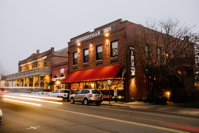
Property Record
175 E California St, Jacksonville, OR 97530


Property Detail
175 E California St
Commercialbuilding
Jackson
HC
Oregon
C and X Area of minimal flood hazard, usually depicted on FIRMs as above the 500-year flood level.
0.26 AC
2025
Medford/Grants Pass
2026
Other Market Areas
001500
Medford, OR
9,078 SF
10005111
NEARBY LISTINGS FOR SALE OR LEASE
-
-
View all Jacksonville listings for sale on LoopNet.com
DEMOGRAPHICS near 175 E California St
1 mile
3 mile
5 mile
2025 Total Population
3,464
7,108
50,004
2030 Population
3,432
6,964
48,826
Pop Growth 2025-2030
(0.92%)
(2.03%)
(2.36%)
Average Age
52
49
41
2025 Total Households
1,642
3,111
19,258
HH Growth 2025-2030
(0.97%)
(1.99%)
(2.46%)
Median Household Inc
$95,105
$96,127
$71,917
Avg Household Size
2.10
2.20
2.50
2025 Avg HH Vehicles
2.00
2.00
2.00
Median Home Value
$685,574
$677,226
$392,701
Median Year Built
1995
1987
1980
Nearby Places
Map Layers
Map Styles
 Street
 Aerial
Layers
 Traffic
 Biking
Places
Listings with unknown addresses are not visible on the map
- Restaurants
- Banks
- Shops
- Fitness
- Groceries
PUBLIC TRANSPORTATION
AIRPORT
Rogue Valley International - Medford
Drive
Walk
Distance
Rogue Valley International - Medford
14 min
7.5 mi
SALE & LEASE HISTORY
LISTING DATE
SALE/LEASE

Feb 26, 2024
For Sale
Feb 23, 2024
For Sale
Dec 05, 2022
For Lease
Nearby Properties
Address
Land Use
TOTAL SIZE
Lot Size
Zoning
Address
Land Use
TOTAL SIZE
Lot Size
Zoning
72.38 AC
SP
Address
Land Use
TOTAL SIZE
Lot Size
Zoning
104,160 SF
1.78 AC
GC
Address
Land Use
TOTAL SIZE
Lot Size
Zoning
50,501 SF
161.14 AC
WR
Address
Land Use
TOTAL SIZE
Lot Size
Zoning
73,595 SF
1.11 AC
GC
Address
Land Use
TOTAL SIZE
Lot Size
Zoning
8.75 AC
SP
Address
Land Use
TOTAL SIZE
Lot Size
Zoning
12,059 SF
20.05 AC
WR
Address
Land Use
TOTAL SIZE
Lot Size
Zoning
51,878 SF
4.07 AC
HC
Address
Land Use
TOTAL SIZE
Lot Size
Zoning
8,734 SF
20.15 AC
WR
Address
Land Use
TOTAL SIZE
Lot Size
Zoning
64.90 AC
EFU
Address
Land Use
TOTAL SIZE
Lot Size
Zoning
20.19 AC
SP
Address
Land Use
TOTAL SIZE
Lot Size
Zoning
19.19 AC
SP
Address
Land Use
TOTAL SIZE
Lot Size
Zoning
18,270 SF
9.84 AC
BR-5
Address
Land Use
TOTAL SIZE
Lot Size
Zoning
3,384 SF
0.10 AC
HC
Address
Land Use
TOTAL SIZE
Lot Size
Zoning
14,829 SF
1.17 AC
MF
Address
Land Use
TOTAL SIZE
Lot Size
Zoning
16.88 AC
SP
Address
Land Use
TOTAL SIZE
Lot Size
Zoning
10,880 SF
0.13 AC
HC
Address
Land Use
TOTAL SIZE
Lot Size
Zoning
16,061 SF
5.77 AC
RR-5
Address
Land Use
TOTAL SIZE
Lot Size
Zoning
29,270 SF
3.19 AC
HC
Address
Land Use
TOTAL SIZE
Lot Size
Zoning
61 SF
17.95 AC
RR-5
Address
Land Use
TOTAL SIZE
Lot Size
Zoning
15,346 SF
217.64 AC
EFU
Address
Land Use
TOTAL SIZE
Lot Size
Zoning
7,739 SF
20.15 AC
WR
Address
Land Use
TOTAL SIZE
Lot Size
Zoning
10.55 AC
HR-1
Address
Land Use
TOTAL SIZE
Lot Size
Zoning
7,612 SF
5 AC
RR-5
Address
Land Use
TOTAL SIZE
Lot Size
Zoning
18,951 SF
0.93 AC
GC
Address
Land Use
TOTAL SIZE
Lot Size
Zoning
10,299 SF
16.35 AC
EFU
Address
Land Use
TOTAL SIZE
Lot Size
Zoning
6,482 SF
81.43 AC
EFU
Address
Land Use
TOTAL SIZE
Lot Size
Zoning
11,053 SF
12.75 AC
EFU
Address
Land Use
TOTAL SIZE
Lot Size
Zoning
7,488 SF
56.73 AC
EFU
Address
Land Use
TOTAL SIZE
Lot Size
Zoning
6,785 SF
4.06 AC
RR-5
The World's #1 Commercial Real Estate Marketplace
Connect with us
© 2026 CoStar Group
The information above has been obtained from sources believed reliable. While we do not doubt its accuracy we have not verified it and make no guarantee, warranty or representation about it. It is your responsibility to independently confirm its accuracy and completeness. Any projections, opinions, assumptions, or estimates used are for example only and do not represent the current or future performance of the property. The value of this transaction to you depends on tax and other factors which should be evaluated by your tax, financial, and legal advisors. You and your advisors should conduct a careful, independent investigation of the property to determine to your satisfaction the suitability of the property for your needs.