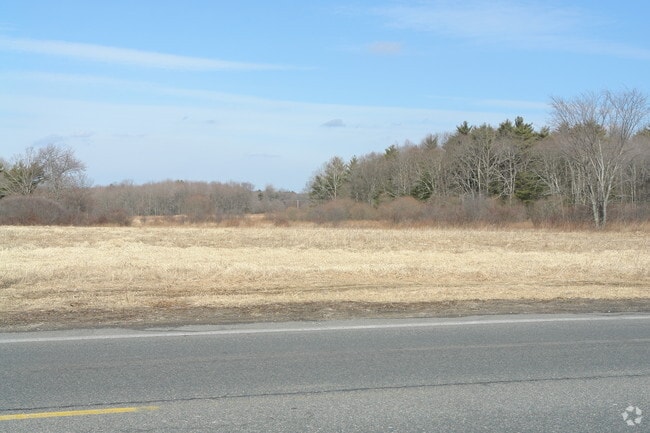
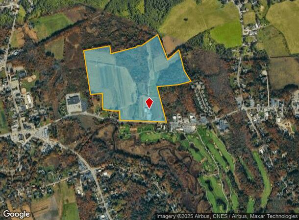
Property Record
175 E Center St, West Bridgewater, MA 02379
NEARBY LISTINGS FOR SALE OR LEASE
Property Detail
175 E Center St
WBRI-000040-000000-000008
Plymouth
Multipleuses
Massachusetts
X
8
25023C0188J
73.84 AC
2025
Route 3 South
2025
Boston
524102
Boston-Cambridge-Newton, MA-NH
3,098 SF
DEMOGRAPHICS near 175 E Center St
1 Mile
3 Mile
5 Mile
2024 Total Population
2,184
33,091
117,426
2029 Population
2,173
32,926
116,896
Pop Growth 2024-2029
(0.50%)
(0.50%)
(0.45%)
Average Age
42
39
40
2024 Total Households
794
11,325
39,564
HH Growth 2024-2029
(0.63%)
(0.59%)
(0.48%)
Median Household Inc
$120,877
$97,987
$89,615
Avg Household Size
2.60
2.60
2.70
2024 Avg HH Vehicles
2.00
2.00
2.00
Median Home Value
$446,614
$431,959
$419,972
Median Year Built
1963
1966
1965
Nearby Places
Map Layers
Map Styles
 Street
 Aerial
- Restaurants
- Banks
- Shops
- Fitness
- Groceries
PUBLIC TRANSPORTATION
COMMUTER RAIL
Campello (Middleborough/Lakeville Line - Massachusetts Bay Transportation Authority Commuter Rail (Purple Line))
DRIVE
WALK
Distance
Campello (Middleborough/Lakeville Line - Massachusetts Bay Transportation Authority Commuter Rail (Purple Line))
7 min
3.8 mi
Bridgewater (Middleborough/Lakeville Line - Massachusetts Bay Transportation Authority Commuter Rail (Purple Line))
DRIVE
WALK
Distance
Bridgewater (Middleborough/Lakeville Line - Massachusetts Bay Transportation Authority Commuter Rail (Purple Line))
10 min
4.5 mi
AIRPORT
General Edward Lawrence Logan International
DRIVE
WALK
Distance
General Edward Lawrence Logan International
46 min
31.8 mi
Freight Ports
Port of Boston
DRIVE
WALK
Distance
Port of Boston
43 min
29.6 mi
Nearby Properties
Address
Land Use
TOTAL SIZE
Lot Size
Zoning
Address
Land Use
TOTAL SIZE
Lot Size
Zoning
22,788 SF
116.37 AC
Address
Land Use
TOTAL SIZE
Lot Size
Zoning
43.60 AC
Address
Land Use
TOTAL SIZE
Lot Size
Zoning
Address
Land Use
TOTAL SIZE
Lot Size
Zoning
349,800 SF
30.82 AC
Address
Land Use
TOTAL SIZE
Lot Size
Zoning
47.64 AC
100
Address
Land Use
TOTAL SIZE
Lot Size
Zoning
Address
Land Use
TOTAL SIZE
Lot Size
Zoning
187,637 SF
20 AC
Address
Land Use
TOTAL SIZE
Lot Size
Zoning
23.60 AC
Address
Land Use
TOTAL SIZE
Lot Size
Zoning
223,200 SF
5.26 AC
C2
Address
Land Use
TOTAL SIZE
Lot Size
Zoning
21.12 AC
Address
Land Use
TOTAL SIZE
Lot Size
Zoning
130,640 SF
10.27 AC
R1C
Address
Land Use
TOTAL SIZE
Lot Size
Zoning
10.98 AC
Address
Land Use
TOTAL SIZE
Lot Size
Zoning
109,960 SF
28.02 AC
Address
Land Use
TOTAL SIZE
Lot Size
Zoning
67.01 AC
Address
Land Use
TOTAL SIZE
Lot Size
Zoning
1,217 SF
13.79 AC
R1C
Address
Land Use
TOTAL SIZE
Lot Size
Zoning
117,950 SF
26 AC
100
Address
Land Use
TOTAL SIZE
Lot Size
Zoning
463,305 SF
116.22 AC
100
Address
Land Use
TOTAL SIZE
Lot Size
Zoning
647 SF
53.67 AC
I3
Address
Land Use
TOTAL SIZE
Lot Size
Zoning
312,000 SF
30.61 AC
Address
Land Use
TOTAL SIZE
Lot Size
Zoning
12.73 AC
Address
Land Use
TOTAL SIZE
Lot Size
Zoning
69,184 SF
7.90 AC
100
Address
Land Use
TOTAL SIZE
Lot Size
Zoning
Address
Land Use
TOTAL SIZE
Lot Size
Zoning
207,654 SF
14.17 AC
R1C
Address
Land Use
TOTAL SIZE
Lot Size
Zoning
5.69 AC
Address
Land Use
TOTAL SIZE
Lot Size
Zoning
80,429 SF
16.68 AC
Address
Land Use
TOTAL SIZE
Lot Size
Zoning
44,138 SF
27.41 AC
Address
Land Use
TOTAL SIZE
Lot Size
Zoning
49,295 SF
6.02 AC
100
Address
Land Use
TOTAL SIZE
Lot Size
Zoning
70,692 SF
2 AC
Address
Land Use
TOTAL SIZE
Lot Size
Zoning
43.94 AC
100
Address
Land Use
TOTAL SIZE
Lot Size
Zoning
4.80 AC
The World's #1 Commercial Real Estate Marketplace
Connect with us
© 2025 CoStar Group
The information above has been obtained from sources believed reliable. While we do not doubt its accuracy we have not verified it and make no guarantee, warranty or representation about it. It is your responsibility to independently confirm its accuracy and completeness. Any projections, opinions, assumptions, or estimates used are for example only and do not represent the current or future performance of the property. The value of this transaction to you depends on tax and other factors which should be evaluated by your tax, financial, and legal advisors. You and your advisors should conduct a careful, independent investigation of the property to determine to your satisfaction the suitability of the property for your needs.