Property Record
175 E Lipoa St, Kihei, HI 96753
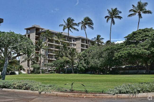

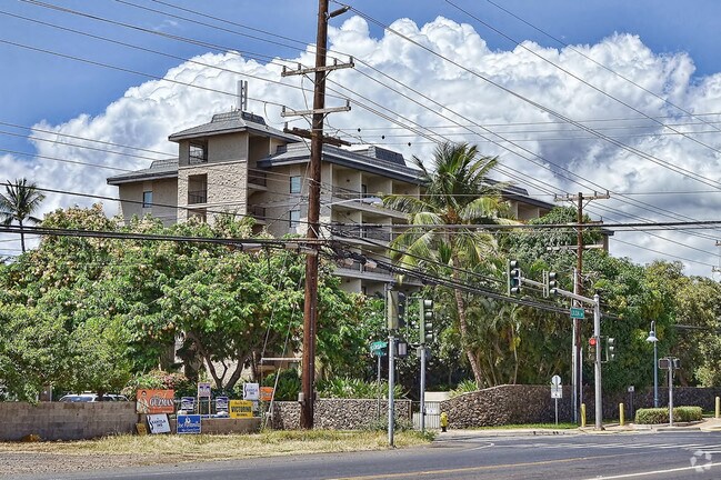

Property Detail
175 E Lipoa St
2-3-9-002-084-0000
LOT 12-F-1 WAIOHULI-KEOKEA HOMESTEADS POR GR 6967 273,194 SF DES
Commercialnec
Maui
320
Hawaii
B and X Area of moderate flood hazard, usually the area between the limits of the 100-year and 500-year floods.
12-f-
2024
6.27 AC
2025
South Maui
030713
Hawaii
169,214 SF
Kahului-Wailuku, HI
NEARBY LISTINGS FOR SALE OR LEASE
-
-
View all Kihei listings for sale on LoopNet.com
DEMOGRAPHICS near 175 E Lipoa St
1 mile
3 mile
5 mile
2025 Total Population
7,497
28,918
36,951
2030 Population
7,580
30,054
38,825
Pop Growth 2025-2030
+ 1.11%
+ 3.93%
+ 5.07%
Average Age
43
45
47
2025 Total Households
2,776
11,440
15,024
HH Growth 2025-2030
+ 0.97%
+ 4.21%
+ 5.36%
Median Household Inc
$87,577
$81,622
$87,435
Avg Household Size
2.50
2.40
2.30
2025 Avg HH Vehicles
2.00
2.00
2.00
Median Home Value
$956,576
$927,004
$1,024,460
Median Year Built
1985
1985
1986
Nearby Places
Map Layers
Map Styles
 Street
 Aerial
Layers
 Traffic
 Biking
Places
Listings with unknown addresses are not visible on the map
- Restaurants
- Banks
- Shops
- Fitness
- Groceries
PUBLIC TRANSPORTATION
AIRPORT
Kahului
Drive
Walk
Distance
Kahului
27 min
13.4 mi
Nearby Properties
Address
Land Use
TOTAL SIZE
Lot Size
Zoning
Address
Land Use
TOTAL SIZE
Lot Size
Zoning
162,578 SF
4.87 AC
H-M
Address
Land Use
TOTAL SIZE
Lot Size
Zoning
4.81 AC
H-2
Address
Land Use
TOTAL SIZE
Lot Size
Zoning
8.27 AC
STATE URB
Address
Land Use
TOTAL SIZE
Lot Size
Zoning
27,234 SF
13.43 AC
SMA
Address
Land Use
TOTAL SIZE
Lot Size
Zoning
8.65 AC
SMA NONE
Address
Land Use
TOTAL SIZE
Lot Size
Zoning
62,311 SF
2.78 AC
PD
Address
Land Use
TOTAL SIZE
Lot Size
Zoning
Address
Land Use
TOTAL SIZE
Lot Size
Zoning
57,326 SF
8.53 AC
A-1
Address
Land Use
TOTAL SIZE
Lot Size
Zoning
111,620 SF
6.71 AC
URBAN
Address
Land Use
TOTAL SIZE
Lot Size
Zoning
159,892 SF
5.74 AC
Address
Land Use
TOTAL SIZE
Lot Size
Zoning
49,321 SF
6.13 AC
PROJECT
Address
Land Use
TOTAL SIZE
Lot Size
Zoning
60,502 SF
5.62 AC
STATE URB
Address
Land Use
TOTAL SIZE
Lot Size
Zoning
61,880 SF
5.27 AC
A-1
Address
Land Use
TOTAL SIZE
Lot Size
Zoning
79.81 AC
Address
Land Use
TOTAL SIZE
Lot Size
Zoning
17.27 AC
2
Address
Land Use
TOTAL SIZE
Lot Size
Zoning
55,894 SF
4.41 AC
2
Address
Land Use
TOTAL SIZE
Lot Size
Zoning
123.84 AC
Address
Land Use
TOTAL SIZE
Lot Size
Zoning
8.62 AC
COUNTY AG
Address
Land Use
TOTAL SIZE
Lot Size
Zoning
60,248 SF
5.18 AC
R&T KIHEI
Address
Land Use
TOTAL SIZE
Lot Size
Zoning
4.23 AC
STATE URB
Address
Land Use
TOTAL SIZE
Lot Size
Zoning
1.02 AC
STATE URB
Address
Land Use
TOTAL SIZE
Lot Size
Zoning
5.67 AC
3
Address
Land Use
TOTAL SIZE
Lot Size
Zoning
2.26 AC
2
Address
Land Use
TOTAL SIZE
Lot Size
Zoning
23,969 SF
4.46 AC
URBAN
Address
Land Use
TOTAL SIZE
Lot Size
Zoning
34,406 SF
4 AC
STATE URB
Address
Land Use
TOTAL SIZE
Lot Size
Zoning
45,199 SF
3.35 AC
B-2
Address
Land Use
TOTAL SIZE
Lot Size
Zoning
37,036 SF
4.34 AC
B-2
Address
Land Use
TOTAL SIZE
Lot Size
Zoning
17.27 AC
2
Address
Land Use
TOTAL SIZE
Lot Size
Zoning
12.81 AC
H-2
The World's #1 Commercial Real Estate Marketplace
Connect with us
© 2026 CoStar Group
The information above has been obtained from sources believed reliable. While we do not doubt its accuracy we have not verified it and make no guarantee, warranty or representation about it. It is your responsibility to independently confirm its accuracy and completeness. Any projections, opinions, assumptions, or estimates used are for example only and do not represent the current or future performance of the property. The value of this transaction to you depends on tax and other factors which should be evaluated by your tax, financial, and legal advisors. You and your advisors should conduct a careful, independent investigation of the property to determine to your satisfaction the suitability of the property for your needs.