Property Record
175 Greenfield Rd, Lancaster, PA 17601
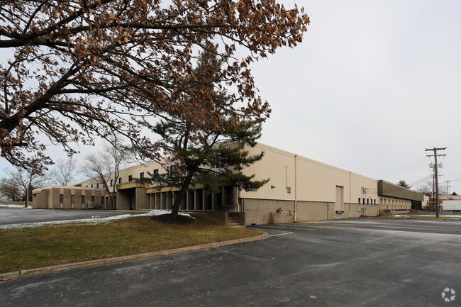

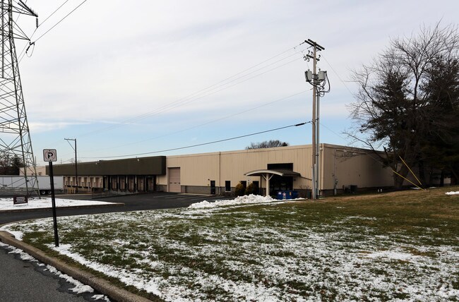
Property Detail
175 Greenfield Rd
310-29954-0-0000
175 GREENFIELD RD
Shipyard
Lancaster
I
Pennsylvania
B and X Area of moderate flood hazard, usually the area between the limits of the 100-year and 500-year floods.
9a
2025
4.80 AC
2026
Lancaster County
013202
Philadelphia
90,211 SF
Lancaster, PA
NEARBY LISTINGS FOR SALE OR LEASE
DEMOGRAPHICS near 175 Greenfield Rd
1 mile
3 mile
5 mile
2025 Total Population
5,554
70,641
153,369
2030 Population
5,640
71,661
155,447
Pop Growth 2025-2030
+ 1.55%
+ 1.44%
+ 1.35%
Average Age
43
39
40
2025 Total Households
2,346
27,019
58,699
HH Growth 2025-2030
+ 1.71%
+ 1.49%
+ 1.34%
Median Household Inc
$79,386
$71,863
$74,496
Avg Household Size
2.30
2.40
2.40
2025 Avg HH Vehicles
2.00
2.00
2.00
Median Home Value
$258,468
$290,373
$294,314
Median Year Built
1982
1963
1965
Nearby Places
Map Layers
Map Styles
 Street
 Aerial
Layers
 Traffic
 Biking
Places
Listings with unknown addresses are not visible on the map
- Restaurants
- Banks
- Shops
- Fitness
- Groceries
PUBLIC TRANSPORTATION
AIRPORT
Harrisburg International
Drive
Walk
Distance
Harrisburg International
44 min
34.1 mi
Freight Ports
Port Newark Container Terminal
Drive
Walk
Distance
Port Newark Container Terminal
75 min
45.4 mi
SALE & LEASE HISTORY
LISTING DATE
SALE/LEASE

Sep 25, 2016
For Lease
May 03, 2020
For Lease
Nearby Properties
Address
Land Use
TOTAL SIZE
Lot Size
Zoning
Address
Land Use
TOTAL SIZE
Lot Size
Zoning
1,120,221 SF
8.40 AC
Address
Land Use
TOTAL SIZE
Lot Size
Zoning
871,695 SF
69.40 AC
R2
Address
Land Use
TOTAL SIZE
Lot Size
Zoning
206,666 SF
1 AC
CB1
Address
Land Use
TOTAL SIZE
Lot Size
Zoning
269,860 SF
0.90 AC
CB1
Address
Land Use
TOTAL SIZE
Lot Size
Zoning
315,373 SF
4.73 AC
DF
Address
Land Use
TOTAL SIZE
Lot Size
Zoning
403,771 SF
106.93 AC
Address
Land Use
TOTAL SIZE
Lot Size
Zoning
610,108 SF
39.96 AC
C-2
Address
Land Use
TOTAL SIZE
Lot Size
Zoning
251,676 SF
40.20 AC
R-2
Address
Land Use
TOTAL SIZE
Lot Size
Zoning
333,301 SF
24.15 AC
MU
Address
Land Use
TOTAL SIZE
Lot Size
Zoning
275,959 SF
68.50 AC
IN
Address
Land Use
TOTAL SIZE
Lot Size
Zoning
233,738 SF
34.10 AC
Address
Land Use
TOTAL SIZE
Lot Size
Zoning
642,651 SF
2.16 AC
CA
Address
Land Use
TOTAL SIZE
Lot Size
Zoning
178,234 SF
0.78 AC
CB
Address
Land Use
TOTAL SIZE
Lot Size
Zoning
322,380 SF
33.29 AC
R-3
Address
Land Use
TOTAL SIZE
Lot Size
Zoning
203,415 SF
10.74 AC
Address
Land Use
TOTAL SIZE
Lot Size
Zoning
234,386 SF
15.30 AC
MU
Address
Land Use
TOTAL SIZE
Lot Size
Zoning
289,398 SF
35.20 AC
C-2
Address
Land Use
TOTAL SIZE
Lot Size
Zoning
254,079 SF
21.54 AC
Address
Land Use
TOTAL SIZE
Lot Size
Zoning
219,576 SF
21.41 AC
Address
Land Use
TOTAL SIZE
Lot Size
Zoning
234,681 SF
7.50 AC
MU
Address
Land Use
TOTAL SIZE
Lot Size
Zoning
195,708 SF
26.17 AC
Address
Land Use
TOTAL SIZE
Lot Size
Zoning
203,942 SF
21.22 AC
B-4
Address
Land Use
TOTAL SIZE
Lot Size
Zoning
233,826 SF
12.73 AC
Address
Land Use
TOTAL SIZE
Lot Size
Zoning
250,229 SF
12.49 AC
B-4
Address
Land Use
TOTAL SIZE
Lot Size
Zoning
323,300 SF
21.60 AC
C-2
Address
Land Use
TOTAL SIZE
Lot Size
Zoning
125,073 SF
19.07 AC
I
Address
Land Use
TOTAL SIZE
Lot Size
Zoning
302,460 SF
51.80 AC
R4
Address
Land Use
TOTAL SIZE
Lot Size
Zoning
131,110 SF
0.40 AC
CB1
Address
Land Use
TOTAL SIZE
Lot Size
Zoning
87,502 SF
11.69 AC
MU
Address
Land Use
TOTAL SIZE
Lot Size
Zoning
256,905 SF
1.57 AC
CB1
The World's #1 Commercial Real Estate Marketplace
Connect with us
© 2026 CoStar Group
The information above has been obtained from sources believed reliable. While we do not doubt its accuracy we have not verified it and make no guarantee, warranty or representation about it. It is your responsibility to independently confirm its accuracy and completeness. Any projections, opinions, assumptions, or estimates used are for example only and do not represent the current or future performance of the property. The value of this transaction to you depends on tax and other factors which should be evaluated by your tax, financial, and legal advisors. You and your advisors should conduct a careful, independent investigation of the property to determine to your satisfaction the suitability of the property for your needs.