Property Record
175 Hancock St, Everett, MA 02149
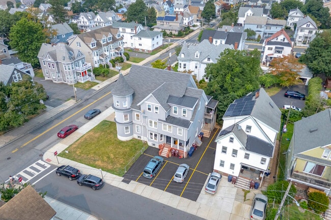

Property Detail
175 Hancock St
EVER-000000-B000006-000113
Middlesex
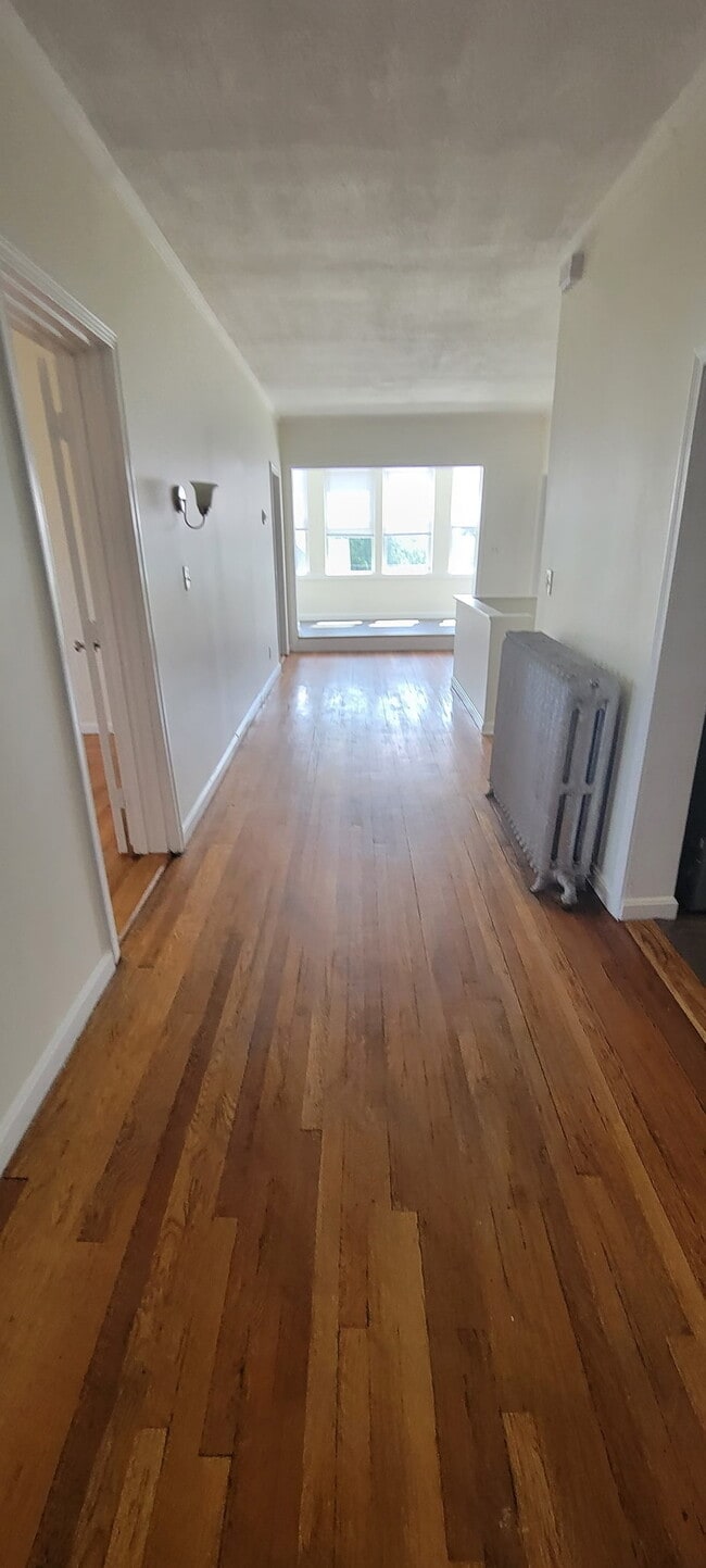
Apartment
Massachusetts
DD
113
B and X Area of moderate flood hazard, usually the area between the limits of the 100-year and 500-year floods.
0.21 AC
2025
Glendale
2025
Boston
342201
Boston-Cambridge-Newton, MA-NH
5,237 SF
NEARBY LISTINGS FOR SALE OR LEASE
DEMOGRAPHICS near 175 Hancock St
1 mile
3 mile
5 mile
2024 Total Population
50,992
297,203
705,059
2029 Population
49,004
285,689
684,080
Pop Growth 2024-2029
(3.90%)
(3.87%)
(2.98%)
Average Age
38
38
38
2024 Total Households
18,287
115,041
293,562
HH Growth 2024-2029
(3.91%)
(3.91%)
(3.02%)
Median Household Inc
$71,231
$86,467
$100,381
Avg Household Size
2.70
2.50
2.20
2024 Avg HH Vehicles
1.00
1.00
1.00
Median Home Value
$593,436
$647,536
$740,785
Median Year Built
1947
1949
1949
Nearby Places
Map Layers
Map Styles
 Street
 Aerial
Transit
 Traffic
 Biking
Places
Listings with unknown addresses are not visible on the map
- Restaurants
- Banks
- Shops
- Fitness
- Groceries
PUBLIC TRANSPORTATION
COMMUTER RAIL
Malden Center (Haverhill Line - Massachusetts Bay Transportation Authority Commuter Rail (Purple Line))
Drive
Walk
Distance
Malden Center (Haverhill Line - Massachusetts Bay Transportation Authority Commuter Rail (Purple Line))
4 min
1.4 mi
Drive
Walk
Distance
5 min
2.0 mi
AIRPORT
General Edward Lawrence Logan International
Drive
Walk
Distance
General Edward Lawrence Logan International
12 min
5.2 mi
SALE & LEASE HISTORY
LISTING DATE
SALE/LEASE

Aug 19, 2025
For Sale
Nearby Properties
Address
Land Use
TOTAL SIZE
Lot Size
Zoning
Address
Land Use
TOTAL SIZE
Lot Size
Zoning
8 AC
HB
Address
Land Use
TOTAL SIZE
Lot Size
Zoning
646,546 SF
89.28 AC
ROD
Address
Land Use
TOTAL SIZE
Lot Size
Zoning
386,825 SF
10.67 AC
Address
Land Use
TOTAL SIZE
Lot Size
Zoning
410,642 SF
4.68 AC
CTED
Address
Land Use
TOTAL SIZE
Lot Size
Zoning
43.90 AC
Address
Land Use
TOTAL SIZE
Lot Size
Zoning
234,450 SF
3.49 AC
I
Address
Land Use
TOTAL SIZE
Lot Size
Zoning
297,396 SF
2.79 AC
CTED
Address
Land Use
TOTAL SIZE
Lot Size
Zoning
424,000 SF
2.63 AC
RC
Address
Land Use
TOTAL SIZE
Lot Size
Zoning
378,339 SF
3.02 AC
E
Address
Land Use
TOTAL SIZE
Lot Size
Zoning
Address
Land Use
TOTAL SIZE
Lot Size
Zoning
6.73 AC
HB
Address
Land Use
TOTAL SIZE
Lot Size
Zoning
13.48 AC
Address
Land Use
TOTAL SIZE
Lot Size
Zoning
324,870 SF
9.37 AC
E
Address
Land Use
TOTAL SIZE
Lot Size
Zoning
339,600 SF
23.09 AC
CIV
Address
Land Use
TOTAL SIZE
Lot Size
Zoning
254,075 SF
3.70 AC
Address
Land Use
TOTAL SIZE
Lot Size
Zoning
613,125 SF
15.74 AC
RC
Address
Land Use
TOTAL SIZE
Lot Size
Zoning
21,024 SF
18.19 AC
Address
Land Use
TOTAL SIZE
Lot Size
Zoning
253,859 SF
3.18 AC
Address
Land Use
TOTAL SIZE
Lot Size
Zoning
454,752 SF
6.22 AC
Address
Land Use
TOTAL SIZE
Lot Size
Zoning
7,736 SF
24.56 AC
UR
Address
Land Use
TOTAL SIZE
Lot Size
Zoning
129,898 SF
43.82 AC
ID
Address
Land Use
TOTAL SIZE
Lot Size
Zoning
Address
Land Use
TOTAL SIZE
Lot Size
Zoning
359,892 SF
9.06 AC
Address
Land Use
TOTAL SIZE
Lot Size
Zoning
252,796 SF
2.46 AC
ASMD
Address
Land Use
TOTAL SIZE
Lot Size
Zoning
273,180 SF
6.53 AC
CI
Address
Land Use
TOTAL SIZE
Lot Size
Zoning
208,865 SF
7.69 AC
E
Address
Land Use
TOTAL SIZE
Lot Size
Zoning
224,080 SF
1.59 AC
CI
Address
Land Use
TOTAL SIZE
Lot Size
Zoning
354,723 SF
20.59 AC
BPA
Address
Land Use
TOTAL SIZE
Lot Size
Zoning
6.02 AC
TED
Address
Land Use
TOTAL SIZE
Lot Size
Zoning
292,515 SF
21.61 AC
The World's #1 Commercial Real Estate Marketplace
Connect with us
© 2026 CoStar Group
The information above has been obtained from sources believed reliable. While we do not doubt its accuracy we have not verified it and make no guarantee, warranty or representation about it. It is your responsibility to independently confirm its accuracy and completeness. Any projections, opinions, assumptions, or estimates used are for example only and do not represent the current or future performance of the property. The value of this transaction to you depends on tax and other factors which should be evaluated by your tax, financial, and legal advisors. You and your advisors should conduct a careful, independent investigation of the property to determine to your satisfaction the suitability of the property for your needs.