Property Record
175 Lafayette Rd, North Hampton, NH 03862
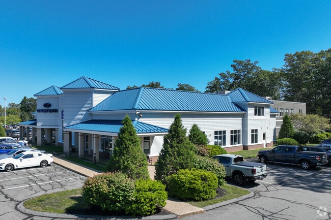

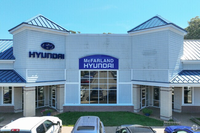
Property Detail
175 Lafayette Rd
Commercialnec
ROCKINGHAM
IB/R
New Hampshire
B and X Area of moderate flood hazard, usually the area between the limits of the 100-year and 500-year floods.
19.20 AC
2025
Rockingham
2025
Boston
066000
Boston-Cambridge-Newton, MA-NH
34,924 SF
NHTN-000017-000097
NEARBY LISTINGS FOR SALE OR LEASE
DEMOGRAPHICS near 175 Lafayette Rd
1 mile
3 mile
5 mile
2025 Total Population
1,354
13,246
41,200
2030 Population
1,377
13,500
42,098
Pop Growth 2025-2030
+ 1.70%
+ 1.92%
+ 2.18%
Average Age
50
47
47
2025 Total Households
598
5,667
17,703
HH Growth 2025-2030
+ 1.67%
+ 1.84%
+ 2.19%
Median Household Inc
$68,951
$111,720
$112,012
Avg Household Size
2.20
2.30
2.30
2025 Avg HH Vehicles
2.00
2.00
2.00
Median Home Value
$541,667
$743,942
$693,169
Median Year Built
1988
1981
1981
Nearby Places
Map Layers
Map Styles
 Street
 Aerial
Layers
 Traffic
 Biking
Places
Listings with unknown addresses are not visible on the map
- Restaurants
- Banks
- Shops
- Fitness
- Groceries
PUBLIC TRANSPORTATION
COMMUTER RAIL
Exeter (Downeaster - Amtrak)
Drive
Walk
Distance
Exeter (Downeaster - Amtrak)
18 min
8.2 mi
AIRPORT
Portsmouth International at Pease
Drive
Walk
Distance
Portsmouth International at Pease
19 min
8.4 mi
Freight Ports
Port of Boston
Drive
Walk
Distance
Port of Boston
76 min
52.5 mi
Nearby Properties
Address
Land Use
TOTAL SIZE
Lot Size
Zoning
Address
Land Use
TOTAL SIZE
Lot Size
Zoning
35.53 AC
GA/MH
Address
Land Use
TOTAL SIZE
Lot Size
Zoning
28.05 AC
GA/MH
Address
Land Use
TOTAL SIZE
Lot Size
Zoning
25.08 AC
NRP
Address
Land Use
TOTAL SIZE
Lot Size
Zoning
7.16 AC
GA/MH
Address
Land Use
TOTAL SIZE
Lot Size
Zoning
53,008 SF
17.70 AC
SRES
Address
Land Use
TOTAL SIZE
Lot Size
Zoning
85,152 SF
13.04 AC
G1
Address
Land Use
TOTAL SIZE
Lot Size
Zoning
143,468 SF
61.40 AC
IB/R
Address
Land Use
TOTAL SIZE
Lot Size
Zoning
1,740 SF
67.09 AC
GA/MH
Address
Land Use
TOTAL SIZE
Lot Size
Zoning
114,814 SF
12.19 AC
IB/R
Address
Land Use
TOTAL SIZE
Lot Size
Zoning
3.80 AC
G1
Address
Land Use
TOTAL SIZE
Lot Size
Zoning
69,745 SF
85.26 AC
R2
Address
Land Use
TOTAL SIZE
Lot Size
Zoning
34,359 SF
10.15 AC
COM
Address
Land Use
TOTAL SIZE
Lot Size
Zoning
1,699 SF
9.61 AC
IB/R
Address
Land Use
TOTAL SIZE
Lot Size
Zoning
3.51 AC
G1
Address
Land Use
TOTAL SIZE
Lot Size
Zoning
56,656 SF
6.21 AC
IB/R
Address
Land Use
TOTAL SIZE
Lot Size
Zoning
17,686 SF
82.87 AC
SRES
Address
Land Use
TOTAL SIZE
Lot Size
Zoning
1.94 AC
G1
Address
Land Use
TOTAL SIZE
Lot Size
Zoning
40,864 SF
6.64 AC
PREC
Address
Land Use
TOTAL SIZE
Lot Size
Zoning
9,640 SF
3.60 AC
SRES
Address
Land Use
TOTAL SIZE
Lot Size
Zoning
6,892 SF
5.70 AC
B
Address
Land Use
TOTAL SIZE
Lot Size
Zoning
20 AC
RES
Address
Land Use
TOTAL SIZE
Lot Size
Zoning
82,240 SF
2.50 AC
IB/R
Address
Land Use
TOTAL SIZE
Lot Size
Zoning
2,703 SF
33.36 AC
IB/R
Address
Land Use
TOTAL SIZE
Lot Size
Zoning
7,667 SF
4.60 AC
R2
Address
Land Use
TOTAL SIZE
Lot Size
Zoning
14,100 SF
43.14 AC
IB/R
Address
Land Use
TOTAL SIZE
Lot Size
Zoning
15,056 SF
3.18 AC
M
Address
Land Use
TOTAL SIZE
Lot Size
Zoning
1,024 SF
21.26 AC
IB/R
Address
Land Use
TOTAL SIZE
Lot Size
Zoning
14,183 SF
2.58 AC
SRES
Address
Land Use
TOTAL SIZE
Lot Size
Zoning
151.90 AC
RES
The World's #1 Commercial Real Estate Marketplace
Connect with us
© 2026 CoStar Group
The information above has been obtained from sources believed reliable. While we do not doubt its accuracy we have not verified it and make no guarantee, warranty or representation about it. It is your responsibility to independently confirm its accuracy and completeness. Any projections, opinions, assumptions, or estimates used are for example only and do not represent the current or future performance of the property. The value of this transaction to you depends on tax and other factors which should be evaluated by your tax, financial, and legal advisors. You and your advisors should conduct a careful, independent investigation of the property to determine to your satisfaction the suitability of the property for your needs.