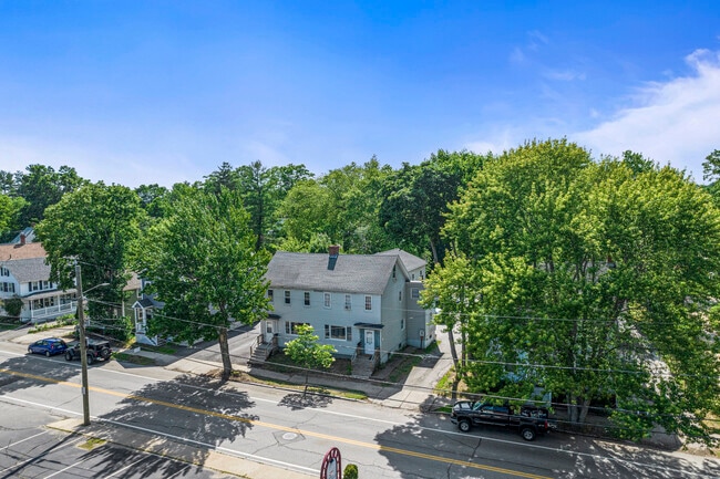
Property Record
175 Locust St, Dover, NH 03820

Property Detail
175 Locust St
DOVR-012064
Strafford
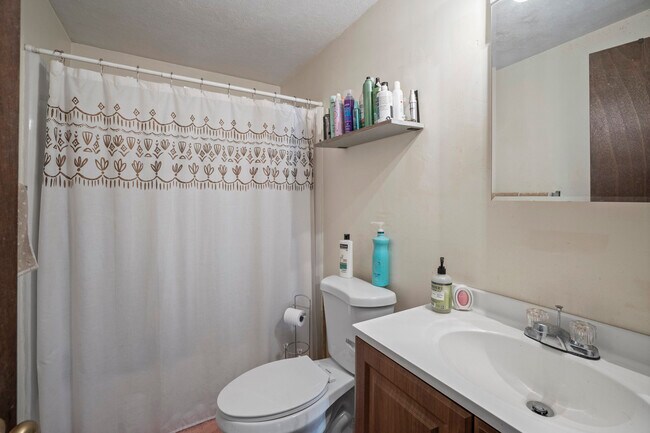
Apartment
New Hampshire
HR
0.38 AC
B and X Area of moderate flood hazard, usually the area between the limits of the 100-year and 500-year floods.
Downtown Dover
2024
Boston
2024
Boston-Cambridge-Newton, MA-NH
081300
NEARBY LISTINGS FOR SALE OR LEASE
DEMOGRAPHICS near 175 Locust St
1 mile
3 mile
5 mile
2025 Total Population
11,669
31,681
62,577
2030 Population
12,027
32,292
63,539
Pop Growth 2025-2030
+ 3.07%
+ 1.93%
+ 1.54%
Average Age
39
40
39
2025 Total Households
5,806
14,454
25,139
HH Growth 2025-2030
+ 3.27%
+ 2.12%
+ 1.73%
Median Household Inc
$81,433
$92,418
$93,381
Avg Household Size
2.00
2.10
2.30
2025 Avg HH Vehicles
2.00
2.00
2.00
Median Home Value
$468,248
$458,481
$438,614
Median Year Built
1965
1975
1973
Nearby Places
Map Layers
Map Styles
 Street
 Aerial
Transit
 Traffic
 Biking
Places
Listings with unknown addresses are not visible on the map
- Restaurants
- Banks
- Shops
- Fitness
- Groceries
PUBLIC TRANSPORTATION
COMMUTER RAIL
Dover (Downeaster - Amtrak)
Drive
Walk
Distance
Dover (Downeaster - Amtrak)
3 min
15 min
0.8 mi
Durham (Downeaster - Amtrak)
Drive
Walk
Distance
Durham (Downeaster - Amtrak)
12 min
5.4 mi
AIRPORT
Portsmouth International at Pease
Drive
Walk
Distance
Portsmouth International at Pease
16 min
9.4 mi
Freight Ports
Portland, ME
Drive
Walk
Distance
Portland, ME
69 min
49.8 mi
SALE & LEASE HISTORY
LISTING DATE
SALE/LEASE

Jun 28, 2021
For Sale
Nearby Properties
Address
Land Use
TOTAL SIZE
Lot Size
Zoning
Address
Land Use
TOTAL SIZE
Lot Size
Zoning
24.83 AC
R-20
Address
Land Use
TOTAL SIZE
Lot Size
Zoning
1.26 AC
CBD-G
Address
Land Use
TOTAL SIZE
Lot Size
Zoning
220.20 AC
IT
Address
Land Use
TOTAL SIZE
Lot Size
Zoning
20.03 AC
R-20
Address
Land Use
TOTAL SIZE
Lot Size
Zoning
7.84 AC
C
Address
Land Use
TOTAL SIZE
Lot Size
Zoning
3.66 AC
IT
Address
Land Use
TOTAL SIZE
Lot Size
Zoning
50.52 AC
RM-SU*
Address
Land Use
TOTAL SIZE
Lot Size
Zoning
18.65 AC
B
Address
Land Use
TOTAL SIZE
Lot Size
Zoning
3.40 AC
CBD-M
Address
Land Use
TOTAL SIZE
Lot Size
Zoning
15.46 AC
C
Address
Land Use
TOTAL SIZE
Lot Size
Zoning
11.80 AC
R-12*
Address
Land Use
TOTAL SIZE
Lot Size
Zoning
26.40 AC
IT*
Address
Land Use
TOTAL SIZE
Lot Size
Zoning
60.41 AC
R-40
Address
Land Use
TOTAL SIZE
Lot Size
Zoning
3.35 AC
CBD-G
Address
Land Use
TOTAL SIZE
Lot Size
Zoning
3.66 AC
C
Address
Land Use
TOTAL SIZE
Lot Size
Zoning
7.92 AC
R-12
Address
Land Use
TOTAL SIZE
Lot Size
Zoning
15.46 AC
G
Address
Land Use
TOTAL SIZE
Lot Size
Zoning
0.22 AC
CBD-G
Address
Land Use
TOTAL SIZE
Lot Size
Zoning
4.15 AC
R-12
Address
Land Use
TOTAL SIZE
Lot Size
Zoning
11.08 AC
RM-U
Address
Land Use
TOTAL SIZE
Lot Size
Zoning
11.47 AC
IT
Address
Land Use
TOTAL SIZE
Lot Size
Zoning
35.86 AC
R-40
Address
Land Use
TOTAL SIZE
Lot Size
Zoning
7.33 AC
G
Address
Land Use
TOTAL SIZE
Lot Size
Zoning
4.15 AC
RM-U
Address
Land Use
TOTAL SIZE
Lot Size
Zoning
12.60 AC
IT
Address
Land Use
TOTAL SIZE
Lot Size
Zoning
9.29 AC
R-12*
Address
Land Use
TOTAL SIZE
Lot Size
Zoning
5 AC
C
Address
Land Use
TOTAL SIZE
Lot Size
Zoning
38.27 AC
RM-U
Address
Land Use
TOTAL SIZE
Lot Size
Zoning
8.96 AC
IT
Address
Land Use
TOTAL SIZE
Lot Size
Zoning
6.81 AC
CM
The World's #1 Commercial Real Estate Marketplace
Connect with us
© 2026 CoStar Group
The information above has been obtained from sources believed reliable. While we do not doubt its accuracy we have not verified it and make no guarantee, warranty or representation about it. It is your responsibility to independently confirm its accuracy and completeness. Any projections, opinions, assumptions, or estimates used are for example only and do not represent the current or future performance of the property. The value of this transaction to you depends on tax and other factors which should be evaluated by your tax, financial, and legal advisors. You and your advisors should conduct a careful, independent investigation of the property to determine to your satisfaction the suitability of the property for your needs.