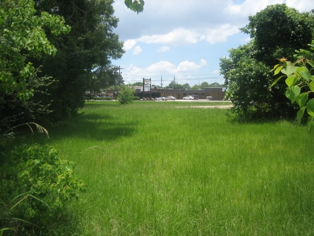
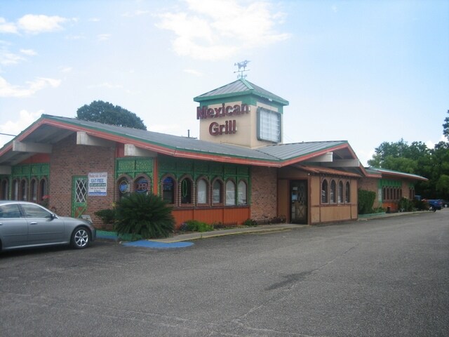
Property Record
175 Mcgehee Dr, Baton Rouge, LA 70815

Property Detail
175 Mcgehee Dr
Baton Rouge, LA
WARD: 1-4, SUBDIVISION: HARELSON, H. B. PROPERTY, LOT: A-1-C. LOT A-1-C. H.B. HARELSON PROPERTY. SEC 65 T7S, RIE. RESUB OF LO
01009516
E BATON ROUGE
Storesoffices
Louisiana
B and X Area of moderate flood hazard, usually the area between the limits of the 100-year and 500-year floods.
a-1-c
2025
2.85 AC
2025
Florida/Airline
003702
Baton Rouge
1,560 SF
NEARBY LISTINGS FOR SALE OR LEASE
DEMOGRAPHICS near 175 Mcgehee Dr
1 mile
3 mile
5 mile
2025 Total Population
11,942
71,507
165,964
2030 Population
11,917
70,788
165,084
Pop Growth 2025-2030
(0.21%)
(1.01%)
(0.53%)
Average Age
39
38
39
2025 Total Households
4,440
27,988
68,130
HH Growth 2025-2030
(0.38%)
(1.16%)
(0.59%)
Median Household Inc
$47,598
$56,725
$57,214
Avg Household Size
2.50
2.40
2.40
2025 Avg HH Vehicles
2.00
2.00
2.00
Median Home Value
$202,510
$215,357
$234,843
Median Year Built
1968
1977
1980
Nearby Places
Map Layers
Map Styles
 Street
 Aerial
Layers
 Traffic
 Biking
Places
Listings with unknown addresses are not visible on the map
- Restaurants
- Banks
- Shops
- Fitness
- Groceries
PUBLIC TRANSPORTATION
AIRPORT
Baton Rouge Metro Ryan Field
Drive
Walk
Distance
Baton Rouge Metro Ryan Field
15 min
8.8 mi
Freight Ports
Port of Greater Baton Rouge
Drive
Walk
Distance
Port of Greater Baton Rouge
22 min
11.2 mi
SALE & LEASE HISTORY
LISTING DATE
SALE/LEASE

Feb 03, 2017
For Sale
Nearby Properties
Address
Land Use
TOTAL SIZE
Lot Size
Zoning
Address
Land Use
TOTAL SIZE
Lot Size
Zoning
97.03 AC
Address
Land Use
TOTAL SIZE
Lot Size
Zoning
Address
Land Use
TOTAL SIZE
Lot Size
Zoning
365,566 SF
8.77 AC
Address
Land Use
TOTAL SIZE
Lot Size
Zoning
501,688 SF
11.17 AC
Address
Land Use
TOTAL SIZE
Lot Size
Zoning
30.26 AC
Address
Land Use
TOTAL SIZE
Lot Size
Zoning
481,760 SF
18.31 AC
Address
Land Use
TOTAL SIZE
Lot Size
Zoning
126,717 SF
56.29 AC
Address
Land Use
TOTAL SIZE
Lot Size
Zoning
74,847 SF
9.96 AC
Address
Land Use
TOTAL SIZE
Lot Size
Zoning
98,912 SF
13.75 AC
Address
Land Use
TOTAL SIZE
Lot Size
Zoning
13.07 AC
Address
Land Use
TOTAL SIZE
Lot Size
Zoning
223,498 SF
20.34 AC
Address
Land Use
TOTAL SIZE
Lot Size
Zoning
12.23 AC
Address
Land Use
TOTAL SIZE
Lot Size
Zoning
145,622 SF
25.07 AC
Address
Land Use
TOTAL SIZE
Lot Size
Zoning
14.31 AC
Address
Land Use
TOTAL SIZE
Lot Size
Zoning
Address
Land Use
TOTAL SIZE
Lot Size
Zoning
Address
Land Use
TOTAL SIZE
Lot Size
Zoning
81,137 SF
2.99 AC
Address
Land Use
TOTAL SIZE
Lot Size
Zoning
Address
Land Use
TOTAL SIZE
Lot Size
Zoning
288,746 SF
12.16 AC
Address
Land Use
TOTAL SIZE
Lot Size
Zoning
152,156 SF
1.53 AC
Address
Land Use
TOTAL SIZE
Lot Size
Zoning
Address
Land Use
TOTAL SIZE
Lot Size
Zoning
25.54 AC
Address
Land Use
TOTAL SIZE
Lot Size
Zoning
303,400 SF
25.16 AC
Address
Land Use
TOTAL SIZE
Lot Size
Zoning
15.16 AC
Address
Land Use
TOTAL SIZE
Lot Size
Zoning
27,720 SF
1.51 AC
Address
Land Use
TOTAL SIZE
Lot Size
Zoning
Address
Land Use
TOTAL SIZE
Lot Size
Zoning
14.11 AC
Address
Land Use
TOTAL SIZE
Lot Size
Zoning
Address
Land Use
TOTAL SIZE
Lot Size
Zoning
252,000 SF
12.95 AC
Address
Land Use
TOTAL SIZE
Lot Size
Zoning
131,502 SF
1.18 AC
The World's #1 Commercial Real Estate Marketplace
Connect with us
© 2026 CoStar Group
The information above has been obtained from sources believed reliable. While we do not doubt its accuracy we have not verified it and make no guarantee, warranty or representation about it. It is your responsibility to independently confirm its accuracy and completeness. Any projections, opinions, assumptions, or estimates used are for example only and do not represent the current or future performance of the property. The value of this transaction to you depends on tax and other factors which should be evaluated by your tax, financial, and legal advisors. You and your advisors should conduct a careful, independent investigation of the property to determine to your satisfaction the suitability of the property for your needs.