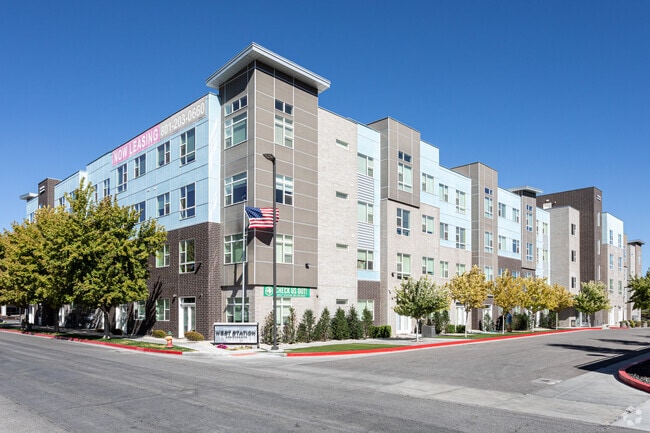
Property Record
175 N Harold St, Salt Lake City, UT 84116


NEARBY LISTINGS FOR SALE OR LEASE
Property Detail
175 N Harold St
Salt Lake City, UT
Deskys Fourth Add
08-34-331-045-0000
LOT 1, CHARS S DESKYS FOURTH ADD AMD & EXT. LESS & EXCEPT, BEG AT THE NE COR OF LOT 1, CHARS S DESKYS FOURTH ADD AMD &EXT; S 000122 E 15 FT; S 895338 W 45.50 FT; N 000122 W 15 FT; N 895838 E 45.50 FT M OR L TO BEG. 3.08 AC M OR L. 10444-6044,6049
Apartment
Salt Lake
X
Utah
49011C0525E
1
2024
3.08 AC
2025
Jordan Meadows
100306
Salt Lake City
30,356 SF
DEMOGRAPHICS near 175 N Harold St
1 Mile
3 Mile
5 Mile
2024 Total Population
14,718
81,985
174,560
2029 Population
15,074
83,973
178,094
Pop Growth 2024-2029
+ 2.42%
+ 2.42%
+ 2.02%
Average Age
35
36
36
2024 Total Households
5,260
32,899
74,765
HH Growth 2024-2029
+ 2.55%
+ 3.21%
+ 2.48%
Median Household Inc
$53,850
$58,352
$59,124
Avg Household Size
2.60
2.30
2.20
2024 Avg HH Vehicles
2.00
2.00
2.00
Median Home Value
$241,755
$348,289
$414,194
Median Year Built
1988
1981
1972
Nearby Places
Map Layers
Map Styles
 Street
 Aerial
- Restaurants
- Banks
- Shops
- Fitness
- Groceries
PUBLIC TRANSPORTATION
TRANSIT/SUBWAY
1940 W. North Temple Station (Green Line - Utah Transit Authority (UTA))
DRIVE
WALK
Distance
1940 W. North Temple Station (Green Line - Utah Transit Authority (UTA))
2 min
10 min
0.5 mi
Power Station (Green Line - Utah Transit Authority (UTA))
DRIVE
WALK
Distance
Power Station (Green Line - Utah Transit Authority (UTA))
1 min
10 min
0.5 mi
Fairpark Station (Green Line - Utah Transit Authority (UTA))
DRIVE
WALK
Distance
Fairpark Station (Green Line - Utah Transit Authority (UTA))
3 min
20 min
1.1 mi
COMMUTER RAIL
North Temple Station (FrontRunner - Utah Transit Authority (UTA))
DRIVE
WALK
Distance
North Temple Station (FrontRunner - Utah Transit Authority (UTA))
7 min
2.4 mi
Warm Springs Relief Point (FrontRunner - Utah Transit Authority (UTA))
DRIVE
WALK
Distance
Warm Springs Relief Point (FrontRunner - Utah Transit Authority (UTA))
9 min
3.7 mi
AIRPORT
Salt Lake City International
DRIVE
WALK
Distance
Salt Lake City International
9 min
4.3 mi
Freight Ports
Port of Stockton
DRIVE
WALK
Distance
Port of Stockton
709 min
694.7 mi
SALE & LEASE HISTORY
LISTING DATE
SALE/LEASE

Sep 24, 2016
For Sale
Nearby Properties
Address
Land Use
TOTAL SIZE
Lot Size
Zoning
Address
Land Use
TOTAL SIZE
Lot Size
Zoning
1,115,174 SF
9.72 AC
D-4
Address
Land Use
TOTAL SIZE
Lot Size
Zoning
427,316 SF
12.31 AC
AIRPRT
Address
Land Use
TOTAL SIZE
Lot Size
Zoning
352,836 SF
20.05 AC
PL
Address
Land Use
TOTAL SIZE
Lot Size
Zoning
350,000 SF
10 AC
U1
Address
Land Use
TOTAL SIZE
Lot Size
Zoning
1,523,947 SF
37.63 AC
AIR
Address
Land Use
TOTAL SIZE
Lot Size
Zoning
186,429 SF
101 AC
AIRPRT
Address
Land Use
TOTAL SIZE
Lot Size
Zoning
56,741 SF
1.70 AC
D-1
Address
Land Use
TOTAL SIZE
Lot Size
Zoning
87,933 SF
4.90 AC
D-1
Address
Land Use
TOTAL SIZE
Lot Size
Zoning
2,566,335 SF
10.01 AC
D-1
Address
Land Use
TOTAL SIZE
Lot Size
Zoning
1,849,748 SF
6.88 AC
D-1
Address
Land Use
TOTAL SIZE
Lot Size
Zoning
1,330,058 SF
5.02 AC
D2
Address
Land Use
TOTAL SIZE
Lot Size
Zoning
836,183 SF
5.89 AC
TSA-UC
Address
Land Use
TOTAL SIZE
Lot Size
Zoning
807,940 SF
0.69 AC
D1
Address
Land Use
TOTAL SIZE
Lot Size
Zoning
712,539 SF
0.01 AC
D1
Address
Land Use
TOTAL SIZE
Lot Size
Zoning
1,256,042 SF
3.50 AC
D-1
Address
Land Use
TOTAL SIZE
Lot Size
Zoning
691,465 SF
18.57 AC
3000
Address
Land Use
TOTAL SIZE
Lot Size
Zoning
434,481 SF
10 AC
D-1
Address
Land Use
TOTAL SIZE
Lot Size
Zoning
157,938 SF
12 AC
1205
Address
Land Use
TOTAL SIZE
Lot Size
Zoning
146,422 SF
2.62 AC
UI
Address
Land Use
TOTAL SIZE
Lot Size
Zoning
449,528 SF
1.64 AC
2000
Address
Land Use
TOTAL SIZE
Lot Size
Zoning
543,780 SF
0.33 AC
D1
Address
Land Use
TOTAL SIZE
Lot Size
Zoning
454,036 SF
1.64 AC
D-1
Address
Land Use
TOTAL SIZE
Lot Size
Zoning
0.01 AC
D-4
Address
Land Use
TOTAL SIZE
Lot Size
Zoning
737,755 SF
1.63 AC
D-1
Address
Land Use
TOTAL SIZE
Lot Size
Zoning
22,022 SF
308 AC
AIRPRT
Address
Land Use
TOTAL SIZE
Lot Size
Zoning
37,536 SF
10 AC
PL
Address
Land Use
TOTAL SIZE
Lot Size
Zoning
366,584 SF
1.95 AC
TSAUC
Address
Land Use
TOTAL SIZE
Lot Size
Zoning
617,901 SF
2.73 AC
TSA-UC
Address
Land Use
TOTAL SIZE
Lot Size
Zoning
695,737 SF
1.70 AC
D-1
Address
Land Use
TOTAL SIZE
Lot Size
Zoning
248,345 SF
50 AC
PL
The World's #1 Commercial Real Estate Marketplace
Connect with us
© 2026 CoStar Group
The information above has been obtained from sources believed reliable. While we do not doubt its accuracy we have not verified it and make no guarantee, warranty or representation about it. It is your responsibility to independently confirm its accuracy and completeness. Any projections, opinions, assumptions, or estimates used are for example only and do not represent the current or future performance of the property. The value of this transaction to you depends on tax and other factors which should be evaluated by your tax, financial, and legal advisors. You and your advisors should conduct a careful, independent investigation of the property to determine to your satisfaction the suitability of the property for your needs.