Property Record
175 Stanhope Sparta Rd, Andover, NJ 07821


NEARBY LISTINGS FOR SALE OR LEASE
-
-
View all Andover listings for lease on LoopNet.com
Property Detail
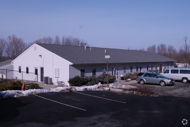
175 Stanhope Sparta Rd
12-40001-0000-00008-01
Sussex
Officebuilding
New Jersey
X
8.1
34037C0408E
2.06 AC
2024
Sussex County
2025
Northern New Jersey
374700
Newark, NJ
DEMOGRAPHICS near 175 Stanhope Sparta Rd
1 Mile
3 Mile
5 Mile
2024 Total Population
2,452
26,703
64,069
2029 Population
2,475
26,999
64,765
Pop Growth 2024-2029
+ 0.94%
+ 1.11%
+ 1.09%
Average Age
42
43
43
2024 Total Households
1,012
10,588
25,552
HH Growth 2024-2029
+ 1.09%
+ 1.14%
+ 1.12%
Median Household Inc
$90,519
$98,630
$102,061
Avg Household Size
2.40
2.50
2.50
2024 Avg HH Vehicles
2.00
2.00
2.00
Median Home Value
$254,810
$303,196
$337,777
Median Year Built
1958
1965
1968
Nearby Places
Map Layers
Map Styles
 Street
 Aerial
- Restaurants
- Banks
- Shops
- Fitness
- Groceries
PUBLIC TRANSPORTATION
COMMUTER RAIL
Netcong (Montclair-Boonton Line - NJ Transit Commuter Rail (NJ Transit), Morris & Essex Morristown Line - NJ Transit Commuter Rail (NJ Transit))
DRIVE
WALK
Distance
Netcong (Montclair-Boonton Line - NJ Transit Commuter Rail (NJ Transit), Morris & Essex Morristown Line - NJ Transit Commuter Rail (NJ Transit))
11 min
4.5 mi
Lake Hopatcong (Montclair-Boonton Line - NJ Transit Commuter Rail (NJ Transit), Morris & Essex Morristown Line - NJ Transit Commuter Rail (NJ Transit))
DRIVE
WALK
Distance
Lake Hopatcong (Montclair-Boonton Line - NJ Transit Commuter Rail (NJ Transit), Morris & Essex Morristown Line - NJ Transit Commuter Rail (NJ Transit))
14 min
5.6 mi
AIRPORT
Newark Liberty International
DRIVE
WALK
Distance
Newark Liberty International
59 min
42.8 mi
Freight Ports
Maher Terminal
DRIVE
WALK
Distance
Maher Terminal
63 min
43.4 mi
SALE & LEASE HISTORY
LISTING DATE
SALE/LEASE

May 31, 2019
For Lease
Nearby Properties
Address
Land Use
TOTAL SIZE
Lot Size
Zoning
Address
Land Use
TOTAL SIZE
Lot Size
Zoning
44.67 AC
R2
Address
Land Use
TOTAL SIZE
Lot Size
Zoning
48.48 AC
MLR
Address
Land Use
TOTAL SIZE
Lot Size
Zoning
19.87 AC
VB
Address
Land Use
TOTAL SIZE
Lot Size
Zoning
89.81 AC
R-2
Address
Land Use
TOTAL SIZE
Lot Size
Zoning
8,664 SF
19.35 AC
R3
Address
Land Use
TOTAL SIZE
Lot Size
Zoning
27.96 AC
R2
Address
Land Use
TOTAL SIZE
Lot Size
Zoning
3.90 AC
RG-5
Address
Land Use
TOTAL SIZE
Lot Size
Zoning
10.76 AC
RG-5
Address
Land Use
TOTAL SIZE
Lot Size
Zoning
26.53 AC
R-5
Address
Land Use
TOTAL SIZE
Lot Size
Zoning
14.93 AC
R2
Address
Land Use
TOTAL SIZE
Lot Size
Zoning
35,140 SF
7.96 AC
GU
Address
Land Use
TOTAL SIZE
Lot Size
Zoning
23,280 SF
3.04 AC
B1
Address
Land Use
TOTAL SIZE
Lot Size
Zoning
12.65 AC
MLR
Address
Land Use
TOTAL SIZE
Lot Size
Zoning
56 AC
SPLT
Address
Land Use
TOTAL SIZE
Lot Size
Zoning
23,950 SF
15.84 AC
RA40
Address
Land Use
TOTAL SIZE
Lot Size
Zoning
2,080 SF
76 AC
C-R
Address
Land Use
TOTAL SIZE
Lot Size
Zoning
2.80 AC
B2
Address
Land Use
TOTAL SIZE
Lot Size
Zoning
1,540 SF
30.13 AC
M1
Address
Land Use
TOTAL SIZE
Lot Size
Zoning
6,757 SF
3.92 AC
V-B
Address
Land Use
TOTAL SIZE
Lot Size
Zoning
3.10 AC
RG-5
Address
Land Use
TOTAL SIZE
Lot Size
Zoning
8.60 AC
NC
Address
Land Use
TOTAL SIZE
Lot Size
Zoning
7,118 SF
2.07 AC
RA30
Address
Land Use
TOTAL SIZE
Lot Size
Zoning
17.22 AC
M1
Address
Land Use
TOTAL SIZE
Lot Size
Zoning
4,400 SF
5.69 AC
HC
Address
Land Use
TOTAL SIZE
Lot Size
Zoning
13 AC
R-2
Address
Land Use
TOTAL SIZE
Lot Size
Zoning
2,721 SF
1.93 AC
V-B
Address
Land Use
TOTAL SIZE
Lot Size
Zoning
1,296 SF
1.04 AC
B1
Address
Land Use
TOTAL SIZE
Lot Size
Zoning
2.15 AC
B1
Address
Land Use
TOTAL SIZE
Lot Size
Zoning
14.68 AC
R1
Address
Land Use
TOTAL SIZE
Lot Size
Zoning
2,880 SF
1.08 AC
R-C
The World's #1 Commercial Real Estate Marketplace
Connect with us
© 2026 CoStar Group
The information above has been obtained from sources believed reliable. While we do not doubt its accuracy we have not verified it and make no guarantee, warranty or representation about it. It is your responsibility to independently confirm its accuracy and completeness. Any projections, opinions, assumptions, or estimates used are for example only and do not represent the current or future performance of the property. The value of this transaction to you depends on tax and other factors which should be evaluated by your tax, financial, and legal advisors. You and your advisors should conduct a careful, independent investigation of the property to determine to your satisfaction the suitability of the property for your needs.