Property Record
175 W Absecon Blvd, Absecon, NJ 08201
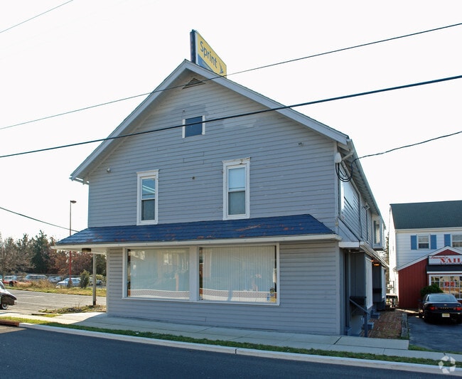


Property Detail
175 W Absecon Blvd
01-00214-0000-00010
Atlantic
Regionalshoppingcenterormallwithanchorstore
New Jersey
HC
10
B and X Area of moderate flood hazard, usually the area between the limits of the 100-year and 500-year floods.
0.92 AC
2024
Atlantic City/Hammonton
2025
Philadelphia
010300
Atlantic City-Hammonton, NJ
NEARBY LISTINGS FOR SALE OR LEASE
DEMOGRAPHICS near 175 W Absecon Blvd
1 mile
3 mile
5 mile
2025 Total Population
6,243
29,076
69,448
2030 Population
6,133
28,597
68,697
Pop Growth 2025-2030
(1.76%)
(1.65%)
(1.08%)
Average Age
42
40
40
2025 Total Households
2,398
10,364
24,292
HH Growth 2025-2030
(2.54%)
(2.41%)
(1.84%)
Median Household Inc
$77,797
$73,911
$73,904
Avg Household Size
2.50
2.70
2.60
2025 Avg HH Vehicles
2.00
2.00
2.00
Median Home Value
$248,187
$251,643
$246,627
Median Year Built
1972
1974
1980
Nearby Places
Map Layers
Map Styles
 Street
 Aerial
Transit
 Traffic
 Biking
Places
Listings with unknown addresses are not visible on the map
- Restaurants
- Banks
- Shops
- Fitness
- Groceries
PUBLIC TRANSPORTATION
COMMUTER RAIL
Absecon (Atlantic City Line - NJ Transit Commuter Rail (NJ Transit))
Drive
Walk
Distance
Absecon (Atlantic City Line - NJ Transit Commuter Rail (NJ Transit))
1 min
2 min
0.1 mi
Atlantic City (Atlantic City Line - NJ Transit Commuter Rail (NJ Transit))
Drive
Walk
Distance
Atlantic City (Atlantic City Line - NJ Transit Commuter Rail (NJ Transit))
15 min
7.0 mi
AIRPORT
Atlantic City International
Drive
Walk
Distance
Atlantic City International
34 min
11.4 mi
Freight Ports
Broadway Terminal - Pier 5
Drive
Walk
Distance
Broadway Terminal - Pier 5
67 min
50.6 mi
Nearby Properties
Address
Land Use
TOTAL SIZE
Lot Size
Zoning
Address
Land Use
TOTAL SIZE
Lot Size
Zoning
40.29 AC
IND
Address
Land Use
TOTAL SIZE
Lot Size
Zoning
4,320 SF
0.84 AC
UEZC
Address
Land Use
TOTAL SIZE
Lot Size
Zoning
9,318 SF
1.38 AC
UEZC
Address
Land Use
TOTAL SIZE
Lot Size
Zoning
17,312 SF
14.95 AC
MF
Address
Land Use
TOTAL SIZE
Lot Size
Zoning
5.56 AC
R-50
Address
Land Use
TOTAL SIZE
Lot Size
Zoning
16.27 AC
Address
Land Use
TOTAL SIZE
Lot Size
Zoning
1.95 AC
UEZC
Address
Land Use
TOTAL SIZE
Lot Size
Zoning
Address
Land Use
TOTAL SIZE
Lot Size
Zoning
10,000 SF
1.57 AC
UEZC
Address
Land Use
TOTAL SIZE
Lot Size
Zoning
1.44 AC
UEZR
Address
Land Use
TOTAL SIZE
Lot Size
Zoning
14.09 AC
DC
Address
Land Use
TOTAL SIZE
Lot Size
Zoning
2,541 SF
19.88 AC
UEZC
Address
Land Use
TOTAL SIZE
Lot Size
Zoning
2,740 SF
0.89 AC
UEZC
Address
Land Use
TOTAL SIZE
Lot Size
Zoning
2.85 AC
R-50
Address
Land Use
TOTAL SIZE
Lot Size
Zoning
1,796 SF
11.10 AC
MF
Address
Land Use
TOTAL SIZE
Lot Size
Zoning
14.57 AC
RC
Address
Land Use
TOTAL SIZE
Lot Size
Zoning
Address
Land Use
TOTAL SIZE
Lot Size
Zoning
1.64 AC
UEZC
Address
Land Use
TOTAL SIZE
Lot Size
Zoning
29.20 AC
Address
Land Use
TOTAL SIZE
Lot Size
Zoning
7.16 AC
Address
Land Use
TOTAL SIZE
Lot Size
Zoning
65,250 SF
8 AC
CVC
Address
Land Use
TOTAL SIZE
Lot Size
Zoning
16,960 SF
9.15 AC
MF
Address
Land Use
TOTAL SIZE
Lot Size
Zoning
5,991 SF
2.31 AC
UEZC
Address
Land Use
TOTAL SIZE
Lot Size
Zoning
Address
Land Use
TOTAL SIZE
Lot Size
Zoning
Address
Land Use
TOTAL SIZE
Lot Size
Zoning
7.18 AC
258
Address
Land Use
TOTAL SIZE
Lot Size
Zoning
Address
Land Use
TOTAL SIZE
Lot Size
Zoning
1.06 AC
UEZR
Address
Land Use
TOTAL SIZE
Lot Size
Zoning
Address
Land Use
TOTAL SIZE
Lot Size
Zoning
The World's #1 Commercial Real Estate Marketplace
Connect with us
© 2026 CoStar Group
The information above has been obtained from sources believed reliable. While we do not doubt its accuracy we have not verified it and make no guarantee, warranty or representation about it. It is your responsibility to independently confirm its accuracy and completeness. Any projections, opinions, assumptions, or estimates used are for example only and do not represent the current or future performance of the property. The value of this transaction to you depends on tax and other factors which should be evaluated by your tax, financial, and legal advisors. You and your advisors should conduct a careful, independent investigation of the property to determine to your satisfaction the suitability of the property for your needs.