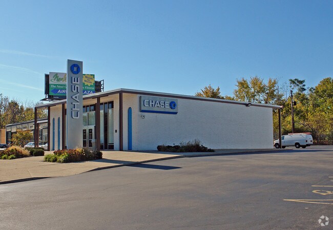
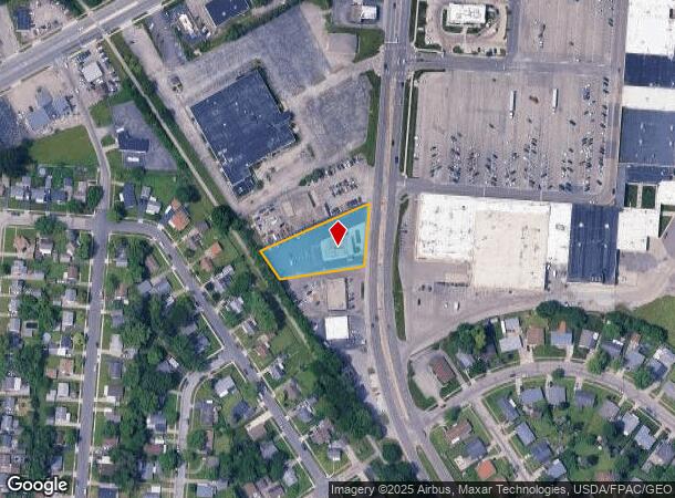
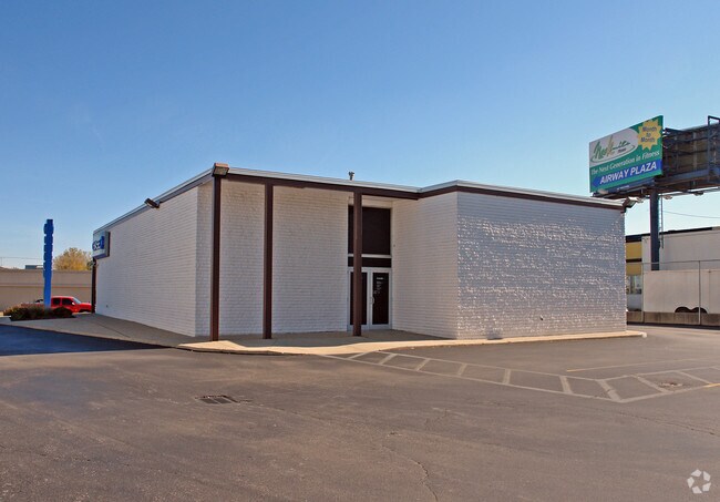
Property Record
175 Woodman Dr, Dayton, OH 45431
NEARBY LISTINGS FOR SALE OR LEASE
Property Detail
175 Woodman Dr
Dayton, OH
Eastview Dev Sec 07 Pt Rep
I39-00114-0030
7-2-22 TIF 10 YR 2014-2023 TAXABLE 2024
Storebuilding
Montgomery
X
Ohio
39057C0015D
30
2023
0.79 AC
2024
East Dayton
090700
Cincinnati/Dayton
3,561 SF
DEMOGRAPHICS near 175 Woodman Dr
1 Mile
3 Mile
5 Mile
2024 Total Population
13,413
84,984
204,136
2029 Population
13,313
85,213
205,637
Pop Growth 2024-2029
(0.75%)
+ 0.27%
+ 0.74%
Average Age
36
37
38
2024 Total Households
5,758
35,778
85,658
HH Growth 2024-2029
(0.82%)
+ 0.17%
+ 0.75%
Median Household Inc
$48,668
$48,519
$54,021
Avg Household Size
2.30
2.30
2.20
2024 Avg HH Vehicles
2.00
2.00
2.00
Median Home Value
$75,429
$92,079
$140,676
Median Year Built
1957
1954
1958
Nearby Places
Map Layers
Map Styles
 Street
 Aerial
- Restaurants
- Banks
- Shops
- Fitness
- Groceries
PUBLIC TRANSPORTATION
AIRPORT
James M Cox Dayton International
DRIVE
WALK
Distance
James M Cox Dayton International
25 min
16.1 mi
Freight Ports
Port of Toledo
DRIVE
WALK
Distance
Port of Toledo
183 min
155.4 mi
SALE & LEASE HISTORY
LISTING DATE
SALE/LEASE

Jan 28, 2020
For Sale
Jan 06, 2021
For Sale
Nearby Properties
Address
Land Use
TOTAL SIZE
Lot Size
Zoning
Address
Land Use
TOTAL SIZE
Lot Size
Zoning
154,360 SF
19.35 AC
Address
Land Use
TOTAL SIZE
Lot Size
Zoning
316.77 AC
Address
Land Use
TOTAL SIZE
Lot Size
Zoning
175,938 SF
49.33 AC
Address
Land Use
TOTAL SIZE
Lot Size
Zoning
53.48 AC
RP1
Address
Land Use
TOTAL SIZE
Lot Size
Zoning
Address
Land Use
TOTAL SIZE
Lot Size
Zoning
133.37 AC
Address
Land Use
TOTAL SIZE
Lot Size
Zoning
88,522 SF
12.96 AC
Address
Land Use
TOTAL SIZE
Lot Size
Zoning
46,796 SF
53.05 AC
RPUD038
Address
Land Use
TOTAL SIZE
Lot Size
Zoning
41.38 AC
Address
Land Use
TOTAL SIZE
Lot Size
Zoning
54.85 AC
Address
Land Use
TOTAL SIZE
Lot Size
Zoning
46.32 AC
Address
Land Use
TOTAL SIZE
Lot Size
Zoning
32.30 AC
Address
Land Use
TOTAL SIZE
Lot Size
Zoning
2,376 SF
18.75 AC
PD1
Address
Land Use
TOTAL SIZE
Lot Size
Zoning
4.98 AC
Address
Land Use
TOTAL SIZE
Lot Size
Zoning
96,732 SF
6.73 AC
CPUD002
Address
Land Use
TOTAL SIZE
Lot Size
Zoning
94,608 SF
7.44 AC
Address
Land Use
TOTAL SIZE
Lot Size
Zoning
9.45 AC
Address
Land Use
TOTAL SIZE
Lot Size
Zoning
8.17 AC
Address
Land Use
TOTAL SIZE
Lot Size
Zoning
45,954 SF
9.46 AC
Address
Land Use
TOTAL SIZE
Lot Size
Zoning
9,216 SF
16.77 AC
RPUD891
Address
Land Use
TOTAL SIZE
Lot Size
Zoning
23.20 AC
Address
Land Use
TOTAL SIZE
Lot Size
Zoning
1,200 SF
4.25 AC
B3
Address
Land Use
TOTAL SIZE
Lot Size
Zoning
Address
Land Use
TOTAL SIZE
Lot Size
Zoning
22.70 AC
Address
Land Use
TOTAL SIZE
Lot Size
Zoning
89,082 SF
4.61 AC
Address
Land Use
TOTAL SIZE
Lot Size
Zoning
101,262 SF
10.83 AC
Address
Land Use
TOTAL SIZE
Lot Size
Zoning
19,008 SF
19.96 AC
PD1
Address
Land Use
TOTAL SIZE
Lot Size
Zoning
122,624 SF
7.17 AC
Address
Land Use
TOTAL SIZE
Lot Size
Zoning
10.47 AC
Address
Land Use
TOTAL SIZE
Lot Size
Zoning
11.58 AC
The World's #1 Commercial Real Estate Marketplace
Connect with us
© 2025 CoStar Group
The information above has been obtained from sources believed reliable. While we do not doubt its accuracy we have not verified it and make no guarantee, warranty or representation about it. It is your responsibility to independently confirm its accuracy and completeness. Any projections, opinions, assumptions, or estimates used are for example only and do not represent the current or future performance of the property. The value of this transaction to you depends on tax and other factors which should be evaluated by your tax, financial, and legal advisors. You and your advisors should conduct a careful, independent investigation of the property to determine to your satisfaction the suitability of the property for your needs.