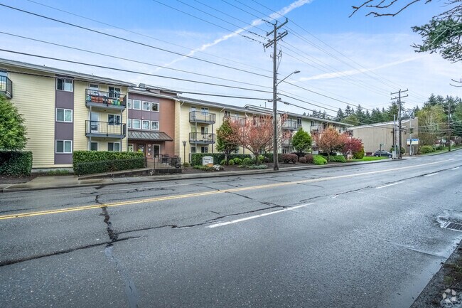
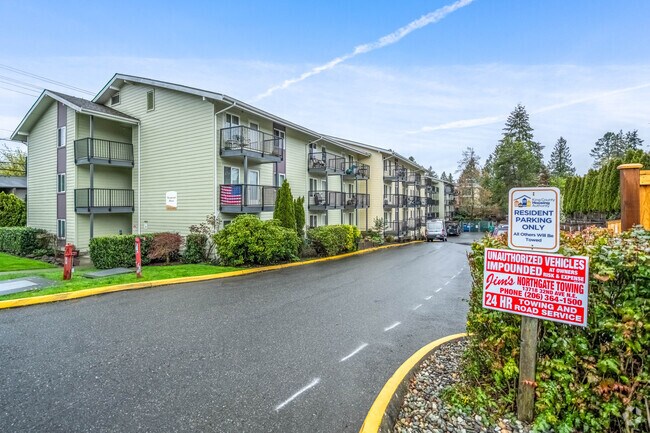
Property Record
1750 Ne 145Th St, Shoreline, WA 98155

NEARBY LISTINGS FOR SALE OR LEASE
Property Detail
1750 Ne 145Th St
Seattle-Tacoma-Bellevue, WA
Jardin El Norte Add
367050-0485
JARDIN EL NORTE ADD
Apartment
King
X
Washington
53033C0331G
11-12
2021
0.37 AC
2024
Shoreline
021100
Seattle/Puget Sound
36,061 SF
DEMOGRAPHICS near 1750 Ne 145Th St
1 Mile
3 Mile
5 Mile
2024 Total Population
20,263
148,181
399,458
2029 Population
20,461
149,552
405,253
Pop Growth 2024-2029
+ 0.98%
+ 0.93%
+ 1.45%
Average Age
40
41
40
2024 Total Households
8,661
63,351
167,614
HH Growth 2024-2029
+ 0.89%
+ 0.95%
+ 1.48%
Median Household Inc
$90,819
$97,699
$110,601
Avg Household Size
2.20
2.20
2.30
2024 Avg HH Vehicles
2.00
2.00
2.00
Median Home Value
$759,633
$782,482
$819,231
Median Year Built
1971
1971
1972
Nearby Places
Map Layers
Map Styles
 Street
 Aerial
- Restaurants
- Banks
- Shops
- Fitness
- Groceries
PUBLIC TRANSPORTATION
TRANSIT/SUBWAY
Shoreline South/148Th (Lynnwood - Angle Lake - Sound Transit)
DRIVE
WALK
Distance
Shoreline South/148Th (Lynnwood - Angle Lake - Sound Transit)
2 min
16 min
0.9 mi
COMMUTER RAIL
Edmonds Station (Sounder South Line - Central Puget Sound Regional Transit Authority Rail (Link Light Rail/Sounder))
DRIVE
WALK
Distance
Edmonds Station (Sounder South Line - Central Puget Sound Regional Transit Authority Rail (Link Light Rail/Sounder))
17 min
9.1 mi
AIRPORT
Seattle Paine Field International
DRIVE
WALK
Distance
Seattle Paine Field International
24 min
15.3 mi
Seattle-Tacoma International
DRIVE
WALK
Distance
Seattle-Tacoma International
36 min
24.1 mi
Freight Ports
Port of Seattle
DRIVE
WALK
Distance
Port of Seattle
23 min
14.6 mi
Nearby Properties
Address
Land Use
TOTAL SIZE
Lot Size
Zoning
Address
Land Use
TOTAL SIZE
Lot Size
Zoning
7,549 SF
59.34 AC
MIO-105-LR
Address
Land Use
TOTAL SIZE
Lot Size
Zoning
172,297 SF
4.21 AC
NC3-95 (M)
Address
Land Use
TOTAL SIZE
Lot Size
Zoning
10,090 SF
11.73 AC
NC3-95 (M)
Address
Land Use
TOTAL SIZE
Lot Size
Zoning
207,576 SF
5.98 AC
MR (M)
Address
Land Use
TOTAL SIZE
Lot Size
Zoning
168,619 SF
7.79 AC
NC3-145 (M
Address
Land Use
TOTAL SIZE
Lot Size
Zoning
17.65 AC
NR3
Address
Land Use
TOTAL SIZE
Lot Size
Zoning
119,405 SF
0.97 AC
NC3-95 (M)
Address
Land Use
TOTAL SIZE
Lot Size
Zoning
54,224 SF
2.22 AC
NC3-55 (M)
Address
Land Use
TOTAL SIZE
Lot Size
Zoning
170,408 SF
1.85 AC
NC3-75 (M)
Address
Land Use
TOTAL SIZE
Lot Size
Zoning
131,236 SF
19.14 AC
R6
Address
Land Use
TOTAL SIZE
Lot Size
Zoning
288,283 SF
3.94 AC
NC3-75 (M)
Address
Land Use
TOTAL SIZE
Lot Size
Zoning
46,513 SF
5.90 AC
SM-NG 145
Address
Land Use
TOTAL SIZE
Lot Size
Zoning
235,163 SF
18.39 AC
NR2
Address
Land Use
TOTAL SIZE
Lot Size
Zoning
220,000 SF
25.47 AC
R6
Address
Land Use
TOTAL SIZE
Lot Size
Zoning
234,128 SF
1.57 AC
NC3-145 (M
Address
Land Use
TOTAL SIZE
Lot Size
Zoning
179,340 SF
6.27 AC
LR2 (M)
Address
Land Use
TOTAL SIZE
Lot Size
Zoning
152,168 SF
3.02 AC
CZ
Address
Land Use
TOTAL SIZE
Lot Size
Zoning
177,990 SF
50.72 AC
PUBLIC/SEM
Address
Land Use
TOTAL SIZE
Lot Size
Zoning
172,514 SF
15.34 AC
MB
Address
Land Use
TOTAL SIZE
Lot Size
Zoning
156,743 SF
18.01 AC
NR2
Address
Land Use
TOTAL SIZE
Lot Size
Zoning
220,968 SF
16.46 AC
TC
Address
Land Use
TOTAL SIZE
Lot Size
Zoning
3,284 SF
72.10 AC
R6
Address
Land Use
TOTAL SIZE
Lot Size
Zoning
236,309 SF
43.88 AC
R6
Address
Land Use
TOTAL SIZE
Lot Size
Zoning
181,168 SF
4.72 AC
MR (M)
Address
Land Use
TOTAL SIZE
Lot Size
Zoning
402,321 SF
32.47 AC
C
Address
Land Use
TOTAL SIZE
Lot Size
Zoning
36,975 SF
4.96 AC
NR2
Address
Land Use
TOTAL SIZE
Lot Size
Zoning
108,040 SF
28.20 AC
R6
Address
Land Use
TOTAL SIZE
Lot Size
Zoning
29,258 SF
18.51 AC
NR2
Address
Land Use
TOTAL SIZE
Lot Size
Zoning
32,009 SF
1.60 AC
NC3-55 (M)
Address
Land Use
TOTAL SIZE
Lot Size
Zoning
130,572 SF
2 AC
C1-75 (M)
The World's #1 Commercial Real Estate Marketplace
Connect with us
© 2025 CoStar Group
The information above has been obtained from sources believed reliable. While we do not doubt its accuracy we have not verified it and make no guarantee, warranty or representation about it. It is your responsibility to independently confirm its accuracy and completeness. Any projections, opinions, assumptions, or estimates used are for example only and do not represent the current or future performance of the property. The value of this transaction to you depends on tax and other factors which should be evaluated by your tax, financial, and legal advisors. You and your advisors should conduct a careful, independent investigation of the property to determine to your satisfaction the suitability of the property for your needs.