Property Record
1750 Ryden Rd, Prescott, WI 54021
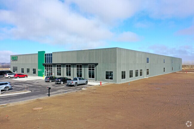
Property Detail
1750 Ryden Rd
Minneapolis/St Paul
PIERCE
Minneapolis-St. Paul-Bloomington, MN-WI
Wisconsin
271-01150-8510
12.17 AC
Commercialnec
Pierce County
B and X Area of moderate flood hazard, usually the area between the limits of the 100-year and 500-year floods.
NEARBY LISTINGS FOR SALE OR LEASE
-
-
View all Prescott listings for sale on LoopNet.com
DEMOGRAPHICS near 1750 Ryden Rd
1 mile
3 mile
5 mile
2025 Total Population
1,926
6,111
21,736
2030 Population
1,993
6,309
22,445
Pop Growth 2025-2030
+ 3.48%
+ 3.24%
+ 3.26%
Average Age
40
41
41
2025 Total Households
754
2,407
8,770
HH Growth 2025-2030
+ 3.32%
+ 3.16%
+ 3.27%
Median Household Inc
$94,852
$99,196
$94,102
Avg Household Size
2.50
2.50
2.40
2025 Avg HH Vehicles
2.00
2.00
2.00
Median Home Value
$326,100
$355,730
$328,461
Median Year Built
1987
1985
1981
Nearby Places
Map Layers
Map Styles
 Street
 Aerial
Transit
 Traffic
 Biking
Places
Listings with unknown addresses are not visible on the map
- Restaurants
- Banks
- Shops
- Fitness
- Groceries
PUBLIC TRANSPORTATION
AIRPORT
Minneapolis-St Paul International/Wold-Chamberlain
Drive
Walk
Distance
Minneapolis-St Paul International/Wold-Chamberlain
41 min
29.3 mi
Freight Ports
Port Milwaukee
Drive
Walk
Distance
Port Milwaukee
363 min
322.9 mi
Nearby Properties
Address
Land Use
TOTAL SIZE
Lot Size
Zoning
Address
Land Use
TOTAL SIZE
Lot Size
Zoning
42.33 AC
Address
Land Use
TOTAL SIZE
Lot Size
Zoning
11,496 SF
81.36 AC
Address
Land Use
TOTAL SIZE
Lot Size
Zoning
1,460 SF
35.71 AC
Address
Land Use
TOTAL SIZE
Lot Size
Zoning
2,980 SF
Address
Land Use
TOTAL SIZE
Lot Size
Zoning
1,902 SF
88.83 AC
Address
Land Use
TOTAL SIZE
Lot Size
Zoning
1,514 SF
Address
Land Use
TOTAL SIZE
Lot Size
Zoning
159.67 AC
Address
Land Use
TOTAL SIZE
Lot Size
Zoning
2,256 SF
43.85 AC
Address
Land Use
TOTAL SIZE
Lot Size
Zoning
1,474 SF
33.30 AC
Address
Land Use
TOTAL SIZE
Lot Size
Zoning
2.24 AC
Address
Land Use
TOTAL SIZE
Lot Size
Zoning
1.07 AC
Address
Land Use
TOTAL SIZE
Lot Size
Zoning
Address
Land Use
TOTAL SIZE
Lot Size
Zoning
3.06 AC
Address
Land Use
TOTAL SIZE
Lot Size
Zoning
1,632 SF
39.71 AC
Address
Land Use
TOTAL SIZE
Lot Size
Zoning
3.31 AC
Address
Land Use
TOTAL SIZE
Lot Size
Zoning
1.14 AC
Address
Land Use
TOTAL SIZE
Lot Size
Zoning
1,753 SF
32.93 AC
Address
Land Use
TOTAL SIZE
Lot Size
Zoning
2,055 SF
35.03 AC
Address
Land Use
TOTAL SIZE
Lot Size
Zoning
2.09 AC
Address
Land Use
TOTAL SIZE
Lot Size
Zoning
1.55 AC
Address
Land Use
TOTAL SIZE
Lot Size
Zoning
2,642 SF
39.06 AC
Address
Land Use
TOTAL SIZE
Lot Size
Zoning
1,536 SF
30.76 AC
Address
Land Use
TOTAL SIZE
Lot Size
Zoning
1.93 AC
Address
Land Use
TOTAL SIZE
Lot Size
Zoning
Address
Land Use
TOTAL SIZE
Lot Size
Zoning
2,327 SF
20 AC
Address
Land Use
TOTAL SIZE
Lot Size
Zoning
63.18 AC
Address
Land Use
TOTAL SIZE
Lot Size
Zoning
0.97 AC
Address
Land Use
TOTAL SIZE
Lot Size
Zoning
9.95 AC
Address
Land Use
TOTAL SIZE
Lot Size
Zoning
1.74 AC
Address
Land Use
TOTAL SIZE
Lot Size
Zoning
0.72 AC
The World's #1 Commercial Real Estate Marketplace
Connect with us
© 2026 CoStar Group
The information above has been obtained from sources believed reliable. While we do not doubt its accuracy we have not verified it and make no guarantee, warranty or representation about it. It is your responsibility to independently confirm its accuracy and completeness. Any projections, opinions, assumptions, or estimates used are for example only and do not represent the current or future performance of the property. The value of this transaction to you depends on tax and other factors which should be evaluated by your tax, financial, and legal advisors. You and your advisors should conduct a careful, independent investigation of the property to determine to your satisfaction the suitability of the property for your needs.