Property Record
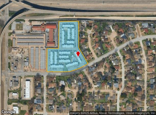
1750 W Tarrant Rd, Grand Prairie, TX 75050

NEARBY LISTINGS FOR SALE OR LEASE
Property Detail
1750 W Tarrant Rd
65011178610330000
Hein Bilsmirer
Apartment
HEIN BILSMIRER ABST 111 PG 786 TR 33 ACS 5.044 VOL93165/3944 EX082093 CO-DALLAS 0111786103300 22801117861
X
Dallas
48439C0245L
Texas
2024
5.04 AC
2025
Grand Prairie
015403
Dallas/Ft Worth
106,492 SF
Dallas-Fort Worth-Arlington, TX
DEMOGRAPHICS near 1750 W Tarrant Rd
1 Mile
3 Mile
5 Mile
2024 Total Population
14,929
72,093
251,788
2029 Population
15,031
73,007
257,691
Pop Growth 2024-2029
+ 0.68%
+ 1.27%
+ 2.34%
Average Age
35
34
35
2024 Total Households
5,352
25,948
91,611
HH Growth 2024-2029
+ 0.28%
+ 1.44%
+ 2.72%
Median Household Inc
$61,573
$49,808
$51,831
Avg Household Size
2.70
2.70
2.70
2024 Avg HH Vehicles
2.00
2.00
2.00
Median Home Value
$223,395
$191,551
$203,591
Median Year Built
1979
1979
1982
Nearby Places
Map Layers
Map Styles
 Street
 Aerial
- Restaurants
- Banks
- Shops
- Fitness
- Groceries
PUBLIC TRANSPORTATION
COMMUTER RAIL
East Tex Yard Limit (TRINITY RAILWAY - Dallas Area Rapid Transit (DART))
DRIVE
WALK
Distance
East Tex Yard Limit (TRINITY RAILWAY - Dallas Area Rapid Transit (DART))
7 min
4.6 mi
West Tex Yard Limit (TRINITY RAILWAY - Dallas Area Rapid Transit (DART))
DRIVE
WALK
Distance
West Tex Yard Limit (TRINITY RAILWAY - Dallas Area Rapid Transit (DART))
13 min
5.8 mi
AIRPORT
Dallas-Fort Worth International
DRIVE
WALK
Distance
Dallas-Fort Worth International
18 min
11.9 mi
Dallas Love Field
DRIVE
WALK
Distance
Dallas Love Field
27 min
18.1 mi
Freight Ports
Port of Shreveport
DRIVE
WALK
Distance
Port of Shreveport
227 min
210.4 mi
Nearby Properties
Address
Land Use
TOTAL SIZE
Lot Size
Zoning
Address
Land Use
TOTAL SIZE
Lot Size
Zoning
5,995,915 SF
248.78 AC
Address
Land Use
TOTAL SIZE
Lot Size
Zoning
1,577,320 SF
122.55 AC
Z123
Address
Land Use
TOTAL SIZE
Lot Size
Zoning
703,500 SF
47.38 AC
Z236
Address
Land Use
TOTAL SIZE
Lot Size
Zoning
496,283 SF
246.29 AC
Z236
Address
Land Use
TOTAL SIZE
Lot Size
Zoning
1,261,810 SF
80.53 AC
Address
Land Use
TOTAL SIZE
Lot Size
Zoning
450,535 SF
27.23 AC
Address
Land Use
TOTAL SIZE
Lot Size
Zoning
680,900 SF
32.25 AC
Z236
Address
Land Use
TOTAL SIZE
Lot Size
Zoning
334,057 SF
20.05 AC
Z312
Address
Land Use
TOTAL SIZE
Lot Size
Zoning
358,350 SF
13.15 AC
Address
Land Use
TOTAL SIZE
Lot Size
Zoning
576,000 SF
55.36 AC
Z123
Address
Land Use
TOTAL SIZE
Lot Size
Zoning
1,054,767 SF
37.45 AC
Z123
Address
Land Use
TOTAL SIZE
Lot Size
Zoning
531,072 SF
26.50 AC
Z236
Address
Land Use
TOTAL SIZE
Lot Size
Zoning
137,878 SF
189.88 AC
Address
Land Use
TOTAL SIZE
Lot Size
Zoning
264,010 SF
34.50 AC
Z190
Address
Land Use
TOTAL SIZE
Lot Size
Zoning
362,847 SF
19.88 AC
Address
Land Use
TOTAL SIZE
Lot Size
Zoning
197,000 SF
25.51 AC
Z236
Address
Land Use
TOTAL SIZE
Lot Size
Zoning
283,087 SF
15.22 AC
Z236
Address
Land Use
TOTAL SIZE
Lot Size
Zoning
436,343 SF
5.36 AC
Z236
Address
Land Use
TOTAL SIZE
Lot Size
Zoning
266,448 SF
17 AC
Z97
Address
Land Use
TOTAL SIZE
Lot Size
Zoning
209,751 SF
6.65 AC
Address
Land Use
TOTAL SIZE
Lot Size
Zoning
304,636 SF
12.84 AC
Address
Land Use
TOTAL SIZE
Lot Size
Zoning
277,385 SF
14.33 AC
Address
Land Use
TOTAL SIZE
Lot Size
Zoning
224,486 SF
18.11 AC
Z236
Address
Land Use
TOTAL SIZE
Lot Size
Zoning
251,392 SF
14.54 AC
Z190
Address
Land Use
TOTAL SIZE
Lot Size
Zoning
492,972 SF
24.23 AC
Address
Land Use
TOTAL SIZE
Lot Size
Zoning
261,338 SF
15.55 AC
Address
Land Use
TOTAL SIZE
Lot Size
Zoning
401,600 SF
23.94 AC
Z236
Address
Land Use
TOTAL SIZE
Lot Size
Zoning
436,014 SF
47.53 AC
Z236
Address
Land Use
TOTAL SIZE
Lot Size
Zoning
226,438 SF
12.98 AC
Z190
Address
Land Use
TOTAL SIZE
Lot Size
Zoning
423,700 SF
23.29 AC
Z236
The World's #1 Commercial Real Estate Marketplace
Connect with us
© 2025 CoStar Group
The information above has been obtained from sources believed reliable. While we do not doubt its accuracy we have not verified it and make no guarantee, warranty or representation about it. It is your responsibility to independently confirm its accuracy and completeness. Any projections, opinions, assumptions, or estimates used are for example only and do not represent the current or future performance of the property. The value of this transaction to you depends on tax and other factors which should be evaluated by your tax, financial, and legal advisors. You and your advisors should conduct a careful, independent investigation of the property to determine to your satisfaction the suitability of the property for your needs.