Property Record
17501 W Bethany Home Rd, Litchfield Park, AZ 85340


NEARBY LISTINGS FOR SALE OR LEASE
Property Detail
17501 W Bethany Home Rd
Phoenix-Mesa-Scottsdale, AZ
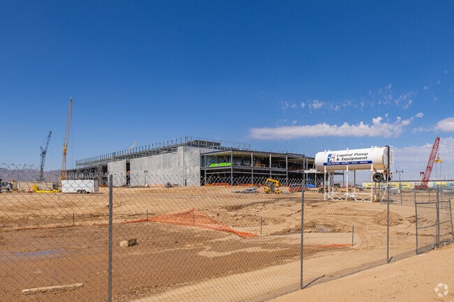
Qts Glendale
502-27-006D
QTS GLENDALE MCR 1815-14
Commercialacreage
Maricopa
X
Arizona
04013C1670L
10
2025
26.08 AC
2025
Glendale
061055
Phoenix
6,208 SF
DEMOGRAPHICS near 17501 W Bethany Home Rd
1 Mile
3 Mile
5 Mile
2024 Total Population
641
30,253
121,457
2029 Population
713
33,842
135,374
Pop Growth 2024-2029
+ 11.23%
+ 11.86%
+ 11.46%
Average Age
38
46
41
2024 Total Households
192
10,845
41,406
HH Growth 2024-2029
+ 10.94%
+ 12.15%
+ 11.64%
Median Household Inc
$129,651
$110,736
$102,886
Avg Household Size
3.20
2.60
2.80
2024 Avg HH Vehicles
3.00
2.00
2.00
Median Home Value
$518,617
$486,601
$439,491
Median Year Built
2011
2010
2008
Nearby Places
Map Layers
Map Styles
 Street
 Aerial
- Restaurants
- Banks
- Shops
- Fitness
- Groceries
PUBLIC TRANSPORTATION
AIRPORT
Phoenix Sky Harbor International
DRIVE
WALK
Distance
Phoenix Sky Harbor International
42 min
32.0 mi
Freight Ports
Port of San Diego
DRIVE
WALK
Distance
Port of San Diego
378 min
337.9 mi
Nearby Properties
Address
Land Use
TOTAL SIZE
Lot Size
Zoning
Address
Land Use
TOTAL SIZE
Lot Size
Zoning
75.54 AC
Address
Land Use
TOTAL SIZE
Lot Size
Zoning
35.05 AC
Address
Land Use
TOTAL SIZE
Lot Size
Zoning
73.09 AC
Address
Land Use
TOTAL SIZE
Lot Size
Zoning
1,192,719 SF
70.75 AC
Address
Land Use
TOTAL SIZE
Lot Size
Zoning
915,160 SF
53.89 AC
Address
Land Use
TOTAL SIZE
Lot Size
Zoning
1,155,404 SF
75.47 AC
Address
Land Use
TOTAL SIZE
Lot Size
Zoning
1,259,666 SF
71.73 AC
R-43
Address
Land Use
TOTAL SIZE
Lot Size
Zoning
1,109,869 SF
67.32 AC
R-43
Address
Land Use
TOTAL SIZE
Lot Size
Zoning
1,253,382 SF
74.13 AC
Address
Land Use
TOTAL SIZE
Lot Size
Zoning
438,256 SF
48.59 AC
Address
Land Use
TOTAL SIZE
Lot Size
Zoning
802,439 SF
56.30 AC
PAD
Address
Land Use
TOTAL SIZE
Lot Size
Zoning
25.69 AC
Address
Land Use
TOTAL SIZE
Lot Size
Zoning
640,330 SF
91.15 AC
Address
Land Use
TOTAL SIZE
Lot Size
Zoning
244,676 SF
131.34 AC
Address
Land Use
TOTAL SIZE
Lot Size
Zoning
721,156 SF
44.90 AC
PAD
Address
Land Use
TOTAL SIZE
Lot Size
Zoning
663,367 SF
38.83 AC
Address
Land Use
TOTAL SIZE
Lot Size
Zoning
601,124 SF
39.88 AC
PAD
Address
Land Use
TOTAL SIZE
Lot Size
Zoning
599,070 SF
38.33 AC
Address
Land Use
TOTAL SIZE
Lot Size
Zoning
563,781 SF
34.84 AC
PAD
Address
Land Use
TOTAL SIZE
Lot Size
Zoning
522,480 SF
31.89 AC
Address
Land Use
TOTAL SIZE
Lot Size
Zoning
897,328 SF
53.70 AC
Address
Land Use
TOTAL SIZE
Lot Size
Zoning
643,798 SF
42.24 AC
PAD
Address
Land Use
TOTAL SIZE
Lot Size
Zoning
643,756 SF
39.25 AC
PAD
Address
Land Use
TOTAL SIZE
Lot Size
Zoning
643,798 SF
39.40 AC
PAD
Address
Land Use
TOTAL SIZE
Lot Size
Zoning
278,670 SF
40.72 AC
Address
Land Use
TOTAL SIZE
Lot Size
Zoning
20.79 AC
Address
Land Use
TOTAL SIZE
Lot Size
Zoning
198,109 SF
79 AC
R-43
Address
Land Use
TOTAL SIZE
Lot Size
Zoning
392,000 SF
26.57 AC
PAD
Address
Land Use
TOTAL SIZE
Lot Size
Zoning
599,678 SF
32.39 AC
Address
Land Use
TOTAL SIZE
Lot Size
Zoning
349,633 SF
23.03 AC
The World's #1 Commercial Real Estate Marketplace
Connect with us
© 2025 CoStar Group
The information above has been obtained from sources believed reliable. While we do not doubt its accuracy we have not verified it and make no guarantee, warranty or representation about it. It is your responsibility to independently confirm its accuracy and completeness. Any projections, opinions, assumptions, or estimates used are for example only and do not represent the current or future performance of the property. The value of this transaction to you depends on tax and other factors which should be evaluated by your tax, financial, and legal advisors. You and your advisors should conduct a careful, independent investigation of the property to determine to your satisfaction the suitability of the property for your needs.