Property Record
1751 Dalton Dr, New Carlisle, OH 45344
NEARBY LISTINGS FOR SALE OR LEASE
-
-
View all New Carlisle listings for sale on LoopNet.com
Property Detail
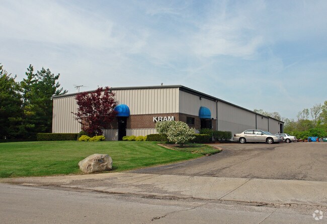
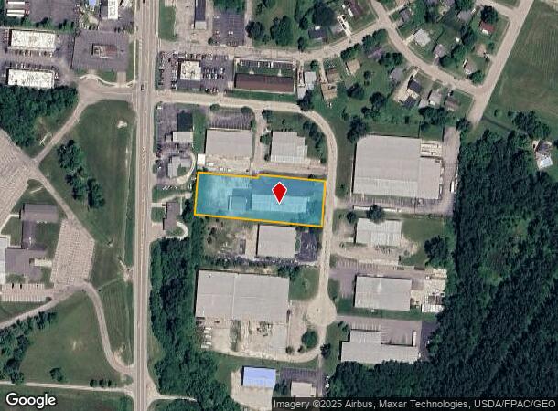
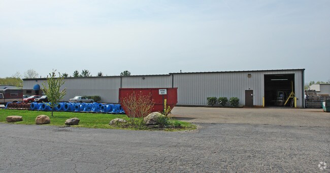
1751 Dalton Dr
Springfield, OH
Industrial Park
01-00500-03130-2020
235 INDUSTRIAL PARK PTS 1 & 2
Lightindustrial
Clark
X
Ohio
39109C0295E
20
2023
1.40 AC
2024
Northeast Dayton
002901
Cincinnati/Dayton
12,090 SF
DEMOGRAPHICS near 1751 Dalton Dr
1 Mile
3 Mile
5 Mile
2024 Total Population
4,403
11,253
55,366
2029 Population
4,337
11,245
55,365
Pop Growth 2024-2029
(1.50%)
(0.07%)
0.00%
Average Age
38
41
40
2024 Total Households
1,683
4,451
21,857
HH Growth 2024-2029
(1.54%)
(0.13%)
(0.03%)
Median Household Inc
$58,594
$65,567
$71,334
Avg Household Size
2.60
2.50
2.50
2024 Avg HH Vehicles
2.00
2.00
2.00
Median Home Value
$91,840
$135,840
$165,094
Median Year Built
1964
1965
1970
Nearby Places
Map Layers
Map Styles
 Street
 Aerial
- Restaurants
- Banks
- Shops
- Fitness
- Groceries
PUBLIC TRANSPORTATION
AIRPORT
James M Cox Dayton International
DRIVE
WALK
Distance
James M Cox Dayton International
20 min
13.7 mi
Nearby Properties
Address
Land Use
TOTAL SIZE
Lot Size
Zoning
Address
Land Use
TOTAL SIZE
Lot Size
Zoning
Address
Land Use
TOTAL SIZE
Lot Size
Zoning
257,104 SF
80.05 AC
Address
Land Use
TOTAL SIZE
Lot Size
Zoning
25.14 AC
A-1
Address
Land Use
TOTAL SIZE
Lot Size
Zoning
173,672 SF
38.87 AC
Address
Land Use
TOTAL SIZE
Lot Size
Zoning
71,007 SF
5.35 AC
Address
Land Use
TOTAL SIZE
Lot Size
Zoning
101,500 SF
37.45 AC
Address
Land Use
TOTAL SIZE
Lot Size
Zoning
53,816 SF
16.46 AC
Address
Land Use
TOTAL SIZE
Lot Size
Zoning
42,733 SF
66.92 AC
Address
Land Use
TOTAL SIZE
Lot Size
Zoning
41,046 SF
17.94 AC
Address
Land Use
TOTAL SIZE
Lot Size
Zoning
104,000 SF
10.29 AC
Address
Land Use
TOTAL SIZE
Lot Size
Zoning
109,818 SF
35.83 AC
Address
Land Use
TOTAL SIZE
Lot Size
Zoning
515.72 AC
A-1
Address
Land Use
TOTAL SIZE
Lot Size
Zoning
16,000 SF
6.50 AC
Address
Land Use
TOTAL SIZE
Lot Size
Zoning
98,992 SF
18.34 AC
Address
Land Use
TOTAL SIZE
Lot Size
Zoning
2,184 SF
17.57 AC
B-3
Address
Land Use
TOTAL SIZE
Lot Size
Zoning
7.95 AC
R-2A
Address
Land Use
TOTAL SIZE
Lot Size
Zoning
2,744 SF
162 AC
Address
Land Use
TOTAL SIZE
Lot Size
Zoning
49,080 SF
7.04 AC
Address
Land Use
TOTAL SIZE
Lot Size
Zoning
162 AC
Address
Land Use
TOTAL SIZE
Lot Size
Zoning
96,000 SF
13.58 AC
Address
Land Use
TOTAL SIZE
Lot Size
Zoning
56,470 SF
9.84 AC
Address
Land Use
TOTAL SIZE
Lot Size
Zoning
42,500 SF
11.35 AC
Address
Land Use
TOTAL SIZE
Lot Size
Zoning
10,200 SF
9.64 AC
Address
Land Use
TOTAL SIZE
Lot Size
Zoning
1,512 SF
379.32 AC
Address
Land Use
TOTAL SIZE
Lot Size
Zoning
5,000 SF
7.29 AC
Address
Land Use
TOTAL SIZE
Lot Size
Zoning
20,840 SF
3.50 AC
Address
Land Use
TOTAL SIZE
Lot Size
Zoning
56,800 SF
2.94 AC
R-4
Address
Land Use
TOTAL SIZE
Lot Size
Zoning
38,782 SF
5 AC
Address
Land Use
TOTAL SIZE
Lot Size
Zoning
38,196 SF
4.39 AC
Address
Land Use
TOTAL SIZE
Lot Size
Zoning
43,135 SF
7.06 AC
The World's #1 Commercial Real Estate Marketplace
Connect with us
© 2025 CoStar Group
The information above has been obtained from sources believed reliable. While we do not doubt its accuracy we have not verified it and make no guarantee, warranty or representation about it. It is your responsibility to independently confirm its accuracy and completeness. Any projections, opinions, assumptions, or estimates used are for example only and do not represent the current or future performance of the property. The value of this transaction to you depends on tax and other factors which should be evaluated by your tax, financial, and legal advisors. You and your advisors should conduct a careful, independent investigation of the property to determine to your satisfaction the suitability of the property for your needs.