Property Record
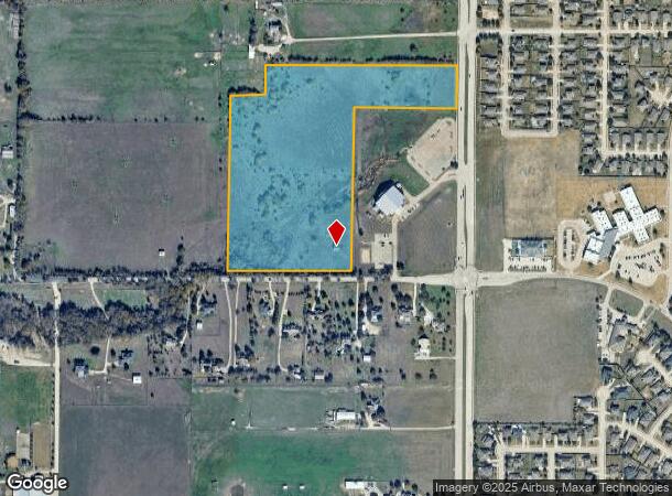
1751 Mcmillen Rd, Wylie, TX 75098


This Property Is For Sale
NEARBY LISTINGS FOR SALE OR LEASE
Property Detail
1751 Mcmillen Rd
Dallas-Fort Worth-Arlington, TX
William Patterson Survey
R-6716-002-0270-1
ABS A0716 WILLIAM PATTERSON SURVEY, SHEET 2, TRACT 27, 23.546 ACRES
Agriculturalland
Collin
X
Texas
48113C0090K
27
2024
23.55 AC
2025
Plano
031319
Dallas/Ft Worth
2,108 SF
DEMOGRAPHICS near 1751 Mcmillen Rd
1 Mile
3 Mile
5 Mile
2024 Total Population
10,204
69,103
162,252
2029 Population
12,328
84,033
193,920
Pop Growth 2024-2029
+ 20.82%
+ 21.61%
+ 19.52%
Average Age
36
37
37
2024 Total Households
3,017
21,148
50,642
HH Growth 2024-2029
+ 21.01%
+ 21.84%
+ 19.55%
Median Household Inc
$104,464
$109,193
$115,202
Avg Household Size
3.30
3.20
3.20
2024 Avg HH Vehicles
2.00
2.00
2.00
Median Home Value
$312,377
$355,027
$371,666
Median Year Built
2004
2004
2003
Nearby Places
Map Layers
Map Styles
 Street
 Aerial
- Restaurants
- Banks
- Shops
- Fitness
- Groceries
PUBLIC TRANSPORTATION
AIRPORT
Dallas Love Field
DRIVE
WALK
Distance
Dallas Love Field
42 min
28.8 mi
Dallas-Fort Worth International
DRIVE
WALK
Distance
Dallas-Fort Worth International
48 min
36.9 mi
Freight Ports
Port of Shreveport
DRIVE
WALK
Distance
Port of Shreveport
228 min
203.2 mi
Nearby Properties
Address
Land Use
TOTAL SIZE
Lot Size
Zoning
Address
Land Use
TOTAL SIZE
Lot Size
Zoning
418,520 SF
103.29 AC
Address
Land Use
TOTAL SIZE
Lot Size
Zoning
339,663 SF
95.04 AC
Address
Land Use
TOTAL SIZE
Lot Size
Zoning
350,553 SF
18.71 AC
MF-M
Address
Land Use
TOTAL SIZE
Lot Size
Zoning
285,392 SF
19.44 AC
MF-M
Address
Land Use
TOTAL SIZE
Lot Size
Zoning
441,356 SF
74.94 AC
Address
Land Use
TOTAL SIZE
Lot Size
Zoning
385,735 SF
13.13 AC
Address
Land Use
TOTAL SIZE
Lot Size
Zoning
266,957 SF
11.34 AC
MFR
Address
Land Use
TOTAL SIZE
Lot Size
Zoning
332,047 SF
18.48 AC
MF-L
Address
Land Use
TOTAL SIZE
Lot Size
Zoning
393,054 SF
55.95 AC
Address
Land Use
TOTAL SIZE
Lot Size
Zoning
257,718 SF
13.10 AC
RESIDENTIA
Address
Land Use
TOTAL SIZE
Lot Size
Zoning
228,536 SF
10.54 AC
MF-M
Address
Land Use
TOTAL SIZE
Lot Size
Zoning
203,383 SF
11.91 AC
MF-M
Address
Land Use
TOTAL SIZE
Lot Size
Zoning
274,329 SF
44.89 AC
Address
Land Use
TOTAL SIZE
Lot Size
Zoning
114,945 SF
19.71 AC
TC
Address
Land Use
TOTAL SIZE
Lot Size
Zoning
746 SF
115.14 AC
Address
Land Use
TOTAL SIZE
Lot Size
Zoning
83,564 SF
10.81 AC
Address
Land Use
TOTAL SIZE
Lot Size
Zoning
140,130 SF
19.67 AC
Address
Land Use
TOTAL SIZE
Lot Size
Zoning
85,393 SF
10 AC
Address
Land Use
TOTAL SIZE
Lot Size
Zoning
132,306 SF
7.85 AC
MF
Address
Land Use
TOTAL SIZE
Lot Size
Zoning
78,708 SF
9.55 AC
Address
Land Use
TOTAL SIZE
Lot Size
Zoning
102,786 SF
28.88 AC
Address
Land Use
TOTAL SIZE
Lot Size
Zoning
77,225 SF
9.59 AC
Address
Land Use
TOTAL SIZE
Lot Size
Zoning
191,200 SF
20.69 AC
TC
Address
Land Use
TOTAL SIZE
Lot Size
Zoning
106,866 SF
15.69 AC
Address
Land Use
TOTAL SIZE
Lot Size
Zoning
186,220 SF
13.64 AC
Address
Land Use
TOTAL SIZE
Lot Size
Zoning
123,621 SF
12.22 AC
Address
Land Use
TOTAL SIZE
Lot Size
Zoning
128,849 SF
7.70 AC
Address
Land Use
TOTAL SIZE
Lot Size
Zoning
141,396 SF
8.40 AC
NS
Address
Land Use
TOTAL SIZE
Lot Size
Zoning
304,978 SF
81.51 AC
Address
Land Use
TOTAL SIZE
Lot Size
Zoning
145,268 SF
16.34 AC
The World's #1 Commercial Real Estate Marketplace
Connect with us
© 2026 CoStar Group
The information above has been obtained from sources believed reliable. While we do not doubt its accuracy we have not verified it and make no guarantee, warranty or representation about it. It is your responsibility to independently confirm its accuracy and completeness. Any projections, opinions, assumptions, or estimates used are for example only and do not represent the current or future performance of the property. The value of this transaction to you depends on tax and other factors which should be evaluated by your tax, financial, and legal advisors. You and your advisors should conduct a careful, independent investigation of the property to determine to your satisfaction the suitability of the property for your needs.