Property Record
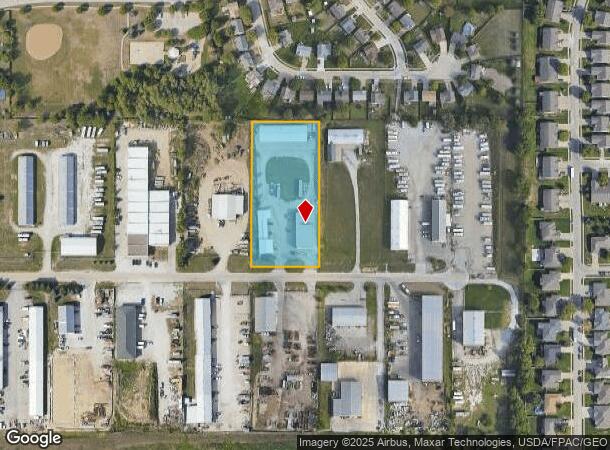
17512 Storage Rd, Omaha, NE 68136
NEARBY LISTINGS FOR SALE OR LEASE
-
-
View all Omaha listings for sale on LoopNet.com
Property Detail
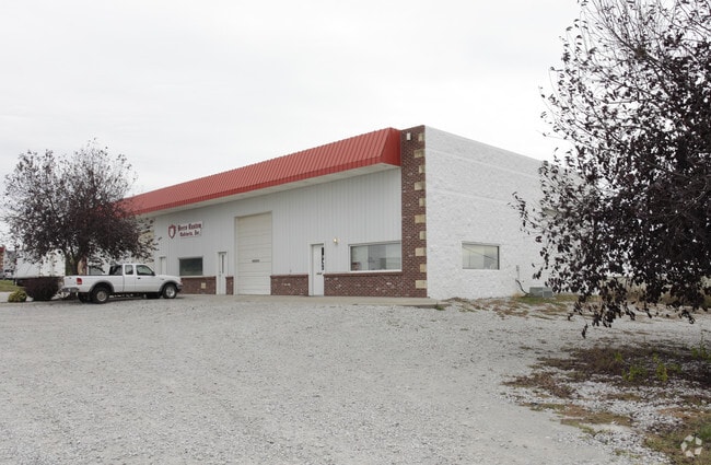
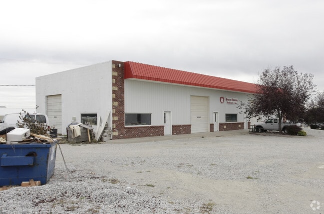
17512 Storage Rd
Omaha-Council Bluffs, NE-IA
Lite Industrial Limited Condo Park A Con
011097442
UNIT 10 LITE INDUSTRIAL LIMITED CONDO PARK A CONDOMINIUM
Industrialgeneral
Sarpy
X
Nebraska
31153C0037H
10
2024
1.96 AC
2025
Sarpy West
010627
Omaha/Council Bluffs
1,600 SF
DEMOGRAPHICS near 17512 Storage Rd
1 Mile
3 Mile
5 Mile
2024 Total Population
11,065
74,497
140,611
2029 Population
11,844
78,069
145,969
Pop Growth 2024-2029
+ 7.04%
+ 4.79%
+ 3.81%
Average Age
36
36
38
2024 Total Households
3,699
25,753
50,911
HH Growth 2024-2029
+ 7.25%
+ 4.85%
+ 3.75%
Median Household Inc
$127,645
$118,400
$108,155
Avg Household Size
3.00
2.90
2.70
2024 Avg HH Vehicles
2.00
2.00
2.00
Median Home Value
$289,678
$285,553
$282,096
Median Year Built
2006
2002
1997
Nearby Places
Map Layers
Map Styles
 Street
 Aerial
- Restaurants
- Banks
- Shops
- Fitness
- Groceries
PUBLIC TRANSPORTATION
AIRPORT
Eppley Airfield
DRIVE
WALK
Distance
Eppley Airfield
38 min
23.1 mi
Nearby Properties
Address
Land Use
TOTAL SIZE
Lot Size
Zoning
Address
Land Use
TOTAL SIZE
Lot Size
Zoning
72.91 AC
Address
Land Use
TOTAL SIZE
Lot Size
Zoning
315,685 SF
21.57 AC
RG10
Address
Land Use
TOTAL SIZE
Lot Size
Zoning
394,017 SF
11.62 AC
Address
Land Use
TOTAL SIZE
Lot Size
Zoning
56,174 SF
8.65 AC
Address
Land Use
TOTAL SIZE
Lot Size
Zoning
277,073 SF
16.78 AC
Address
Land Use
TOTAL SIZE
Lot Size
Zoning
294,334 SF
19.14 AC
R6
Address
Land Use
TOTAL SIZE
Lot Size
Zoning
165,950 SF
11.57 AC
MH
Address
Land Use
TOTAL SIZE
Lot Size
Zoning
2,295 SF
11.77 AC
Address
Land Use
TOTAL SIZE
Lot Size
Zoning
27,027 SF
11.15 AC
Address
Land Use
TOTAL SIZE
Lot Size
Zoning
12.60 AC
Address
Land Use
TOTAL SIZE
Lot Size
Zoning
238,428 SF
18.64 AC
R5
Address
Land Use
TOTAL SIZE
Lot Size
Zoning
12,720 SF
3.44 AC
IL
Address
Land Use
TOTAL SIZE
Lot Size
Zoning
162,717 SF
6.73 AC
R6
Address
Land Use
TOTAL SIZE
Lot Size
Zoning
170,760 SF
10.30 AC
RG10
Address
Land Use
TOTAL SIZE
Lot Size
Zoning
280,482 SF
11.64 AC
R6
Address
Land Use
TOTAL SIZE
Lot Size
Zoning
193,490 SF
9.35 AC
Address
Land Use
TOTAL SIZE
Lot Size
Zoning
37,295 SF
Address
Land Use
TOTAL SIZE
Lot Size
Zoning
147,076 SF
7.81 AC
Address
Land Use
TOTAL SIZE
Lot Size
Zoning
89,181 SF
4.85 AC
Address
Land Use
TOTAL SIZE
Lot Size
Zoning
28,444 SF
0.85 AC
Address
Land Use
TOTAL SIZE
Lot Size
Zoning
10.06 AC
Address
Land Use
TOTAL SIZE
Lot Size
Zoning
387,400 SF
6.13 AC
Address
Land Use
TOTAL SIZE
Lot Size
Zoning
133,134 SF
6.03 AC
Address
Land Use
TOTAL SIZE
Lot Size
Zoning
13,993 SF
12.17 AC
Address
Land Use
TOTAL SIZE
Lot Size
Zoning
52,791 SF
8.09 AC
Address
Land Use
TOTAL SIZE
Lot Size
Zoning
10,107 SF
9.82 AC
Address
Land Use
TOTAL SIZE
Lot Size
Zoning
134,709 SF
2.32 AC
MU
Address
Land Use
TOTAL SIZE
Lot Size
Zoning
138,942 SF
2.86 AC
Address
Land Use
TOTAL SIZE
Lot Size
Zoning
1,950 SF
3.59 AC
Address
Land Use
TOTAL SIZE
Lot Size
Zoning
32,748 SF
5 AC
The World's #1 Commercial Real Estate Marketplace
Connect with us
© 2025 CoStar Group
The information above has been obtained from sources believed reliable. While we do not doubt its accuracy we have not verified it and make no guarantee, warranty or representation about it. It is your responsibility to independently confirm its accuracy and completeness. Any projections, opinions, assumptions, or estimates used are for example only and do not represent the current or future performance of the property. The value of this transaction to you depends on tax and other factors which should be evaluated by your tax, financial, and legal advisors. You and your advisors should conduct a careful, independent investigation of the property to determine to your satisfaction the suitability of the property for your needs.