Property Record
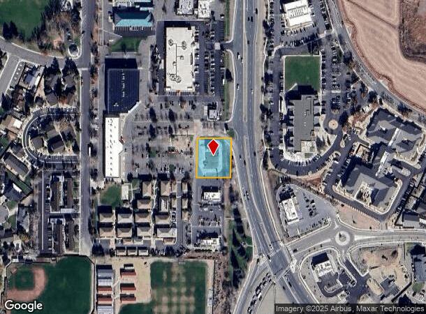
1752 Us Highway 395 N, Minden, NV 89423


NEARBY LISTINGS FOR SALE OR LEASE
-
-
View all Minden listings for lease on LoopNet.com
Property Detail
1752 Us Highway 395 N
Gardnerville Ranchos, NV
Minden Ironwood Comm Sub
1320-30-211-103
MINDEN IRONWOOD COMM SUB LOT F
Commercialnec
Douglas
X
Nevada
32005C0234J
f
2024
0.58 AC
2025
Douglas County
002200
Reno/Sparks
666 SF
DEMOGRAPHICS near 1752 Us Highway 395 N
1 Mile
3 Mile
5 Mile
2024 Total Population
2,804
8,386
19,255
2029 Population
2,838
8,479
19,639
Pop Growth 2024-2029
+ 1.21%
+ 1.11%
+ 1.99%
Average Age
49
47
49
2024 Total Households
1,286
3,860
8,478
HH Growth 2024-2029
+ 1.32%
+ 1.22%
+ 2.02%
Median Household Inc
$84,606
$71,973
$82,546
Avg Household Size
2.10
2.10
2.20
2024 Avg HH Vehicles
2.00
2.00
2.00
Median Home Value
$477,834
$410,719
$485,093
Median Year Built
1992
1997
1994
Nearby Places
Map Layers
Map Styles
 Street
 Aerial
- Restaurants
- Banks
- Shops
- Fitness
- Groceries
SALE & LEASE HISTORY
LISTING DATE
SALE/LEASE

Jul 28, 2025
For Lease
Jul 03, 2025
For Sale
Dec 01, 2023
For Sale
Apr 04, 2023
For Sale
Nearby Properties
Address
Land Use
TOTAL SIZE
Lot Size
Zoning
Address
Land Use
TOTAL SIZE
Lot Size
Zoning
2,832 SF
38.82 AC
Address
Land Use
TOTAL SIZE
Lot Size
Zoning
266,955 SF
26.62 AC
Address
Land Use
TOTAL SIZE
Lot Size
Zoning
210,541 SF
38.41 AC
Address
Land Use
TOTAL SIZE
Lot Size
Zoning
67,309 SF
21.20 AC
Address
Land Use
TOTAL SIZE
Lot Size
Zoning
188,096 SF
20.87 AC
Address
Land Use
TOTAL SIZE
Lot Size
Zoning
187,640 SF
20.34 AC
Address
Land Use
TOTAL SIZE
Lot Size
Zoning
126,248 SF
589.50 AC
Address
Land Use
TOTAL SIZE
Lot Size
Zoning
82,367 SF
27.90 AC
Address
Land Use
TOTAL SIZE
Lot Size
Zoning
119,616 SF
8.70 AC
Address
Land Use
TOTAL SIZE
Lot Size
Zoning
51,300 SF
10 AC
Address
Land Use
TOTAL SIZE
Lot Size
Zoning
77,929 SF
3.93 AC
Address
Land Use
TOTAL SIZE
Lot Size
Zoning
47,197 SF
4.69 AC
Address
Land Use
TOTAL SIZE
Lot Size
Zoning
108,444 SF
25.72 AC
Address
Land Use
TOTAL SIZE
Lot Size
Zoning
16,288 SF
2.02 AC
Address
Land Use
TOTAL SIZE
Lot Size
Zoning
75,430 SF
4.67 AC
Address
Land Use
TOTAL SIZE
Lot Size
Zoning
68,860 SF
12 AC
Address
Land Use
TOTAL SIZE
Lot Size
Zoning
48,789 SF
2.34 AC
Address
Land Use
TOTAL SIZE
Lot Size
Zoning
29,349 SF
3.24 AC
Address
Land Use
TOTAL SIZE
Lot Size
Zoning
78,774 SF
3.49 AC
Address
Land Use
TOTAL SIZE
Lot Size
Zoning
30,442 SF
1.80 AC
Address
Land Use
TOTAL SIZE
Lot Size
Zoning
49,737 SF
5.91 AC
Address
Land Use
TOTAL SIZE
Lot Size
Zoning
54,000 SF
5.35 AC
Address
Land Use
TOTAL SIZE
Lot Size
Zoning
5,194 SF
36.84 AC
Address
Land Use
TOTAL SIZE
Lot Size
Zoning
31,543 SF
6.20 AC
Address
Land Use
TOTAL SIZE
Lot Size
Zoning
20,587 SF
5.08 AC
Address
Land Use
TOTAL SIZE
Lot Size
Zoning
76,319 SF
5.50 AC
Address
Land Use
TOTAL SIZE
Lot Size
Zoning
42,150 SF
4.28 AC
Address
Land Use
TOTAL SIZE
Lot Size
Zoning
2,398 SF
10.07 AC
Address
Land Use
TOTAL SIZE
Lot Size
Zoning
7,085 SF
35.96 AC
The World's #1 Commercial Real Estate Marketplace
Connect with us
© 2025 CoStar Group
The information above has been obtained from sources believed reliable. While we do not doubt its accuracy we have not verified it and make no guarantee, warranty or representation about it. It is your responsibility to independently confirm its accuracy and completeness. Any projections, opinions, assumptions, or estimates used are for example only and do not represent the current or future performance of the property. The value of this transaction to you depends on tax and other factors which should be evaluated by your tax, financial, and legal advisors. You and your advisors should conduct a careful, independent investigation of the property to determine to your satisfaction the suitability of the property for your needs.