Property Record
17524 E Euclid Ave, Spokane Valley, WA 99216
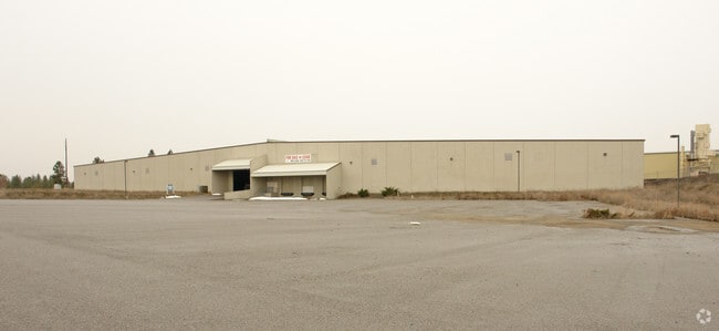


Property Detail
17524 E Euclid Ave
55072.0335
07-25-45; PTN OF NW1/4 DAF; COMM NW COR SEC7; TH S895856E 1261.69FT; TH S005429E 40FT TO POB; TH S005429E 185.52FT; TH S890531W 15FT; TH S554141W 575.38FT; TH S150954E 373.39FT; TH N745055E 431.69FT; TH N745209E 361.49FT; TH N004807W 663.17FT; TH N89
Wholesaleoutletdiscountstore
Spokane
I-2
Washington
B and X Area of moderate flood hazard, usually the area between the limits of the 100-year and 500-year floods.
11.08 AC
2025
Valley
2025
Spokane
011400
Spokane-Spokane Valley, WA
107,955 SF
NEARBY LISTINGS FOR SALE OR LEASE
DEMOGRAPHICS near 17524 E Euclid Ave
1 mile
3 mile
5 mile
2025 Total Population
3,369
44,839
109,683
2030 Population
3,509
46,234
112,682
Pop Growth 2025-2030
+ 4.16%
+ 3.11%
+ 2.73%
Average Age
40
40
40
2025 Total Households
1,411
18,382
43,584
HH Growth 2025-2030
+ 4.11%
+ 3.04%
+ 2.71%
Median Household Inc
$75,530
$77,189
$79,190
Avg Household Size
2.40
2.40
2.50
2025 Avg HH Vehicles
2.00
2.00
2.00
Median Home Value
$364,626
$437,857
$443,389
Median Year Built
2000
1997
1991
Nearby Places
Map Layers
Map Styles
 Street
 Aerial
Layers
 Traffic
 Biking
Places
Listings with unknown addresses are not visible on the map
- Restaurants
- Banks
- Shops
- Fitness
- Groceries
PUBLIC TRANSPORTATION
AIRPORT
Spokane International
Drive
Walk
Distance
Spokane International
29 min
19.1 mi
Freight Ports
Port of Everett
Drive
Walk
Distance
Port of Everett
356 min
314.7 mi
Nearby Properties
Address
Land Use
TOTAL SIZE
Lot Size
Zoning
Address
Land Use
TOTAL SIZE
Lot Size
Zoning
2,818,475 SF
466.05 AC
I-2
Address
Land Use
TOTAL SIZE
Lot Size
Zoning
1,077,082 SF
85.91 AC
I-2
Address
Land Use
TOTAL SIZE
Lot Size
Zoning
275,534 SF
67.98 AC
P
Address
Land Use
TOTAL SIZE
Lot Size
Zoning
373,111 SF
12.44 AC
MUC
Address
Land Use
TOTAL SIZE
Lot Size
Zoning
130,380 SF
11.10 AC
MUC
Address
Land Use
TOTAL SIZE
Lot Size
Zoning
237,094 SF
58.56 AC
R-3
Address
Land Use
TOTAL SIZE
Lot Size
Zoning
3,688,247 SF
244.85 AC
I-2
Address
Land Use
TOTAL SIZE
Lot Size
Zoning
296,760 SF
37.61 AC
I-1
Address
Land Use
TOTAL SIZE
Lot Size
Zoning
169,003 SF
5.18 AC
MUC
Address
Land Use
TOTAL SIZE
Lot Size
Zoning
270,453 SF
28.62 AC
Address
Land Use
TOTAL SIZE
Lot Size
Zoning
216,965 SF
10.70 AC
MUC
Address
Land Use
TOTAL SIZE
Lot Size
Zoning
227,044 SF
7.20 AC
MUC
Address
Land Use
TOTAL SIZE
Lot Size
Zoning
318,756 SF
13.64 AC
MF-2
Address
Land Use
TOTAL SIZE
Lot Size
Zoning
98,088 SF
13.94 AC
SAP
Address
Land Use
TOTAL SIZE
Lot Size
Zoning
323,993 SF
10.97 AC
MUC
Address
Land Use
TOTAL SIZE
Lot Size
Zoning
197,868 SF
7.15 AC
MUC
Address
Land Use
TOTAL SIZE
Lot Size
Zoning
192,698 SF
9.55 AC
MUC
Address
Land Use
TOTAL SIZE
Lot Size
Zoning
346,589 SF
16.28 AC
MF-2
Address
Land Use
TOTAL SIZE
Lot Size
Zoning
204,730 SF
8.60 AC
MUC
Address
Land Use
TOTAL SIZE
Lot Size
Zoning
123,400 SF
4.50 AC
MUC
Address
Land Use
TOTAL SIZE
Lot Size
Zoning
133,310 SF
10.93 AC
M2
Address
Land Use
TOTAL SIZE
Lot Size
Zoning
211,011 SF
8.81 AC
CMU
Address
Land Use
TOTAL SIZE
Lot Size
Zoning
139,122 SF
6.17 AC
MUC
Address
Land Use
TOTAL SIZE
Lot Size
Zoning
150,936 SF
9.30 AC
M2
Address
Land Use
TOTAL SIZE
Lot Size
Zoning
138,379 SF
17.39 AC
RC
Address
Land Use
TOTAL SIZE
Lot Size
Zoning
68,928 SF
10.96 AC
R-3
Address
Land Use
TOTAL SIZE
Lot Size
Zoning
231,172 SF
19.20 AC
RC
Address
Land Use
TOTAL SIZE
Lot Size
Zoning
145,884 SF
6.87 AC
M2
Address
Land Use
TOTAL SIZE
Lot Size
Zoning
107,279 SF
7.31 AC
MF-2
Address
Land Use
TOTAL SIZE
Lot Size
Zoning
144,544 SF
9.65 AC
I-1
The World's #1 Commercial Real Estate Marketplace
Connect with us
© 2026 CoStar Group
The information above has been obtained from sources believed reliable. While we do not doubt its accuracy we have not verified it and make no guarantee, warranty or representation about it. It is your responsibility to independently confirm its accuracy and completeness. Any projections, opinions, assumptions, or estimates used are for example only and do not represent the current or future performance of the property. The value of this transaction to you depends on tax and other factors which should be evaluated by your tax, financial, and legal advisors. You and your advisors should conduct a careful, independent investigation of the property to determine to your satisfaction the suitability of the property for your needs.