Property Record
1754 Kenmore Rd, Columbus, OH 43219


NEARBY LISTINGS FOR SALE OR LEASE
Property Detail
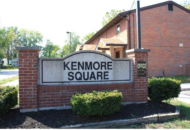
1754 Kenmore Rd
Columbus, OH
Norlea Park
010-098532
HUDSON ST NORLEA PARK LOTS 1-14 RES A-B D & PT C
Charitableorganization
Franklin
X
Ohio
39049C0189K
1-14
0
3.74 AC
2025
Argyle Park
007511
Columbus
12,448 SF
DEMOGRAPHICS near 1754 Kenmore Rd
1 mile
3 mile
5 mile
2024 Total Population
19,236
155,113
374,907
2029 Population
19,547
156,483
377,470
Pop Growth 2024-2029
+ 1.62%
+ 0.88%
+ 0.68%
Average Age
36
33
35
2024 Total Households
7,042
60,828
160,319
HH Growth 2024-2029
+ 1.51%
+ 0.94%
+ 0.75%
Median Household Inc
$31,292
$43,036
$55,497
Avg Household Size
2.60
2.30
2.20
2024 Avg HH Vehicles
1.00
2.00
2.00
Median Home Value
$76,309
$165,285
$248,900
Median Year Built
1954
1962
1963
Nearby Places
Map Layers
Map Styles
 Street
 Aerial
Transit
 Traffic
 Biking
Places
Listings with unknown addresses are not visible on the map
- Restaurants
- Banks
- Shops
- Fitness
- Groceries
PUBLIC TRANSPORTATION
AIRPORT
John Glenn Columbus International
Drive
Walk
Distance
John Glenn Columbus International
11 min
6.5 mi
Rickenbacker International
Drive
Walk
Distance
Rickenbacker International
28 min
18.2 mi
Freight Ports
Port of Toledo
Drive
Walk
Distance
Port of Toledo
183 min
147.6 mi
Nearby Properties
Address
Land Use
TOTAL SIZE
Lot Size
Zoning
Address
Land Use
TOTAL SIZE
Lot Size
Zoning
382,270 SF
319.59 AC
Address
Land Use
TOTAL SIZE
Lot Size
Zoning
Address
Land Use
TOTAL SIZE
Lot Size
Zoning
1.64 AC
Address
Land Use
TOTAL SIZE
Lot Size
Zoning
560,146 SF
63.19 AC
Address
Land Use
TOTAL SIZE
Lot Size
Zoning
284,481 SF
94.09 AC
Address
Land Use
TOTAL SIZE
Lot Size
Zoning
4.90 AC
Address
Land Use
TOTAL SIZE
Lot Size
Zoning
770,975 SF
64.63 AC
Address
Land Use
TOTAL SIZE
Lot Size
Zoning
2.25 AC
Address
Land Use
TOTAL SIZE
Lot Size
Zoning
325,684 SF
2 AC
Address
Land Use
TOTAL SIZE
Lot Size
Zoning
339,332 SF
1.42 AC
Address
Land Use
TOTAL SIZE
Lot Size
Zoning
242,064 SF
18.02 AC
Address
Land Use
TOTAL SIZE
Lot Size
Zoning
0.99 AC
Address
Land Use
TOTAL SIZE
Lot Size
Zoning
1.39 AC
Address
Land Use
TOTAL SIZE
Lot Size
Zoning
301,882 SF
1.13 AC
Address
Land Use
TOTAL SIZE
Lot Size
Zoning
349,372 SF
3.09 AC
Address
Land Use
TOTAL SIZE
Lot Size
Zoning
29,668 SF
1.32 AC
Address
Land Use
TOTAL SIZE
Lot Size
Zoning
255,831 SF
2.50 AC
Address
Land Use
TOTAL SIZE
Lot Size
Zoning
201,866 SF
3.61 AC
Address
Land Use
TOTAL SIZE
Lot Size
Zoning
156,039 SF
4.23 AC
Address
Land Use
TOTAL SIZE
Lot Size
Zoning
230,354 SF
1.05 AC
Address
Land Use
TOTAL SIZE
Lot Size
Zoning
299,220 SF
29.68 AC
Address
Land Use
TOTAL SIZE
Lot Size
Zoning
0.20 AC
Address
Land Use
TOTAL SIZE
Lot Size
Zoning
274,272 SF
6.45 AC
Address
Land Use
TOTAL SIZE
Lot Size
Zoning
0.66 AC
Address
Land Use
TOTAL SIZE
Lot Size
Zoning
35,434 SF
17.56 AC
Address
Land Use
TOTAL SIZE
Lot Size
Zoning
218,403 SF
9.98 AC
Address
Land Use
TOTAL SIZE
Lot Size
Zoning
332,616 SF
26.90 AC
Address
Land Use
TOTAL SIZE
Lot Size
Zoning
211,391 SF
1.15 AC
Address
Land Use
TOTAL SIZE
Lot Size
Zoning
209,542 SF
27.50 AC
Address
Land Use
TOTAL SIZE
Lot Size
Zoning
605,359 SF
23.28 AC
The World's #1 Commercial Real Estate Marketplace
Connect with us
© 2026 CoStar Group
The information above has been obtained from sources believed reliable. While we do not doubt its accuracy we have not verified it and make no guarantee, warranty or representation about it. It is your responsibility to independently confirm its accuracy and completeness. Any projections, opinions, assumptions, or estimates used are for example only and do not represent the current or future performance of the property. The value of this transaction to you depends on tax and other factors which should be evaluated by your tax, financial, and legal advisors. You and your advisors should conduct a careful, independent investigation of the property to determine to your satisfaction the suitability of the property for your needs.