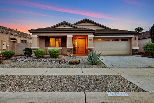
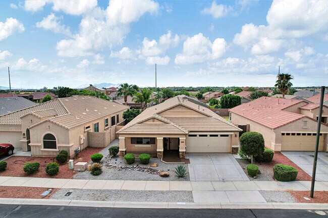
Property Record
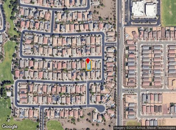
17543 W Columbine Dr, Surprise, AZ 85388
NEARBY LISTINGS FOR SALE OR LEASE
-
-
View all Surprise listings for sale on LoopNet.com
Property Detail
17543 W Columbine Dr
Phoenix-Mesa-Scottsdale, AZ
Sarah Ann Ranch Unit 2
502-06-107
Maricopa
Sfr
Arizona
X
0.14 AC
04013C1660L
Loop 303/Surprise
2,155 SF
Phoenix
DEMOGRAPHICS near 17543 W Columbine Dr
1 Mile
3 Mile
5 Mile
2024 Total Population
6,029
67,033
132,739
2029 Population
6,792
73,319
145,527
Pop Growth 2024-2029
+ 12.66%
+ 9.38%
+ 9.63%
Average Age
36
36
41
2024 Total Households
1,802
20,681
46,106
HH Growth 2024-2029
+ 12.82%
+ 9.45%
+ 9.88%
Median Household Inc
$108,693
$96,825
$88,828
Avg Household Size
3.20
3.20
2.80
2024 Avg HH Vehicles
3.00
2.00
2.00
Median Home Value
$422,923
$372,442
$367,665
Median Year Built
2010
2006
2005
Nearby Places
Map Layers
Map Styles
 Street
 Aerial
- Restaurants
- Banks
- Shops
- Fitness
- Groceries
PUBLIC TRANSPORTATION
AIRPORT
Phoenix Sky Harbor International
DRIVE
WALK
Distance
Phoenix Sky Harbor International
48 min
37.2 mi
Freight Ports
Port of San Diego
DRIVE
WALK
Distance
Port of San Diego
384 min
344.5 mi
SALE & LEASE HISTORY
LISTING DATE
SALE/LEASE

Aug 01, 2022
For Sale
Nearby Properties
Address
Land Use
TOTAL SIZE
Lot Size
Zoning
Address
Land Use
TOTAL SIZE
Lot Size
Zoning
283,614 SF
55.80 AC
PAD
Address
Land Use
TOTAL SIZE
Lot Size
Zoning
1,758,410 SF
98.58 AC
PAD
Address
Land Use
TOTAL SIZE
Lot Size
Zoning
256,094 SF
49.15 AC
PAD
Address
Land Use
TOTAL SIZE
Lot Size
Zoning
1,178,814 SF
64.63 AC
Address
Land Use
TOTAL SIZE
Lot Size
Zoning
216,334 SF
55.45 AC
R16
Address
Land Use
TOTAL SIZE
Lot Size
Zoning
134,364 SF
15.26 AC
PAD
Address
Land Use
TOTAL SIZE
Lot Size
Zoning
232,202 SF
27.32 AC
PAD
Address
Land Use
TOTAL SIZE
Lot Size
Zoning
210,197 SF
19.40 AC
RH15
Address
Land Use
TOTAL SIZE
Lot Size
Zoning
90,387 SF
14.97 AC
PAD
Address
Land Use
TOTAL SIZE
Lot Size
Zoning
98,560 SF
12.87 AC
PAD
Address
Land Use
TOTAL SIZE
Lot Size
Zoning
104,102 SF
10.81 AC
PAD
Address
Land Use
TOTAL SIZE
Lot Size
Zoning
96,782 SF
15.66 AC
PAD
Address
Land Use
TOTAL SIZE
Lot Size
Zoning
102,295 SF
12.58 AC
R-6
Address
Land Use
TOTAL SIZE
Lot Size
Zoning
153,918 SF
20.58 AC
PAD
Address
Land Use
TOTAL SIZE
Lot Size
Zoning
154,628 SF
16.36 AC
PAD
Address
Land Use
TOTAL SIZE
Lot Size
Zoning
86,770 SF
18.26 AC
PAD
Address
Land Use
TOTAL SIZE
Lot Size
Zoning
340,420 SF
16.26 AC
Address
Land Use
TOTAL SIZE
Lot Size
Zoning
104,769 SF
10.41 AC
PAD
Address
Land Use
TOTAL SIZE
Lot Size
Zoning
172,273 SF
29.79 AC
RU43
Address
Land Use
TOTAL SIZE
Lot Size
Zoning
71,747 SF
8.55 AC
PAD
Address
Land Use
TOTAL SIZE
Lot Size
Zoning
82,928 SF
9.88 AC
PAD
Address
Land Use
TOTAL SIZE
Lot Size
Zoning
46,424 SF
10 AC
PAD
Address
Land Use
TOTAL SIZE
Lot Size
Zoning
73,791 SF
8.87 AC
PAD
Address
Land Use
TOTAL SIZE
Lot Size
Zoning
143,451 SF
35.12 AC
Address
Land Use
TOTAL SIZE
Lot Size
Zoning
134,570 SF
13.93 AC
PAD
Address
Land Use
TOTAL SIZE
Lot Size
Zoning
31,328 SF
2.95 AC
PAD
Address
Land Use
TOTAL SIZE
Lot Size
Zoning
121,889 SF
10.84 AC
PAD
Address
Land Use
TOTAL SIZE
Lot Size
Zoning
53,526 SF
11.89 AC
PAD
Address
Land Use
TOTAL SIZE
Lot Size
Zoning
82,692 SF
9.85 AC
CR
Address
Land Use
TOTAL SIZE
Lot Size
Zoning
61,000 SF
6.50 AC
The World's #1 Commercial Real Estate Marketplace
Connect with us
© 2025 CoStar Group
The information above has been obtained from sources believed reliable. While we do not doubt its accuracy we have not verified it and make no guarantee, warranty or representation about it. It is your responsibility to independently confirm its accuracy and completeness. Any projections, opinions, assumptions, or estimates used are for example only and do not represent the current or future performance of the property. The value of this transaction to you depends on tax and other factors which should be evaluated by your tax, financial, and legal advisors. You and your advisors should conduct a careful, independent investigation of the property to determine to your satisfaction the suitability of the property for your needs.