Property Record
1755 Central Park Dr, Steamboat Springs, CO 80487
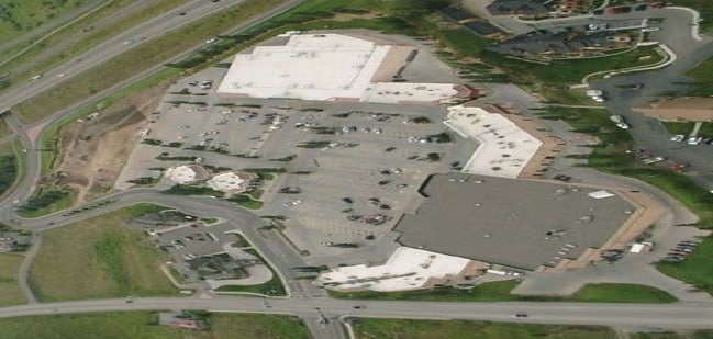

Property Detail
1755 Central Park Dr
Steamboat Springs, CO
LOT 2 STEAMBOAT VILLAGE COMM CENTER REPLAT D
R6257089
Routt
Storebuilding
Colorado
B and X Area of moderate flood hazard, usually the area between the limits of the 100-year and 500-year floods.
2
2025
4.06 AC
2025
Colorado Ski Area
000701
Other Market Areas
28,453 SF
NEARBY LISTINGS FOR SALE OR LEASE
DEMOGRAPHICS near 1755 Central Park Dr
1 mile
3 mile
5 mile
2025 Total Population
3,286
14,352
16,422
2030 Population
3,478
14,721
16,772
Pop Growth 2025-2030
+ 5.84%
+ 2.57%
+ 2.13%
Average Age
45
42
42
2025 Total Households
1,470
6,169
6,936
HH Growth 2025-2030
+ 5.78%
+ 2.66%
+ 2.23%
Median Household Inc
$96,890
$114,393
$108,408
Avg Household Size
2.20
2.20
2.30
2025 Avg HH Vehicles
2.00
2.00
2.00
Median Home Value
$1,080,851
$1,044,165
$1,026,326
Median Year Built
1997
1992
1992
Nearby Places
Map Layers
Map Styles
 Street
 Aerial
Layers
 Traffic
 Biking
Places
Listings with unknown addresses are not visible on the map
- Restaurants
- Banks
- Shops
- Fitness
- Groceries
PUBLIC TRANSPORTATION
AIRPORT
Yampa Valley
Drive
Walk
Distance
Yampa Valley
33 min
26.7 mi
Freight Ports
Tulsa Port Of Catoosa
Drive
Walk
Distance
Tulsa Port Of Catoosa
924 min
863.5 mi
Nearby Properties
Address
Land Use
TOTAL SIZE
Lot Size
Zoning
Address
Land Use
TOTAL SIZE
Lot Size
Zoning
Address
Land Use
TOTAL SIZE
Lot Size
Zoning
165,497 SF
61.09 AC
Address
Land Use
TOTAL SIZE
Lot Size
Zoning
164,090 SF
36.31 AC
AF
Address
Land Use
TOTAL SIZE
Lot Size
Zoning
50,497 SF
150 AC
Address
Land Use
TOTAL SIZE
Lot Size
Zoning
Address
Land Use
TOTAL SIZE
Lot Size
Zoning
195,194 SF
18.50 AC
Address
Land Use
TOTAL SIZE
Lot Size
Zoning
78,518 SF
2.80 AC
Address
Land Use
TOTAL SIZE
Lot Size
Zoning
89,146 SF
10.09 AC
Address
Land Use
TOTAL SIZE
Lot Size
Zoning
52,850 SF
1.92 AC
Z14
Address
Land Use
TOTAL SIZE
Lot Size
Zoning
254,414 SF
3.87 AC
Address
Land Use
TOTAL SIZE
Lot Size
Zoning
21,800 SF
232.64 AC
Address
Land Use
TOTAL SIZE
Lot Size
Zoning
Address
Land Use
TOTAL SIZE
Lot Size
Zoning
86,967 SF
4.20 AC
Address
Land Use
TOTAL SIZE
Lot Size
Zoning
19,214 SF
59.28 AC
Address
Land Use
TOTAL SIZE
Lot Size
Zoning
72,111 SF
2.93 AC
Address
Land Use
TOTAL SIZE
Lot Size
Zoning
22,707 SF
5 AC
Address
Land Use
TOTAL SIZE
Lot Size
Zoning
35.10 AC
AF
Address
Land Use
TOTAL SIZE
Lot Size
Zoning
13,325 SF
5.98 AC
Address
Land Use
TOTAL SIZE
Lot Size
Zoning
59,305 SF
4.64 AC
Address
Land Use
TOTAL SIZE
Lot Size
Zoning
25,310 SF
1.27 AC
Address
Land Use
TOTAL SIZE
Lot Size
Zoning
34,665 SF
0.86 AC
Address
Land Use
TOTAL SIZE
Lot Size
Zoning
84,533 SF
14.65 AC
Address
Land Use
TOTAL SIZE
Lot Size
Zoning
20,957 SF
0.64 AC
Address
Land Use
TOTAL SIZE
Lot Size
Zoning
67,489 SF
7 AC
Address
Land Use
TOTAL SIZE
Lot Size
Zoning
42,462 SF
0.91 AC
Address
Land Use
TOTAL SIZE
Lot Size
Zoning
22,796 SF
0.64 AC
Address
Land Use
TOTAL SIZE
Lot Size
Zoning
35,133 SF
0.64 AC
Address
Land Use
TOTAL SIZE
Lot Size
Zoning
13,660 SF
6.12 AC
AF
Address
Land Use
TOTAL SIZE
Lot Size
Zoning
53,405 SF
2.35 AC
RO
The World's #1 Commercial Real Estate Marketplace
Connect with us
© 2026 CoStar Group
The information above has been obtained from sources believed reliable. While we do not doubt its accuracy we have not verified it and make no guarantee, warranty or representation about it. It is your responsibility to independently confirm its accuracy and completeness. Any projections, opinions, assumptions, or estimates used are for example only and do not represent the current or future performance of the property. The value of this transaction to you depends on tax and other factors which should be evaluated by your tax, financial, and legal advisors. You and your advisors should conduct a careful, independent investigation of the property to determine to your satisfaction the suitability of the property for your needs.