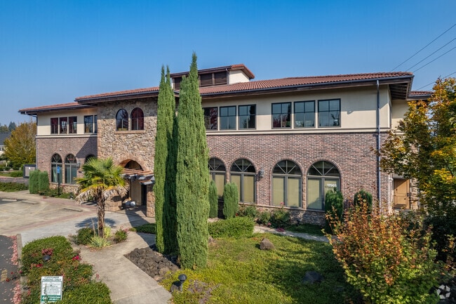
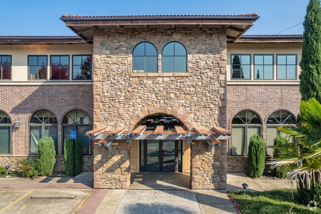
Property Record
17565 Sw Handley St, Sherwood, OR 97140

Current Lease Availabilities
Property Detail
17565 Sw Handley St
R2153893
2007-029 PARTITION PLAT, LOT PT 3, ACRES 0.59
Commercialbuilding
Washington
GC
Oregon
B and X Area of moderate flood hazard, usually the area between the limits of the 100-year and 500-year floods.
3
2024
0.59 AC
2026
Westside Outlying
032201
Portland
15,960 SF
Portland-Vancouver-Hillsboro, OR-WA
NEARBY LISTINGS FOR SALE OR LEASE
DEMOGRAPHICS near 17565 Sw Handley St
1 mile
3 mile
5 mile
2025 Total Population
14,629
24,833
95,566
2030 Population
14,864
25,188
96,925
Pop Growth 2025-2030
+ 1.61%
+ 1.43%
+ 1.42%
Average Age
38
39
41
2025 Total Households
4,954
8,566
35,364
HH Growth 2025-2030
+ 1.78%
+ 1.63%
+ 1.48%
Median Household Inc
$113,002
$117,526
$114,152
Avg Household Size
2.90
2.90
2.60
2025 Avg HH Vehicles
2.00
2.00
2.00
Median Home Value
$640,665
$659,212
$673,613
Median Year Built
1999
1997
1995
Nearby Places
Map Layers
Map Styles
 Street
 Aerial
Transit
 Traffic
 Biking
Places
Listings with unknown addresses are not visible on the map
- Restaurants
- Banks
- Shops
- Fitness
- Groceries
PUBLIC TRANSPORTATION
COMMUTER RAIL
Tualatin (Westside Express Service - Tri-County Metropolitan Transportation District of Oregon Rail (TriMet Rail))
Drive
Walk
Distance
Tualatin (Westside Express Service - Tri-County Metropolitan Transportation District of Oregon Rail (TriMet Rail))
11 min
5.5 mi
Wilsonville (Westside Express Service - Tri-County Metropolitan Transportation District of Oregon Rail (TriMet Rail))
Drive
Walk
Distance
Wilsonville (Westside Express Service - Tri-County Metropolitan Transportation District of Oregon Rail (TriMet Rail))
16 min
7.3 mi
AIRPORT
Portland International
Drive
Walk
Distance
Portland International
47 min
27.7 mi
Nearby Properties
Address
Land Use
TOTAL SIZE
Lot Size
Zoning
Address
Land Use
TOTAL SIZE
Lot Size
Zoning
23.98 AC
EI
Address
Land Use
TOTAL SIZE
Lot Size
Zoning
353,000 SF
69.95 AC
IP
Address
Land Use
TOTAL SIZE
Lot Size
Zoning
27.85 AC
IP
Address
Land Use
TOTAL SIZE
Lot Size
Zoning
1,232 SF
27.77 AC
EI
Address
Land Use
TOTAL SIZE
Lot Size
Zoning
18.06 AC
Address
Land Use
TOTAL SIZE
Lot Size
Zoning
127,476 SF
13.48 AC
RC
Address
Land Use
TOTAL SIZE
Lot Size
Zoning
139,356 SF
13.99 AC
LI_PUD
Address
Land Use
TOTAL SIZE
Lot Size
Zoning
15,000 SF
21.08 AC
MG
Address
Land Use
TOTAL SIZE
Lot Size
Zoning
168,065 SF
5.09 AC
HDR_PUD
Address
Land Use
TOTAL SIZE
Lot Size
Zoning
261,104 SF
13.52 AC
HDR_PUD
Address
Land Use
TOTAL SIZE
Lot Size
Zoning
1,360 SF
7.41 AC
HDR
Address
Land Use
TOTAL SIZE
Lot Size
Zoning
124,718 SF
10.89 AC
RC_PUD
Address
Land Use
TOTAL SIZE
Lot Size
Zoning
145,000 SF
4.01 AC
RC
Address
Land Use
TOTAL SIZE
Lot Size
Zoning
226,960 SF
11.38 AC
MG
Address
Land Use
TOTAL SIZE
Lot Size
Zoning
190,000 SF
24.86 AC
IP
Address
Land Use
TOTAL SIZE
Lot Size
Zoning
8.40 AC
Address
Land Use
TOTAL SIZE
Lot Size
Zoning
68,800 SF
11.05 AC
MDRH
Address
Land Use
TOTAL SIZE
Lot Size
Zoning
33,056 SF
8.85 AC
RC
Address
Land Use
TOTAL SIZE
Lot Size
Zoning
18.34 AC
MG
Address
Land Use
TOTAL SIZE
Lot Size
Zoning
78,101 SF
12.32 AC
GC
Address
Land Use
TOTAL SIZE
Lot Size
Zoning
72,000 SF
10.41 AC
IP
Address
Land Use
TOTAL SIZE
Lot Size
Zoning
157,230 SF
8.75 AC
MG
Address
Land Use
TOTAL SIZE
Lot Size
Zoning
11.82 AC
MG
Address
Land Use
TOTAL SIZE
Lot Size
Zoning
145,136 SF
6.48 AC
MG
Address
Land Use
TOTAL SIZE
Lot Size
Zoning
7.35 AC
LI_PUD
Address
Land Use
TOTAL SIZE
Lot Size
Zoning
2,352 SF
36.05 AC
MBP
Address
Land Use
TOTAL SIZE
Lot Size
Zoning
115,000 SF
6.42 AC
GI
Address
Land Use
TOTAL SIZE
Lot Size
Zoning
166,837 SF
18.32 AC
LI
Address
Land Use
TOTAL SIZE
Lot Size
Zoning
66,650 SF
0.03 AC
MDRH
The World's #1 Commercial Real Estate Marketplace
Connect with us
© 2026 CoStar Group
The information above has been obtained from sources believed reliable. While we do not doubt its accuracy we have not verified it and make no guarantee, warranty or representation about it. It is your responsibility to independently confirm its accuracy and completeness. Any projections, opinions, assumptions, or estimates used are for example only and do not represent the current or future performance of the property. The value of this transaction to you depends on tax and other factors which should be evaluated by your tax, financial, and legal advisors. You and your advisors should conduct a careful, independent investigation of the property to determine to your satisfaction the suitability of the property for your needs.