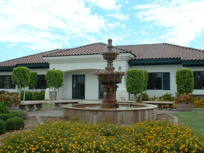
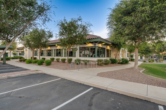
Property Record
1757 E Baseline Rd, Gilbert, AZ 85233

Property Detail
1757 E Baseline Rd
314-01-052
GILBERT TOWNSHIP VILLAS CONDOMINIUM MCR 617-38
Officecondo
Maricopa
C-N
Arizona
C and X Area of minimal flood hazard, usually depicted on FIRMs as above the 500-year flood level.
142
2025
0.04 AC
2025
Superstition Corridor
422308
Phoenix
6,152 SF
Phoenix-Mesa-Chandler, AZ
NEARBY LISTINGS FOR SALE OR LEASE
DEMOGRAPHICS near 1757 E Baseline Rd
1 mile
3 mile
5 mile
2024 Total Population
15,759
148,503
412,115
2029 Population
16,197
152,942
426,120
Pop Growth 2024-2029
+ 2.78%
+ 2.99%
+ 3.40%
Average Age
36
37
38
2024 Total Households
5,786
52,138
154,318
HH Growth 2024-2029
+ 2.75%
+ 3.10%
+ 3.66%
Median Household Inc
$89,498
$82,575
$81,381
Avg Household Size
2.70
2.80
2.60
2024 Avg HH Vehicles
2.00
2.00
2.00
Median Home Value
$459,410
$438,997
$435,973
Median Year Built
1985
1985
1987
Nearby Places
Map Layers
Map Styles
 Street
 Aerial
Transit
 Traffic
 Biking
Places
Listings with unknown addresses are not visible on the map
- Restaurants
- Banks
- Shops
- Fitness
- Groceries
PUBLIC TRANSPORTATION
AIRPORT
Phoenix-Mesa Gateway
Drive
Walk
Distance
Phoenix-Mesa Gateway
23 min
13.7 mi
Phoenix Sky Harbor International
Drive
Walk
Distance
Phoenix Sky Harbor International
25 min
16.7 mi
SALE & LEASE HISTORY
LISTING DATE
SALE/LEASE

Oct 18, 2021
For Lease
Oct 13, 2022
For Lease
Feb 14, 2022
For Sale
Apr 12, 2024
For Sale
Nearby Properties
Address
Land Use
TOTAL SIZE
Lot Size
Zoning
Address
Land Use
TOTAL SIZE
Lot Size
Zoning
7.90 AC
Address
Land Use
TOTAL SIZE
Lot Size
Zoning
184,558 SF
6.18 AC
Address
Land Use
TOTAL SIZE
Lot Size
Zoning
127,962 SF
18.60 AC
I-1
Address
Land Use
TOTAL SIZE
Lot Size
Zoning
5.92 AC
I-1
Address
Land Use
TOTAL SIZE
Lot Size
Zoning
4.96 AC
Address
Land Use
TOTAL SIZE
Lot Size
Zoning
30,075 SF
6.86 AC
I-1
Address
Land Use
TOTAL SIZE
Lot Size
Zoning
739,944 SF
40.02 AC
MFM
Address
Land Use
TOTAL SIZE
Lot Size
Zoning
9.25 AC
I-1
Address
Land Use
TOTAL SIZE
Lot Size
Zoning
62,328 SF
2.65 AC
Address
Land Use
TOTAL SIZE
Lot Size
Zoning
281,301 SF
19.13 AC
I-1
Address
Land Use
TOTAL SIZE
Lot Size
Zoning
15,050 SF
1.42 AC
C-G
Address
Land Use
TOTAL SIZE
Lot Size
Zoning
290,450 SF
38.47 AC
PF
Address
Land Use
TOTAL SIZE
Lot Size
Zoning
13,336 SF
1.98 AC
I-2
Address
Land Use
TOTAL SIZE
Lot Size
Zoning
411,683 SF
15.53 AC
RM3
Address
Land Use
TOTAL SIZE
Lot Size
Zoning
357,952 SF
33.73 AC
LI
Address
Land Use
TOTAL SIZE
Lot Size
Zoning
112,628 SF
17.37 AC
I-1
Address
Land Use
TOTAL SIZE
Lot Size
Zoning
185,382 SF
23.37 AC
C-G
Address
Land Use
TOTAL SIZE
Lot Size
Zoning
309,031 SF
18.55 AC
Address
Land Use
TOTAL SIZE
Lot Size
Zoning
16.57 AC
PF
Address
Land Use
TOTAL SIZE
Lot Size
Zoning
427,210 SF
38.33 AC
PF
Address
Land Use
TOTAL SIZE
Lot Size
Zoning
572,119 SF
22.45 AC
PF
Address
Land Use
TOTAL SIZE
Lot Size
Zoning
344,641 SF
21.43 AC
I-1
Address
Land Use
TOTAL SIZE
Lot Size
Zoning
16,133 SF
1.79 AC
PF
Address
Land Use
TOTAL SIZE
Lot Size
Zoning
348,151 SF
20.69 AC
LI
Address
Land Use
TOTAL SIZE
Lot Size
Zoning
1.46 AC
C-G
Address
Land Use
TOTAL SIZE
Lot Size
Zoning
7,418 SF
2.37 AC
C-G
Address
Land Use
TOTAL SIZE
Lot Size
Zoning
1.17 AC
Address
Land Use
TOTAL SIZE
Lot Size
Zoning
115,920 SF
18.19 AC
Address
Land Use
TOTAL SIZE
Lot Size
Zoning
154,816 SF
35.89 AC
I-1
Address
Land Use
TOTAL SIZE
Lot Size
Zoning
1.62 AC
The World's #1 Commercial Real Estate Marketplace
Connect with us
© 2026 CoStar Group
The information above has been obtained from sources believed reliable. While we do not doubt its accuracy we have not verified it and make no guarantee, warranty or representation about it. It is your responsibility to independently confirm its accuracy and completeness. Any projections, opinions, assumptions, or estimates used are for example only and do not represent the current or future performance of the property. The value of this transaction to you depends on tax and other factors which should be evaluated by your tax, financial, and legal advisors. You and your advisors should conduct a careful, independent investigation of the property to determine to your satisfaction the suitability of the property for your needs.