Property Record
17580 Frazho Rd, Roseville, MI 48066


NEARBY LISTINGS FOR SALE OR LEASE
Property Detail
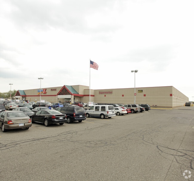
17580 Frazho Rd
Detroit-Warren-Dearborn, MI
Inclusive Of Roseville Half Acre Sub
08-14-20-326-040
PORTION LOT27
Publicstorage
Macomb
X
Michigan
26163C0130F
27,1-2
2025
16.80 AC
2025
Macomb East
256600
Detroit
167,589 SF
DEMOGRAPHICS near 17580 Frazho Rd
1 Mile
3 Mile
5 Mile
2024 Total Population
17,938
143,167
346,838
2029 Population
17,696
141,133
343,089
Pop Growth 2024-2029
(1.35%)
(1.42%)
(1.08%)
Average Age
39
40
40
2024 Total Households
7,112
59,085
140,035
HH Growth 2024-2029
(1.41%)
(1.46%)
(1.20%)
Median Household Inc
$51,572
$58,078
$55,815
Avg Household Size
2.40
2.40
2.40
2024 Avg HH Vehicles
2.00
2.00
2.00
Median Home Value
$114,442
$139,323
$144,972
Median Year Built
1957
1957
1958
Nearby Places
Map Layers
Map Styles
 Street
 Aerial
- Restaurants
- Banks
- Shops
- Fitness
- Groceries
PUBLIC TRANSPORTATION
AIRPORT
Windsor International
DRIVE
WALK
Distance
Windsor International
49 min
27.2 mi
Detroit Metro Wayne County
DRIVE
WALK
Distance
Detroit Metro Wayne County
53 min
36.8 mi
Freight Ports
Port of Toledo
DRIVE
WALK
Distance
Port of Toledo
98 min
77.5 mi
SALE & LEASE HISTORY
LISTING DATE
SALE/LEASE

Jan 19, 2017
For Lease
Jan 18, 2017
For Sale
Nearby Properties
Address
Land Use
TOTAL SIZE
Lot Size
Zoning
Address
Land Use
TOTAL SIZE
Lot Size
Zoning
1,034,990 SF
28.60 AC
Address
Land Use
TOTAL SIZE
Lot Size
Zoning
260,164 SF
Address
Land Use
TOTAL SIZE
Lot Size
Zoning
238,144 SF
12.15 AC
MZ
Address
Land Use
TOTAL SIZE
Lot Size
Zoning
661,151 SF
37.28 AC
MZ
Address
Land Use
TOTAL SIZE
Lot Size
Zoning
323,858 SF
20.66 AC
R-3
Address
Land Use
TOTAL SIZE
Lot Size
Zoning
10,070 SF
31.84 AC
RH
Address
Land Use
TOTAL SIZE
Lot Size
Zoning
362,350 SF
22.39 AC
M-2
Address
Land Use
TOTAL SIZE
Lot Size
Zoning
89,970 SF
2.86 AC
RM-1
Address
Land Use
TOTAL SIZE
Lot Size
Zoning
162,597 SF
17.94 AC
C-2
Address
Land Use
TOTAL SIZE
Lot Size
Zoning
192,387 SF
11.26 AC
CLD
Address
Land Use
TOTAL SIZE
Lot Size
Zoning
217,369 SF
20.15 AC
B-2
Address
Land Use
TOTAL SIZE
Lot Size
Zoning
204,620 SF
13.73 AC
R-3
Address
Land Use
TOTAL SIZE
Lot Size
Zoning
129,502 SF
3.17 AC
RM-1
Address
Land Use
TOTAL SIZE
Lot Size
Zoning
376,278 SF
19.85 AC
RM-1
Address
Land Use
TOTAL SIZE
Lot Size
Zoning
179,653 SF
11.56 AC
B-2
Address
Land Use
TOTAL SIZE
Lot Size
Zoning
103,069 SF
11.41 AC
B-3
Address
Land Use
TOTAL SIZE
Lot Size
Zoning
92,800 SF
6.71 AC
R-3
Address
Land Use
TOTAL SIZE
Lot Size
Zoning
41,065 SF
4.30 AC
B-3
Address
Land Use
TOTAL SIZE
Lot Size
Zoning
105,354 SF
2.33 AC
B-3
Address
Land Use
TOTAL SIZE
Lot Size
Zoning
160,600 SF
9.62 AC
R-3
Address
Land Use
TOTAL SIZE
Lot Size
Zoning
228,269 SF
10.37 AC
I-2
Address
Land Use
TOTAL SIZE
Lot Size
Zoning
193,020 SF
13.62 AC
RM-1
Address
Land Use
TOTAL SIZE
Lot Size
Zoning
119,898 SF
14.65 AC
B-2
Address
Land Use
TOTAL SIZE
Lot Size
Zoning
70,292 SF
3.45 AC
IC
Address
Land Use
TOTAL SIZE
Lot Size
Zoning
133,611 SF
11.74 AC
B-3
Address
Land Use
TOTAL SIZE
Lot Size
Zoning
99,810 SF
7.69 AC
RM-1
Address
Land Use
TOTAL SIZE
Lot Size
Zoning
87,747 SF
6.41 AC
RM-1
Address
Land Use
TOTAL SIZE
Lot Size
Zoning
136,270 SF
3.42 AC
LI
Address
Land Use
TOTAL SIZE
Lot Size
Zoning
65,412 SF
B-3
The World's #1 Commercial Real Estate Marketplace
Connect with us
© 2026 CoStar Group
The information above has been obtained from sources believed reliable. While we do not doubt its accuracy we have not verified it and make no guarantee, warranty or representation about it. It is your responsibility to independently confirm its accuracy and completeness. Any projections, opinions, assumptions, or estimates used are for example only and do not represent the current or future performance of the property. The value of this transaction to you depends on tax and other factors which should be evaluated by your tax, financial, and legal advisors. You and your advisors should conduct a careful, independent investigation of the property to determine to your satisfaction the suitability of the property for your needs.