Property Record
176 State Route 565, Wantage, NJ 07461

NEARBY LISTINGS FOR SALE OR LEASE
-
-
View all Wantage listings for sale on LoopNet.com
Property Detail
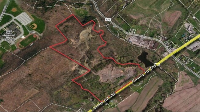
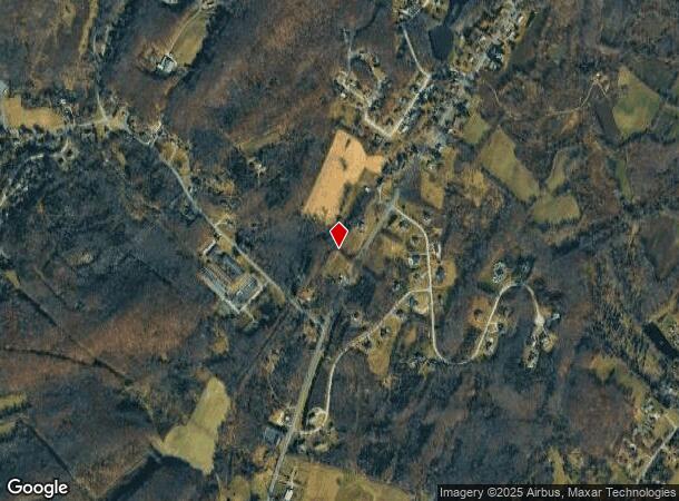
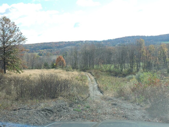
176 State Route 565
Newark, NJ-PA
Sussex
24-00117-0000-00038-01
New Jersey
Sfr
10 AC
A
Sussex County
34037C0160E
Northern New Jersey
DEMOGRAPHICS near 176 State Route 565
1 Mile
3 Mile
5 Mile
2024 Total Population
450
8,421
23,344
2029 Population
454
8,436
23,536
Pop Growth 2024-2029
+ 0.89%
+ 0.18%
+ 0.82%
Average Age
43
43
43
2024 Total Households
176
3,333
9,147
HH Growth 2024-2029
+ 1.14%
+ 0.15%
+ 0.90%
Median Household Inc
$65,000
$69,048
$90,354
Avg Household Size
2.60
2.50
2.50
2024 Avg HH Vehicles
2.00
2.00
2.00
Median Home Value
$271,874
$312,698
$301,132
Median Year Built
1968
1972
1978
Nearby Places
Map Layers
Map Styles
 Street
 Aerial
- Restaurants
- Banks
- Shops
- Fitness
- Groceries
SALE & LEASE HISTORY
LISTING DATE
SALE/LEASE

Jun 29, 2022
For Sale
Jan 19, 2024
For Sale
Jan 17, 2017
For Sale
Nearby Properties
Address
Land Use
TOTAL SIZE
Lot Size
Zoning
Address
Land Use
TOTAL SIZE
Lot Size
Zoning
0.92 AC
R-5
Address
Land Use
TOTAL SIZE
Lot Size
Zoning
5.73 AC
LI&U
Address
Land Use
TOTAL SIZE
Lot Size
Zoning
7.57 AC
NHCO
Address
Land Use
TOTAL SIZE
Lot Size
Zoning
Address
Land Use
TOTAL SIZE
Lot Size
Zoning
10,920 SF
12.47 AC
R-3
Address
Land Use
TOTAL SIZE
Lot Size
Zoning
11.60 AC
HWCO
Address
Land Use
TOTAL SIZE
Lot Size
Zoning
9.74 AC
M-L
Address
Land Use
TOTAL SIZE
Lot Size
Zoning
161.70 AC
I
Address
Land Use
TOTAL SIZE
Lot Size
Zoning
8,008 SF
6.88 AC
R-3
Address
Land Use
TOTAL SIZE
Lot Size
Zoning
61,795 SF
7.79 AC
P
Address
Land Use
TOTAL SIZE
Lot Size
Zoning
64.73 AC
R-5
Address
Land Use
TOTAL SIZE
Lot Size
Zoning
0.36 AC
R-1
Address
Land Use
TOTAL SIZE
Lot Size
Zoning
5.88 AC
HWCO
Address
Land Use
TOTAL SIZE
Lot Size
Zoning
5,588 SF
338 AC
P
Address
Land Use
TOTAL SIZE
Lot Size
Zoning
19,388 SF
6.05 AC
HWCO
Address
Land Use
TOTAL SIZE
Lot Size
Zoning
27 AC
LIT
Address
Land Use
TOTAL SIZE
Lot Size
Zoning
35,191 SF
12.72 AC
R-1
Address
Land Use
TOTAL SIZE
Lot Size
Zoning
16,989 SF
11.66 AC
R-5
Address
Land Use
TOTAL SIZE
Lot Size
Zoning
6,205 SF
4.46 AC
HWCO
Address
Land Use
TOTAL SIZE
Lot Size
Zoning
5,424 SF
2.74 AC
Address
Land Use
TOTAL SIZE
Lot Size
Zoning
5.87 AC
R-5
Address
Land Use
TOTAL SIZE
Lot Size
Zoning
15,180 SF
9.04 AC
HWCO
Address
Land Use
TOTAL SIZE
Lot Size
Zoning
310.72 AC
P
Address
Land Use
TOTAL SIZE
Lot Size
Zoning
21,250 SF
2.66 AC
C-2
Address
Land Use
TOTAL SIZE
Lot Size
Zoning
18,548 SF
21.73 AC
LTI
Address
Land Use
TOTAL SIZE
Lot Size
Zoning
Address
Land Use
TOTAL SIZE
Lot Size
Zoning
19,572 SF
7.97 AC
HWCO
Address
Land Use
TOTAL SIZE
Lot Size
Zoning
131.17 AC
Address
Land Use
TOTAL SIZE
Lot Size
Zoning
8.36 AC
R-5
Address
Land Use
TOTAL SIZE
Lot Size
Zoning
63,528 SF
1.36 AC
INST
The World's #1 Commercial Real Estate Marketplace
Connect with us
© 2025 CoStar Group
The information above has been obtained from sources believed reliable. While we do not doubt its accuracy we have not verified it and make no guarantee, warranty or representation about it. It is your responsibility to independently confirm its accuracy and completeness. Any projections, opinions, assumptions, or estimates used are for example only and do not represent the current or future performance of the property. The value of this transaction to you depends on tax and other factors which should be evaluated by your tax, financial, and legal advisors. You and your advisors should conduct a careful, independent investigation of the property to determine to your satisfaction the suitability of the property for your needs.