Property Record
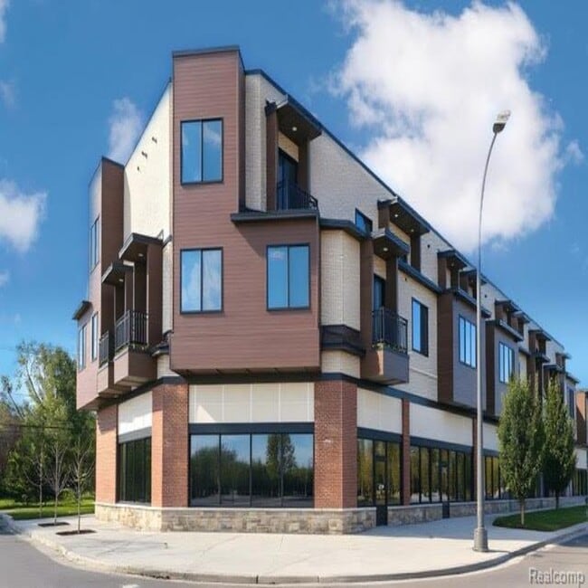
1760 E Auburn Rd, Rochester, MI 48307

Current Lease Availabilities
NEARBY LISTINGS FOR SALE OR LEASE
Property Detail
1760 E Auburn Rd
Detroit
Supervisor's Plat Of Brooklands Park No.
Detroit-Warren-Dearborn, MI
T3N, R11E, SEC 36 SUPERVISOR'S PLAT OF BROOKLANDS PARK NO 4 LOTS 1545 TO 1548 INCL10-22-20 FR 003, 004 & 005
15-36-226-068
Oakland
Miscellaneous
Michigan
2024
1545
2022
0.49 AC
193400
Brooklands Park
DEMOGRAPHICS near 1760 E Auburn Rd
1 Mile
3 Mile
5 Mile
2024 Total Population
9,572
74,548
210,713
2029 Population
9,784
75,932
214,335
Pop Growth 2024-2029
+ 2.21%
+ 1.86%
+ 1.72%
Average Age
40
41
42
2024 Total Households
4,163
29,623
82,004
HH Growth 2024-2029
+ 2.33%
+ 1.89%
+ 1.80%
Median Household Inc
$78,928
$93,149
$97,023
Avg Household Size
2.30
2.50
2.50
2024 Avg HH Vehicles
2.00
2.00
2.00
Median Home Value
$257,220
$347,930
$350,519
Median Year Built
1982
1986
1981
Nearby Places
Map Layers
Map Styles
 Street
 Aerial
- Restaurants
- Banks
- Shops
- Fitness
- Groceries
PUBLIC TRANSPORTATION
AIRPORT
Windsor International
DRIVE
WALK
Distance
Windsor International
59 min
33.0 mi
Detroit Metro Wayne County
DRIVE
WALK
Distance
Detroit Metro Wayne County
62 min
42.7 mi
Bishop International
DRIVE
WALK
Distance
Bishop International
66 min
49.6 mi
Nearby Properties
Address
Land Use
TOTAL SIZE
Lot Size
Zoning
Address
Land Use
TOTAL SIZE
Lot Size
Zoning
3,529 SF
29.19 AC
BI
Address
Land Use
TOTAL SIZE
Lot Size
Zoning
57.84 AC
AV
Address
Land Use
TOTAL SIZE
Lot Size
Zoning
Address
Land Use
TOTAL SIZE
Lot Size
Zoning
12.38 AC
R-10
Address
Land Use
TOTAL SIZE
Lot Size
Zoning
46.56 AC
CK MAP
Address
Land Use
TOTAL SIZE
Lot Size
Zoning
1,150 SF
25.68 AC
CK MAP
Address
Land Use
TOTAL SIZE
Lot Size
Zoning
242,857 SF
9.61 AC
RM-3
Address
Land Use
TOTAL SIZE
Lot Size
Zoning
34.43 AC
CK MAP
Address
Land Use
TOTAL SIZE
Lot Size
Zoning
35.60 AC
R-12
Address
Land Use
TOTAL SIZE
Lot Size
Zoning
41.09 AC
R-7
Address
Land Use
TOTAL SIZE
Lot Size
Zoning
27.89 AC
CK MAP
Address
Land Use
TOTAL SIZE
Lot Size
Zoning
28.58 AC
AI
Address
Land Use
TOTAL SIZE
Lot Size
Zoning
336,720 SF
63.11 AC
CR1
Address
Land Use
TOTAL SIZE
Lot Size
Zoning
255,070 SF
20.33 AC
RM-2
Address
Land Use
TOTAL SIZE
Lot Size
Zoning
22.09 AC
AI
Address
Land Use
TOTAL SIZE
Lot Size
Zoning
19.47 AC
R-8
Address
Land Use
TOTAL SIZE
Lot Size
Zoning
119.30 AC
Address
Land Use
TOTAL SIZE
Lot Size
Zoning
43.80 AC
Address
Land Use
TOTAL SIZE
Lot Size
Zoning
29.39 AC
CK MAP
Address
Land Use
TOTAL SIZE
Lot Size
Zoning
1,350 SF
21.90 AC
CK MAP
Address
Land Use
TOTAL SIZE
Lot Size
Zoning
106,130 SF
5.37 AC
O-2
Address
Land Use
TOTAL SIZE
Lot Size
Zoning
21.52 AC
AI
Address
Land Use
TOTAL SIZE
Lot Size
Zoning
Address
Land Use
TOTAL SIZE
Lot Size
Zoning
19.30 AC
CK MAP
Address
Land Use
TOTAL SIZE
Lot Size
Zoning
128,364 SF
40.11 AC
C-4
Address
Land Use
TOTAL SIZE
Lot Size
Zoning
51.98 AC
MHP
Address
Land Use
TOTAL SIZE
Lot Size
Zoning
12.22 AC
RM-2
Address
Land Use
TOTAL SIZE
Lot Size
Zoning
11.98 AC
RI
Address
Land Use
TOTAL SIZE
Lot Size
Zoning
89,460 SF
7.31 AC
BI
The World's #1 Commercial Real Estate Marketplace
Connect with us
© 2025 CoStar Group
The information above has been obtained from sources believed reliable. While we do not doubt its accuracy we have not verified it and make no guarantee, warranty or representation about it. It is your responsibility to independently confirm its accuracy and completeness. Any projections, opinions, assumptions, or estimates used are for example only and do not represent the current or future performance of the property. The value of this transaction to you depends on tax and other factors which should be evaluated by your tax, financial, and legal advisors. You and your advisors should conduct a careful, independent investigation of the property to determine to your satisfaction the suitability of the property for your needs.