Property Record
17601 Nw 78Th Ave, Hialeah, FL 33015
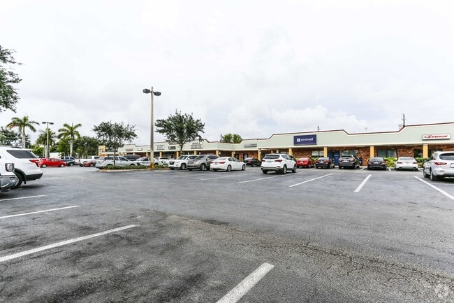


Property Detail
17601 Nw 78Th Ave
30-2010-000-0011
10 52 40 3.074 AC M/L PORT OF SE1/4 DESC COMM NE COR OF SE1/4 OF SEC TH N 87 DEG W 153.16FT S35.40FT FOR POB TH CONT S602.12FT N 87 DEG W 198.32FT WLY & NLY AD 38.15FT N552.07FT NLY & ELY AD 40.39FT S 87 DEG E 196.07FT TO POB
Storemultistory
Miami-Dade
6200
Florida
AE The base floodplain where base flood elevations are provided. AE Zones are now used on new format FIRMs instead of A1-A30 Zones.
3.07 AC
2024
Miami Lakes
2025
South Florida
012200
Miami-Miami Beach-Kendall, FL
32,092 SF
NEARBY LISTINGS FOR SALE OR LEASE
DEMOGRAPHICS near 17601 Nw 78Th Ave
1 mile
3 mile
5 mile
2025 Total Population
35,174
158,250
436,670
2030 Population
37,598
168,531
466,525
Pop Growth 2025-2030
+ 6.89%
+ 6.50%
+ 6.84%
Average Age
40
40
42
2025 Total Households
11,978
51,577
148,241
HH Growth 2025-2030
+ 6.93%
+ 6.40%
+ 7.18%
Median Household Inc
$79,907
$89,066
$69,922
Avg Household Size
2.90
3.00
2.90
2025 Avg HH Vehicles
2.00
2.00
2.00
Median Home Value
$455,421
$492,766
$416,314
Median Year Built
1988
1990
1989
Nearby Places
Map Layers
Map Styles
 Street
 Aerial
Transit
 Traffic
 Biking
Places
Listings with unknown addresses are not visible on the map
- Restaurants
- Banks
- Shops
- Fitness
- Groceries
PUBLIC TRANSPORTATION
COMMUTER RAIL
Palmetto (Metrorail Green Line - Miami-Dade Transit (Metrorail/Metromover))
Drive
Walk
Distance
Palmetto (Metrorail Green Line - Miami-Dade Transit (Metrorail/Metromover))
14 min
7.0 mi
Opa-Locka (Tri-County Commuter - South Florida Regional Transportation Authority (Tri-Rail))
Drive
Walk
Distance
Opa-Locka (Tri-County Commuter - South Florida Regional Transportation Authority (Tri-Rail))
14 min
7.1 mi
AIRPORT
Miami International
Drive
Walk
Distance
Miami International
24 min
12.1 mi
Fort Lauderdale/Hollywood International
Drive
Walk
Distance
Fort Lauderdale/Hollywood International
32 min
21.6 mi
Freight Ports
Port of Miami
Drive
Walk
Distance
Port of Miami
34 min
20.5 mi
Nearby Properties
Address
Land Use
TOTAL SIZE
Lot Size
Zoning
Address
Land Use
TOTAL SIZE
Lot Size
Zoning
483,328 SF
63.80 AC
7701
Address
Land Use
TOTAL SIZE
Lot Size
Zoning
572,062 SF
38.15 AC
9400
Address
Land Use
TOTAL SIZE
Lot Size
Zoning
436,707 SF
32.94 AC
RM3
Address
Land Use
TOTAL SIZE
Lot Size
Zoning
359,351 SF
28.25 AC
RM3
Address
Land Use
TOTAL SIZE
Lot Size
Zoning
426,620 SF
17.69 AC
RM3
Address
Land Use
TOTAL SIZE
Lot Size
Zoning
696,550 SF
2.97 AC
6109
Address
Land Use
TOTAL SIZE
Lot Size
Zoning
509,271 SF
28.69 AC
7701
Address
Land Use
TOTAL SIZE
Lot Size
Zoning
399,805 SF
14.02 AC
8000
Address
Land Use
TOTAL SIZE
Lot Size
Zoning
110,869 SF
155.94 AC
RL
Address
Land Use
TOTAL SIZE
Lot Size
Zoning
374,816 SF
21.41 AC
7701
Address
Land Use
TOTAL SIZE
Lot Size
Zoning
355,120 SF
18 AC
5000
Address
Land Use
TOTAL SIZE
Lot Size
Zoning
359,483 SF
11.34 AC
8000
Address
Land Use
TOTAL SIZE
Lot Size
Zoning
223,543 SF
39.40 AC
6407
Address
Land Use
TOTAL SIZE
Lot Size
Zoning
307,032 SF
20.08 AC
7701
Address
Land Use
TOTAL SIZE
Lot Size
Zoning
331,131 SF
12.09 AC
3900
Address
Land Use
TOTAL SIZE
Lot Size
Zoning
537,862 SF
22.21 AC
7701
Address
Land Use
TOTAL SIZE
Lot Size
Zoning
333,414 SF
24.20 AC
7701
Address
Land Use
TOTAL SIZE
Lot Size
Zoning
345,413 SF
10.48 AC
9000
Address
Land Use
TOTAL SIZE
Lot Size
Zoning
298,578 SF
15.95 AC
7701
Address
Land Use
TOTAL SIZE
Lot Size
Zoning
382,421 SF
19.66 AC
3700
Address
Land Use
TOTAL SIZE
Lot Size
Zoning
551,945 SF
31.31 AC
PID
Address
Land Use
TOTAL SIZE
Lot Size
Zoning
370,044 SF
17.86 AC
6051
Address
Land Use
TOTAL SIZE
Lot Size
Zoning
400,062 SF
33.33 AC
0101
Address
Land Use
TOTAL SIZE
Lot Size
Zoning
315,033 SF
11.48 AC
6109
Address
Land Use
TOTAL SIZE
Lot Size
Zoning
230,147 SF
15 AC
7701
Address
Land Use
TOTAL SIZE
Lot Size
Zoning
320,597 SF
14.52 AC
7701
Address
Land Use
TOTAL SIZE
Lot Size
Zoning
552,632 SF
6.05 AC
4100
Address
Land Use
TOTAL SIZE
Lot Size
Zoning
189,293 SF
6.08 AC
RM3
Address
Land Use
TOTAL SIZE
Lot Size
Zoning
214,526 SF
10.15 AC
7701
Address
Land Use
TOTAL SIZE
Lot Size
Zoning
214,526 SF
10.16 AC
7701
The World's #1 Commercial Real Estate Marketplace
Connect with us
© 2026 CoStar Group
The information above has been obtained from sources believed reliable. While we do not doubt its accuracy we have not verified it and make no guarantee, warranty or representation about it. It is your responsibility to independently confirm its accuracy and completeness. Any projections, opinions, assumptions, or estimates used are for example only and do not represent the current or future performance of the property. The value of this transaction to you depends on tax and other factors which should be evaluated by your tax, financial, and legal advisors. You and your advisors should conduct a careful, independent investigation of the property to determine to your satisfaction the suitability of the property for your needs.