Property Record
17605 W Mcdowell Rd, Goodyear, AZ 85395

NEARBY LISTINGS FOR SALE OR LEASE
Property Detail
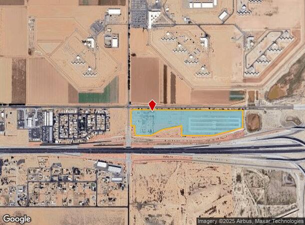
17605 W Mcdowell Rd
Phoenix-Mesa-Chandler, AZ
POR N2 SEC 2 DAF BEG NW COR SEC 2 TH E 2644.85F TH E 902.85F TH S 165F TH E 15F TH S 389.27F TH S 80D 01M W 385.50F TH S 48D 45M W 531.51F TH W 1400F TH N 500F TH S 78D 38M W 509.90F TH S 63D 22M W 670.82F TH S 100F TH W 226.24F TH N 520.09F TH W 55F
502-40-269A
Maricopa
Stateproperty
Arizona
2025
39.31 AC
2025
West I-10
061057
Phoenix
DEMOGRAPHICS near 17605 W Mcdowell Rd
1 Mile
3 Mile
5 Mile
2024 Total Population
808
50,978
138,103
2029 Population
860
56,751
153,990
Pop Growth 2024-2029
+ 6.44%
+ 11.32%
+ 11.50%
Average Age
42
40
39
2024 Total Households
265
16,953
46,129
HH Growth 2024-2029
+ 5.28%
+ 11.47%
+ 11.67%
Median Household Inc
$27,000
$93,726
$101,333
Avg Household Size
2.60
2.90
2.90
2024 Avg HH Vehicles
1.00
2.00
2.00
Median Home Value
$102,564
$386,606
$415,730
Median Year Built
1986
2009
2009
Nearby Places
Map Layers
Map Styles
 Street
 Aerial
- Restaurants
- Banks
- Shops
- Fitness
- Groceries
PUBLIC TRANSPORTATION
AIRPORT
Phoenix Sky Harbor International
DRIVE
WALK
Distance
Phoenix Sky Harbor International
37 min
27.7 mi
SALE & LEASE HISTORY
LISTING DATE
SALE/LEASE

Aug 18, 2021
For Sale
Nearby Properties
Address
Land Use
TOTAL SIZE
Lot Size
Zoning
Address
Land Use
TOTAL SIZE
Lot Size
Zoning
75.54 AC
Address
Land Use
TOTAL SIZE
Lot Size
Zoning
35.05 AC
Address
Land Use
TOTAL SIZE
Lot Size
Zoning
551,831 SF
609.49 AC
AG
Address
Land Use
TOTAL SIZE
Lot Size
Zoning
196,353 SF
13.05 AC
C-C
Address
Land Use
TOTAL SIZE
Lot Size
Zoning
438,256 SF
48.59 AC
Address
Land Use
TOTAL SIZE
Lot Size
Zoning
640,330 SF
91.15 AC
Address
Land Use
TOTAL SIZE
Lot Size
Zoning
721,156 SF
44.90 AC
PAD
Address
Land Use
TOTAL SIZE
Lot Size
Zoning
601,124 SF
39.88 AC
PAD
Address
Land Use
TOTAL SIZE
Lot Size
Zoning
643,756 SF
39.25 AC
PAD
Address
Land Use
TOTAL SIZE
Lot Size
Zoning
643,798 SF
39.40 AC
PAD
Address
Land Use
TOTAL SIZE
Lot Size
Zoning
337,781 SF
9.11 AC
PF
Address
Land Use
TOTAL SIZE
Lot Size
Zoning
392,000 SF
26.57 AC
PAD
Address
Land Use
TOTAL SIZE
Lot Size
Zoning
292,218 SF
15.12 AC
PAD
Address
Land Use
TOTAL SIZE
Lot Size
Zoning
249,623 SF
50.12 AC
PAD
Address
Land Use
TOTAL SIZE
Lot Size
Zoning
239,259 SF
22.68 AC
PAD
Address
Land Use
TOTAL SIZE
Lot Size
Zoning
185,251 SF
13.29 AC
PAD
Address
Land Use
TOTAL SIZE
Lot Size
Zoning
4,472 SF
1.27 AC
PAD
Address
Land Use
TOTAL SIZE
Lot Size
Zoning
246,621 SF
22.29 AC
PAD
Address
Land Use
TOTAL SIZE
Lot Size
Zoning
488,400 SF
30.80 AC
PAD
Address
Land Use
TOTAL SIZE
Lot Size
Zoning
200,448 SF
30.39 AC
PAD
Address
Land Use
TOTAL SIZE
Lot Size
Zoning
226,139 SF
19.46 AC
PAD
Address
Land Use
TOTAL SIZE
Lot Size
Zoning
1,001,652 SF
137.82 AC
PAD
Address
Land Use
TOTAL SIZE
Lot Size
Zoning
89,088 SF
9.87 AC
PAD
Address
Land Use
TOTAL SIZE
Lot Size
Zoning
82,494 SF
10.04 AC
PAD
Address
Land Use
TOTAL SIZE
Lot Size
Zoning
223,890 SF
12.64 AC
PAD
Address
Land Use
TOTAL SIZE
Lot Size
Zoning
2,212 SF
1.01 AC
PAD
Address
Land Use
TOTAL SIZE
Lot Size
Zoning
217,242 SF
24.93 AC
C-G
Address
Land Use
TOTAL SIZE
Lot Size
Zoning
168,519 SF
14.83 AC
PAD
Address
Land Use
TOTAL SIZE
Lot Size
Zoning
156,060 SF
12.04 AC
R-43
The World's #1 Commercial Real Estate Marketplace
Connect with us
© 2026 CoStar Group
The information above has been obtained from sources believed reliable. While we do not doubt its accuracy we have not verified it and make no guarantee, warranty or representation about it. It is your responsibility to independently confirm its accuracy and completeness. Any projections, opinions, assumptions, or estimates used are for example only and do not represent the current or future performance of the property. The value of this transaction to you depends on tax and other factors which should be evaluated by your tax, financial, and legal advisors. You and your advisors should conduct a careful, independent investigation of the property to determine to your satisfaction the suitability of the property for your needs.