Property Record
17607 Commerce Dr, New Boston, MI 48164


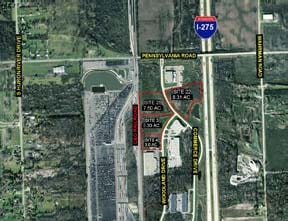

NEARBY LISTINGS FOR SALE OR LEASE
Property Detail
17607 Commerce Dr
Detroit-Warren-Dearborn, MI
Huron Commerce Center
75-017-02-0022-000
*05D22* UNIT 22 REPLAT NO 1 OF WAYNE COUNTY SUB PLAN NO 679 AKA HURON COMMERCE CENTER T4S R9E L37543 OF DEEDS P720 TO 730
Distributionwarehouseregional
Wayne
X
Michigan
26163C0370F
0022
2024
8.31 AC
2025
Airport District
590500
Detroit
20,000 SF
DEMOGRAPHICS near 17607 Commerce Dr
1 Mile
3 Mile
5 Mile
2024 Total Population
619
8,748
44,092
2029 Population
604
8,407
42,288
Pop Growth 2024-2029
(2.42%)
(3.90%)
(4.09%)
Average Age
45
42
40
2024 Total Households
257
3,384
17,297
HH Growth 2024-2029
(2.33%)
(3.84%)
(4.12%)
Median Household Inc
$92,727
$78,156
$68,003
Avg Household Size
2.40
2.50
2.50
2024 Avg HH Vehicles
2.00
2.00
2.00
Median Home Value
$209,028
$211,283
$215,663
Median Year Built
1990
1969
1975
Nearby Places
Map Layers
Map Styles
 Street
 Aerial
- Restaurants
- Banks
- Shops
- Fitness
- Groceries
PUBLIC TRANSPORTATION
AIRPORT
Detroit Metro Wayne County
DRIVE
WALK
Distance
Detroit Metro Wayne County
8 min
4.3 mi
Windsor International
DRIVE
WALK
Distance
Windsor International
55 min
32.7 mi
Freight Ports
Port of Toledo
DRIVE
WALK
Distance
Port of Toledo
57 min
43.8 mi
Nearby Properties
Address
Land Use
TOTAL SIZE
Lot Size
Zoning
Address
Land Use
TOTAL SIZE
Lot Size
Zoning
752,400 SF
72.97 AC
PDA
Address
Land Use
TOTAL SIZE
Lot Size
Zoning
516,762 SF
51.63 AC
PDA
Address
Land Use
TOTAL SIZE
Lot Size
Zoning
500,240 SF
M1-LIG
Address
Land Use
TOTAL SIZE
Lot Size
Zoning
146,562 SF
M2-GEN
Address
Land Use
TOTAL SIZE
Lot Size
Zoning
500,240 SF
55.95 AC
M2-GEN
Address
Land Use
TOTAL SIZE
Lot Size
Zoning
1,141,765 SF
154.21 AC
M2-GEN
Address
Land Use
TOTAL SIZE
Lot Size
Zoning
600,000 SF
M1-LIG
Address
Land Use
TOTAL SIZE
Lot Size
Zoning
199,922 SF
30.86 AC
M2-GEN
Address
Land Use
TOTAL SIZE
Lot Size
Zoning
462,840 SF
45.66 AC
PDA
Address
Land Use
TOTAL SIZE
Lot Size
Zoning
87,000 SF
18.02 AC
Address
Land Use
TOTAL SIZE
Lot Size
Zoning
285,251 SF
17.27 AC
I3 PLAN
Address
Land Use
TOTAL SIZE
Lot Size
Zoning
88,790 SF
M2-GEN
Address
Land Use
TOTAL SIZE
Lot Size
Zoning
M1-LIG
Address
Land Use
TOTAL SIZE
Lot Size
Zoning
338,896 SF
14.35 AC
M2-GEN
Address
Land Use
TOTAL SIZE
Lot Size
Zoning
105,000 SF
15.26 AC
M2-GEN
Address
Land Use
TOTAL SIZE
Lot Size
Zoning
87,000 SF
17.20 AC
B1 LOCA
Address
Land Use
TOTAL SIZE
Lot Size
Zoning
88,790 SF
10.48 AC
M2-GEN
Address
Land Use
TOTAL SIZE
Lot Size
Zoning
117,695 SF
21.72 AC
M2-GEN
Address
Land Use
TOTAL SIZE
Lot Size
Zoning
88.62 AC
M1-LIG
Address
Land Use
TOTAL SIZE
Lot Size
Zoning
47.09 AC
I2 HEAV
Address
Land Use
TOTAL SIZE
Lot Size
Zoning
70.99 AC
M1-LIG
Address
Land Use
TOTAL SIZE
Lot Size
Zoning
Address
Land Use
TOTAL SIZE
Lot Size
Zoning
76.32 AC
PDA
Address
Land Use
TOTAL SIZE
Lot Size
Zoning
105,728 SF
18.41 AC
M2-GEN
Address
Land Use
TOTAL SIZE
Lot Size
Zoning
62,760 SF
4.25 AC
M-2/PDA
Address
Land Use
TOTAL SIZE
Lot Size
Zoning
100,394 SF
16.89 AC
M2-GEN
Address
Land Use
TOTAL SIZE
Lot Size
Zoning
38,345 SF
8.09 AC
I2 HEAV
Address
Land Use
TOTAL SIZE
Lot Size
Zoning
82,615 SF
8.61 AC
M2-GEN
Address
Land Use
TOTAL SIZE
Lot Size
Zoning
88,740 SF
13.36 AC
M2-GEN
Address
Land Use
TOTAL SIZE
Lot Size
Zoning
46,948 SF
19.70 AC
I2 HEAV
The World's #1 Commercial Real Estate Marketplace
Connect with us
© 2025 CoStar Group
The information above has been obtained from sources believed reliable. While we do not doubt its accuracy we have not verified it and make no guarantee, warranty or representation about it. It is your responsibility to independently confirm its accuracy and completeness. Any projections, opinions, assumptions, or estimates used are for example only and do not represent the current or future performance of the property. The value of this transaction to you depends on tax and other factors which should be evaluated by your tax, financial, and legal advisors. You and your advisors should conduct a careful, independent investigation of the property to determine to your satisfaction the suitability of the property for your needs.