Property Record
17649 Us Highway 12, New Buffalo, MI 49117


NEARBY LISTINGS FOR SALE OR LEASE
Property Detail
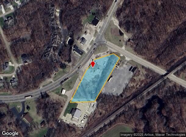
17649 Us Highway 12
11-13-0002-0009-08-2
COM AT SW COR OF SE1/4 OF SW 1/4 SEC 2 T8S R21W TH N88DEG 01'W 26.46'TH N28DEG E 424.63'TH N73DEG35'E 279.91' TH S60DEG49'E 17.5'TH S30 DEG19'W TO S LN SEC 2 TH N88 DEG01'W OF S SEC LN TO POB
Restaurantbuilding
Berrien
X
Michigan
26021C0336D
2.43 AC
2024
Michigan Southwest Area
2025
Other Market Areas
011302
Niles-Benton Harbor, MI
3,903 SF
DEMOGRAPHICS near 17649 Us Highway 12
1 Mile
3 Mile
5 Mile
2024 Total Population
966
5,391
8,803
2029 Population
1,019
5,723
9,322
Pop Growth 2024-2029
+ 5.49%
+ 6.16%
+ 5.90%
Average Age
48
49
50
2024 Total Households
463
2,564
4,164
HH Growth 2024-2029
+ 5.40%
+ 6.12%
+ 6.00%
Median Household Inc
$64,018
$68,176
$72,061
Avg Household Size
2.10
2.10
2.10
2024 Avg HH Vehicles
2.00
2.00
2.00
Median Home Value
$349,305
$366,121
$358,230
Median Year Built
1982
1979
1976
Nearby Places
Map Layers
Map Styles
 Street
 Aerial
- Restaurants
- Banks
- Shops
- Fitness
- Groceries
PUBLIC TRANSPORTATION
AIRPORT
South Bend International
DRIVE
WALK
Distance
South Bend International
40 min
31.0 mi
Freight Ports
Port of Baltimore
DRIVE
WALK
Distance
Port of Baltimore
1 min
559.4 mi
SALE & LEASE HISTORY
LISTING DATE
SALE/LEASE

Nov 09, 2017
For Lease
Nov 09, 2017
For Sale
Nearby Properties
Address
Land Use
TOTAL SIZE
Lot Size
Zoning
Address
Land Use
TOTAL SIZE
Lot Size
Zoning
29,124 SF
14.50 AC
I-1
Address
Land Use
TOTAL SIZE
Lot Size
Zoning
14,542 SF
4.10 AC
R-1
Address
Land Use
TOTAL SIZE
Lot Size
Zoning
9,000 SF
10.19 AC
GCD
Address
Land Use
TOTAL SIZE
Lot Size
Zoning
44,978 SF
2.08 AC
C-2
Address
Land Use
TOTAL SIZE
Lot Size
Zoning
61,856 SF
2.52 AC
C-2
Address
Land Use
TOTAL SIZE
Lot Size
Zoning
30,221 SF
23.62 AC
Address
Land Use
TOTAL SIZE
Lot Size
Zoning
35,378 SF
3.94 AC
SELECTZONI
Address
Land Use
TOTAL SIZE
Lot Size
Zoning
43,365 SF
2.40 AC
SELECTZONI
Address
Land Use
TOTAL SIZE
Lot Size
Zoning
8,998 SF
2.73 AC
GCD
Address
Land Use
TOTAL SIZE
Lot Size
Zoning
7,632 SF
1.07 AC
R-1
Address
Land Use
TOTAL SIZE
Lot Size
Zoning
7,464 SF
2.40 AC
GCD
Address
Land Use
TOTAL SIZE
Lot Size
Zoning
14,642 SF
0.30 AC
CBD
Address
Land Use
TOTAL SIZE
Lot Size
Zoning
86.91 AC
Address
Land Use
TOTAL SIZE
Lot Size
Zoning
0.74 AC
R-1
Address
Land Use
TOTAL SIZE
Lot Size
Zoning
0.57 AC
R-1
Address
Land Use
TOTAL SIZE
Lot Size
Zoning
0.57 AC
R-1
Address
Land Use
TOTAL SIZE
Lot Size
Zoning
0.57 AC
R-1
Address
Land Use
TOTAL SIZE
Lot Size
Zoning
70,091 SF
15.94 AC
SELECTZONI
Address
Land Use
TOTAL SIZE
Lot Size
Zoning
8,680 SF
5.10 AC
SELECTZONI
Address
Land Use
TOTAL SIZE
Lot Size
Zoning
0.20 AC
Address
Land Use
TOTAL SIZE
Lot Size
Zoning
15,198 SF
0.80 AC
CBD
Address
Land Use
TOTAL SIZE
Lot Size
Zoning
0.76 AC
WM
Address
Land Use
TOTAL SIZE
Lot Size
Zoning
2,791 SF
62.43 AC
Address
Land Use
TOTAL SIZE
Lot Size
Zoning
21,854 SF
0.70 AC
CBD
Address
Land Use
TOTAL SIZE
Lot Size
Zoning
60,475 SF
Address
Land Use
TOTAL SIZE
Lot Size
Zoning
7,910 SF
0.41 AC
CBD
Address
Land Use
TOTAL SIZE
Lot Size
Zoning
3,721 SF
2.50 AC
GCD
Address
Land Use
TOTAL SIZE
Lot Size
Zoning
0.74 AC
R-1
Address
Land Use
TOTAL SIZE
Lot Size
Zoning
1.70 AC
R-1
The World's #1 Commercial Real Estate Marketplace
Connect with us
© 2025 CoStar Group
The information above has been obtained from sources believed reliable. While we do not doubt its accuracy we have not verified it and make no guarantee, warranty or representation about it. It is your responsibility to independently confirm its accuracy and completeness. Any projections, opinions, assumptions, or estimates used are for example only and do not represent the current or future performance of the property. The value of this transaction to you depends on tax and other factors which should be evaluated by your tax, financial, and legal advisors. You and your advisors should conduct a careful, independent investigation of the property to determine to your satisfaction the suitability of the property for your needs.