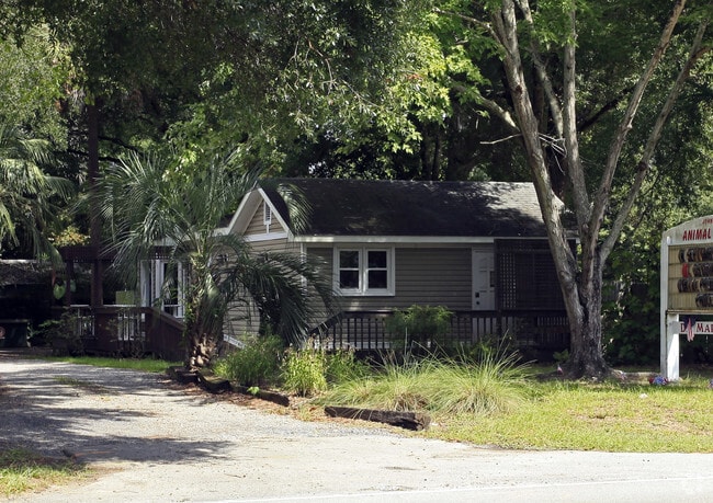
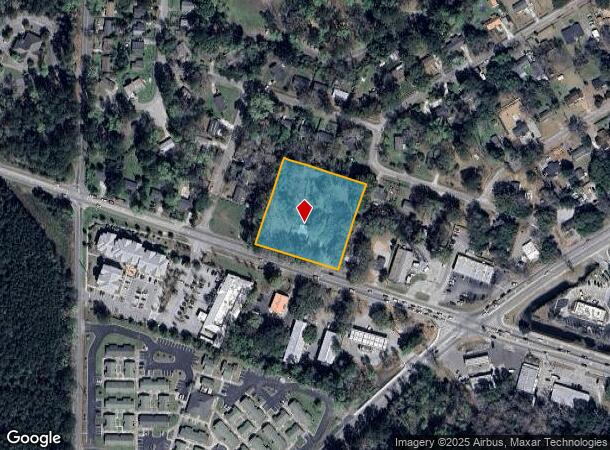
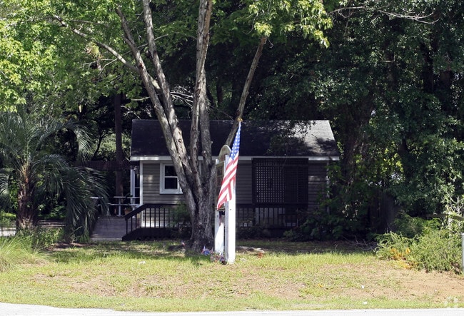
Property Record
1765 Main Rd, Johns Island, SC 29455
NEARBY LISTINGS FOR SALE OR LEASE
Property Detail
1765 Main Rd
279-14-00-052
Dunmovin
Commercialnec
SUBDIVISION NAME -DUNMOVIN TRACT
X
Charleston
45019C0655K
South Carolina
2025
1.94 AC
2024
West Islands
002107
Charleston/N Charleston
2,314 SF
Charleston-North Charleston, SC
DEMOGRAPHICS near 1765 Main Rd
1 Mile
3 Mile
5 Mile
2024 Total Population
3,245
16,220
25,530
2029 Population
3,459
17,503
27,584
Pop Growth 2024-2029
+ 6.59%
+ 7.91%
+ 8.05%
Average Age
40
40
41
2024 Total Households
1,284
6,580
10,416
HH Growth 2024-2029
+ 6.39%
+ 7.77%
+ 7.85%
Median Household Inc
$86,585
$93,749
$90,581
Avg Household Size
2.40
2.40
2.40
2024 Avg HH Vehicles
2.00
2.00
2.00
Median Home Value
$327,600
$361,461
$391,683
Median Year Built
1996
2009
2005
Nearby Places
Map Layers
Map Styles
 Street
 Aerial
- Restaurants
- Banks
- Shops
- Fitness
- Groceries
PUBLIC TRANSPORTATION
AIRPORT
Charleston AFB/International
DRIVE
WALK
Distance
Charleston AFB/International
34 min
21.8 mi
Freight Ports
Columbus Street Terminal
DRIVE
WALK
Distance
Columbus Street Terminal
20 min
11.1 mi
Nearby Properties
Address
Land Use
TOTAL SIZE
Lot Size
Zoning
Address
Land Use
TOTAL SIZE
Lot Size
Zoning
2,901 SF
4.76 AC
Address
Land Use
TOTAL SIZE
Lot Size
Zoning
34.54 AC
Address
Land Use
TOTAL SIZE
Lot Size
Zoning
10,176 SF
3.02 AC
Address
Land Use
TOTAL SIZE
Lot Size
Zoning
21,612 SF
14.90 AC
Address
Land Use
TOTAL SIZE
Lot Size
Zoning
960 SF
1.15 AC
Address
Land Use
TOTAL SIZE
Lot Size
Zoning
2,050 SF
3.71 AC
Address
Land Use
TOTAL SIZE
Lot Size
Zoning
2,024 SF
Address
Land Use
TOTAL SIZE
Lot Size
Zoning
950 SF
10.11 AC
Address
Land Use
TOTAL SIZE
Lot Size
Zoning
10,500 SF
5.78 AC
Address
Land Use
TOTAL SIZE
Lot Size
Zoning
5,392 SF
2 AC
Address
Land Use
TOTAL SIZE
Lot Size
Zoning
21,612 SF
4 AC
Address
Land Use
TOTAL SIZE
Lot Size
Zoning
2,184 SF
14 AC
Address
Land Use
TOTAL SIZE
Lot Size
Zoning
943 SF
2.81 AC
Address
Land Use
TOTAL SIZE
Lot Size
Zoning
13.71 AC
Address
Land Use
TOTAL SIZE
Lot Size
Zoning
2,815 SF
5.75 AC
Address
Land Use
TOTAL SIZE
Lot Size
Zoning
60,592 SF
9.73 AC
Address
Land Use
TOTAL SIZE
Lot Size
Zoning
Address
Land Use
TOTAL SIZE
Lot Size
Zoning
900 SF
3.23 AC
Address
Land Use
TOTAL SIZE
Lot Size
Zoning
Address
Land Use
TOTAL SIZE
Lot Size
Zoning
Address
Land Use
TOTAL SIZE
Lot Size
Zoning
Address
Land Use
TOTAL SIZE
Lot Size
Zoning
128 SF
1.28 AC
GI
Address
Land Use
TOTAL SIZE
Lot Size
Zoning
1,584 SF
2.50 AC
Address
Land Use
TOTAL SIZE
Lot Size
Zoning
13.71 AC
Address
Land Use
TOTAL SIZE
Lot Size
Zoning
14.87 AC
Address
Land Use
TOTAL SIZE
Lot Size
Zoning
24.13 AC
Address
Land Use
TOTAL SIZE
Lot Size
Zoning
Address
Land Use
TOTAL SIZE
Lot Size
Zoning
2,000 SF
7.64 AC
Address
Land Use
TOTAL SIZE
Lot Size
Zoning
1,248 SF
105.11 AC
Address
Land Use
TOTAL SIZE
Lot Size
Zoning
The World's #1 Commercial Real Estate Marketplace
Connect with us
© 2025 CoStar Group
The information above has been obtained from sources believed reliable. While we do not doubt its accuracy we have not verified it and make no guarantee, warranty or representation about it. It is your responsibility to independently confirm its accuracy and completeness. Any projections, opinions, assumptions, or estimates used are for example only and do not represent the current or future performance of the property. The value of this transaction to you depends on tax and other factors which should be evaluated by your tax, financial, and legal advisors. You and your advisors should conduct a careful, independent investigation of the property to determine to your satisfaction the suitability of the property for your needs.