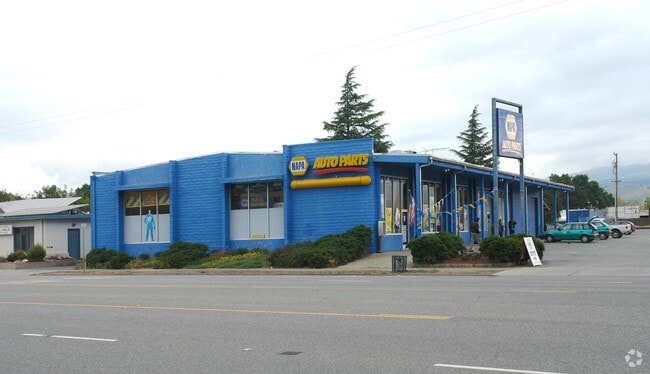
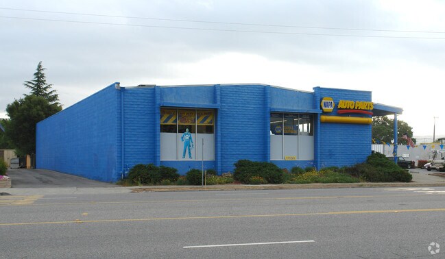
Property Record
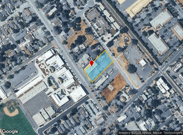
17650 Monterey St, Morgan Hill, CA 95037
NEARBY LISTINGS FOR SALE OR LEASE
Property Detail
17650 Monterey St
726-23-010
Map Of Old Homestead Tract
Storebuilding
Santa Clara
AE
California
06085C0444H
27,31
2024
1.01 AC
2025
Morgan Hill
512314
South Bay/San Jose
8,400 SF
San Jose-Sunnyvale-Santa Clara, CA
DEMOGRAPHICS near 17650 Monterey St
1 Mile
3 Mile
5 Mile
2024 Total Population
17,859
44,401
52,356
2029 Population
17,247
42,551
49,971
Pop Growth 2024-2029
(3.43%)
(4.17%)
(4.56%)
Average Age
39
40
41
2024 Total Households
5,739
14,511
17,028
HH Growth 2024-2029
(3.62%)
(4.41%)
(4.78%)
Median Household Inc
$124,553
$143,095
$143,374
Avg Household Size
3.00
3.00
3.00
2024 Avg HH Vehicles
2.00
2.00
2.00
Median Home Value
$932,117
$1,033,149
$1,048,268
Median Year Built
1988
1986
1984
Nearby Places
Map Layers
Map Styles
 Street
 Aerial
- Restaurants
- Banks
- Shops
- Fitness
- Groceries
PUBLIC TRANSPORTATION
COMMUTER RAIL
DRIVE
WALK
Distance
2 min
8 min
0.4 mi
Morgan Hill (Caltrain - Caltrain (Caltrain))
DRIVE
WALK
Distance
Morgan Hill (Caltrain - Caltrain (Caltrain))
2 min
9 min
0.4 mi
AIRPORT
Norman Y Mineta San Jose International
DRIVE
WALK
Distance
Norman Y Mineta San Jose International
34 min
25.9 mi
Freight Ports
Port of Redwood City
DRIVE
WALK
Distance
Port of Redwood City
56 min
43.9 mi
Nearby Properties
Address
Land Use
TOTAL SIZE
Lot Size
Zoning
Address
Land Use
TOTAL SIZE
Lot Size
Zoning
23.35 AC
PUD
Address
Land Use
TOTAL SIZE
Lot Size
Zoning
7.53 AC
CT
Address
Land Use
TOTAL SIZE
Lot Size
Zoning
223,897 SF
8.25 AC
A-20A
Address
Land Use
TOTAL SIZE
Lot Size
Zoning
19.50 AC
RAM
Address
Land Use
TOTAL SIZE
Lot Size
Zoning
257,296 SF
14.71 AC
M
Address
Land Use
TOTAL SIZE
Lot Size
Zoning
133,738 SF
5.66 AC
APD
Address
Land Use
TOTAL SIZE
Lot Size
Zoning
9.18 AC
IL
Address
Land Use
TOTAL SIZE
Lot Size
Zoning
6,748 SF
26.12 AC
PUD
Address
Land Use
TOTAL SIZE
Lot Size
Zoning
23.56 AC
R1
Address
Land Use
TOTAL SIZE
Lot Size
Zoning
128,450 SF
1.65 AC
CC
Address
Land Use
TOTAL SIZE
Lot Size
Zoning
6.84 AC
IL
Address
Land Use
TOTAL SIZE
Lot Size
Zoning
8.65 AC
IL
Address
Land Use
TOTAL SIZE
Lot Size
Zoning
285,877 SF
16.30 AC
MPUD
Address
Land Use
TOTAL SIZE
Lot Size
Zoning
112,738 SF
4.05 AC
R3
Address
Land Use
TOTAL SIZE
Lot Size
Zoning
91,853 SF
5.30 AC
M
Address
Land Use
TOTAL SIZE
Lot Size
Zoning
91,712 SF
4.03 AC
R3
Address
Land Use
TOTAL SIZE
Lot Size
Zoning
79,059 SF
5.87 AC
M1
Address
Land Use
TOTAL SIZE
Lot Size
Zoning
85,456 SF
4.98 AC
M
Address
Land Use
TOTAL SIZE
Lot Size
Zoning
76,845 SF
2.43 AC
A140
Address
Land Use
TOTAL SIZE
Lot Size
Zoning
151,242 SF
10.44 AC
ML
Address
Land Use
TOTAL SIZE
Lot Size
Zoning
4.95 AC
M
Address
Land Use
TOTAL SIZE
Lot Size
Zoning
82,446 SF
5.32 AC
M
Address
Land Use
TOTAL SIZE
Lot Size
Zoning
60,890 SF
1.73 AC
R3
Address
Land Use
TOTAL SIZE
Lot Size
Zoning
65,809 SF
2.93 AC
R3
Address
Land Use
TOTAL SIZE
Lot Size
Zoning
4.53 AC
IL
Address
Land Use
TOTAL SIZE
Lot Size
Zoning
73,600 SF
5 AC
M
Address
Land Use
TOTAL SIZE
Lot Size
Zoning
137,553 SF
8.09 AC
R3
Address
Land Use
TOTAL SIZE
Lot Size
Zoning
9.24 AC
PUD
Address
Land Use
TOTAL SIZE
Lot Size
Zoning
4.30 AC
M
Address
Land Use
TOTAL SIZE
Lot Size
Zoning
58,035 SF
2.60 AC
PUDHC
The World's #1 Commercial Real Estate Marketplace
Connect with us
© 2026 CoStar Group
The information above has been obtained from sources believed reliable. While we do not doubt its accuracy we have not verified it and make no guarantee, warranty or representation about it. It is your responsibility to independently confirm its accuracy and completeness. Any projections, opinions, assumptions, or estimates used are for example only and do not represent the current or future performance of the property. The value of this transaction to you depends on tax and other factors which should be evaluated by your tax, financial, and legal advisors. You and your advisors should conduct a careful, independent investigation of the property to determine to your satisfaction the suitability of the property for your needs.