Property Record
17654 Amity Dr, Gaithersburg, MD 20877

NEARBY LISTINGS FOR SALE OR LEASE
Property Detail
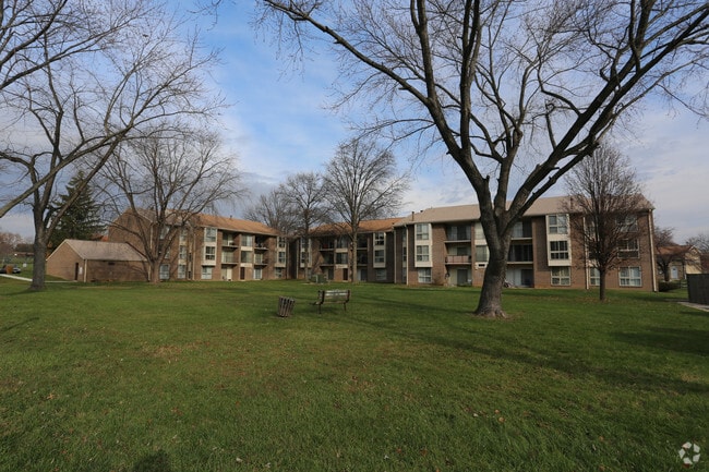
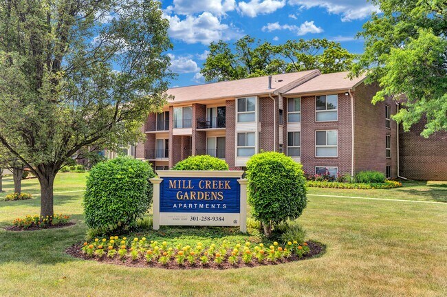
17654 Amity Dr
09-02692245
Wms Range Etc
Apartment
PLAT 16381 HAMLET NO RTH
X
Montgomery
24031C0193D
Maryland
2024
10.21 AC
2025
Redland
700711
Washington, DC
185,271 SF
Washington-Arlington-Alexandria, DC-VA-MD-WV
DEMOGRAPHICS near 17654 Amity Dr
1 mile
3 mile
5 mile
2024 Total Population
17,010
119,240
262,589
2029 Population
16,777
118,198
259,490
Pop Growth 2024-2029
(1.37%)
(0.87%)
(1.18%)
Average Age
39
39
40
2024 Total Households
5,363
43,090
94,302
HH Growth 2024-2029
(1.49%)
(0.90%)
(1.24%)
Median Household Inc
$111,980
$93,716
$107,568
Avg Household Size
3.00
2.70
2.70
2024 Avg HH Vehicles
2.00
2.00
2.00
Median Home Value
$444,540
$436,174
$521,693
Median Year Built
1982
1985
1985
Nearby Places
Map Layers
Map Styles
 Street
 Aerial
Transit
 Traffic
 Biking
Places
Listings with unknown addresses are not visible on the map
- Restaurants
- Banks
- Shops
- Fitness
- Groceries
PUBLIC TRANSPORTATION
TRANSIT/SUBWAY
Washington Grove (Brunswick Line - Maryland Area Regional Commuter Trains (The MARC))
Drive
Walk
Distance
Washington Grove (Brunswick Line - Maryland Area Regional Commuter Trains (The MARC))
3 min
19 min
1.0 mi
COMMUTER RAIL
Washington Grove (Brunswick Line - Maryland Area Regional Commuter Trains (The MARC))
Drive
Walk
Distance
Washington Grove (Brunswick Line - Maryland Area Regional Commuter Trains (The MARC))
3 min
19 min
1.0 mi
Drive
Walk
Distance
5 min
1.8 mi
AIRPORT
Ronald Reagan Washington Ntl
Drive
Walk
Distance
Ronald Reagan Washington Ntl
48 min
27.3 mi
Washington Dulles International
Drive
Walk
Distance
Washington Dulles International
53 min
33.6 mi
Baltimore/Washington International Thurgood Marshall
Drive
Walk
Distance
Baltimore/Washington International Thurgood Marshall
52 min
39.4 mi
Freight Ports
Port of Baltimore
Drive
Walk
Distance
Port of Baltimore
55 min
42.0 mi
Nearby Properties
Address
Land Use
TOTAL SIZE
Lot Size
Zoning
Address
Land Use
TOTAL SIZE
Lot Size
Zoning
978,527 SF
11.54 AC
03
Address
Land Use
TOTAL SIZE
Lot Size
Zoning
298,220 SF
38.37 AC
I3
Address
Land Use
TOTAL SIZE
Lot Size
Zoning
431,178 SF
40.97 AC
RA
Address
Land Use
TOTAL SIZE
Lot Size
Zoning
450,000 SF
8.53 AC
MXD
Address
Land Use
TOTAL SIZE
Lot Size
Zoning
185,000 SF
2.60 AC
EOF
Address
Land Use
TOTAL SIZE
Lot Size
Zoning
912,992 SF
6.11 AC
CBD
Address
Land Use
TOTAL SIZE
Lot Size
Zoning
434,440 SF
5.09 AC
CR1.5
Address
Land Use
TOTAL SIZE
Lot Size
Zoning
754,379 SF
28.29 AC
R90
Address
Land Use
TOTAL SIZE
Lot Size
Zoning
185,040 SF
49.79 AC
IL1.0
Address
Land Use
TOTAL SIZE
Lot Size
Zoning
407,130 SF
4.62 AC
CRT1.
Address
Land Use
TOTAL SIZE
Lot Size
Zoning
370,422 SF
13.87 AC
CRT1.
Address
Land Use
TOTAL SIZE
Lot Size
Zoning
2,556 SF
555.47 AC
R200
Address
Land Use
TOTAL SIZE
Lot Size
Zoning
302,484 SF
4.99 AC
MXD
Address
Land Use
TOTAL SIZE
Lot Size
Zoning
85,381 SF
5.86 AC
MXD
Address
Land Use
TOTAL SIZE
Lot Size
Zoning
363,000 SF
4.37 AC
MXTD
Address
Land Use
TOTAL SIZE
Lot Size
Zoning
899,156 SF
6.05 AC
CD
Address
Land Use
TOTAL SIZE
Lot Size
Zoning
323,940 SF
17.92 AC
R30
Address
Land Use
TOTAL SIZE
Lot Size
Zoning
1.64 AC
MXD
Address
Land Use
TOTAL SIZE
Lot Size
Zoning
405,742 SF
14.48 AC
R30
Address
Land Use
TOTAL SIZE
Lot Size
Zoning
385,641 SF
2.65 AC
MXD
Address
Land Use
TOTAL SIZE
Lot Size
Zoning
325,990 SF
51.21 AC
CRT07
Address
Land Use
TOTAL SIZE
Lot Size
Zoning
279,442 SF
9.78 AC
CRT1.
Address
Land Use
TOTAL SIZE
Lot Size
Zoning
316,883 SF
8.62 AC
OCPD
Address
Land Use
TOTAL SIZE
Lot Size
Zoning
17.64 AC
MXD
Address
Land Use
TOTAL SIZE
Lot Size
Zoning
565,209 SF
6.53 AC
MXD
Address
Land Use
TOTAL SIZE
Lot Size
Zoning
658,721 SF
4.90 AC
PD-UR
Address
Land Use
TOTAL SIZE
Lot Size
Zoning
207,587 SF
16.41 AC
CD
Address
Land Use
TOTAL SIZE
Lot Size
Zoning
407,972 SF
44.95 AC
IL1.0
Address
Land Use
TOTAL SIZE
Lot Size
Zoning
240,000 SF
1.77 AC
MXD
Address
Land Use
TOTAL SIZE
Lot Size
Zoning
230,460 SF
6.38 AC
03
The World's #1 Commercial Real Estate Marketplace
Connect with us
© 2026 CoStar Group
The information above has been obtained from sources believed reliable. While we do not doubt its accuracy we have not verified it and make no guarantee, warranty or representation about it. It is your responsibility to independently confirm its accuracy and completeness. Any projections, opinions, assumptions, or estimates used are for example only and do not represent the current or future performance of the property. The value of this transaction to you depends on tax and other factors which should be evaluated by your tax, financial, and legal advisors. You and your advisors should conduct a careful, independent investigation of the property to determine to your satisfaction the suitability of the property for your needs.