Property Record
1767 S Wickiup Rd, Apache Junction, AZ 85119
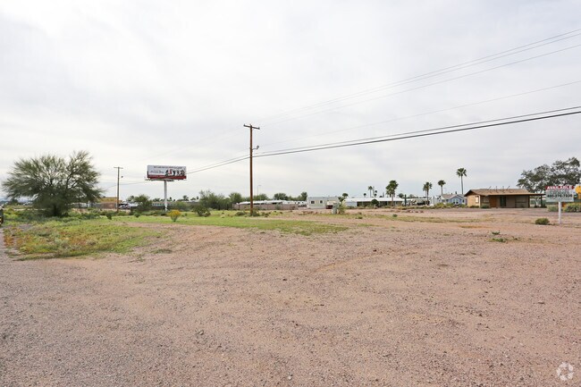

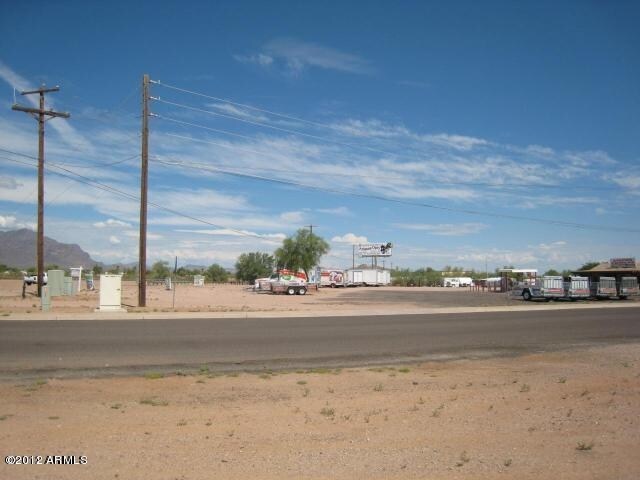

Property Detail
1767 S Wickiup Rd
103-20-008A
S1/2 NW NE SW OF SEC 27-1N-8E S OF HWY LESS PCL SOLD EXC W-33 FO R R/W (.25 AC FOR R/W) SEC 27-1N-8E 1.89 AC
Commercialnec
Pinal
UNDESIGNAT
Arizona
B and X Area of moderate flood hazard, usually the area between the limits of the 100-year and 500-year floods.
1.89 AC
2024
Superstition Corridor
2025
Phoenix
000315
Phoenix-Mesa-Chandler, AZ
600 SF
NEARBY LISTINGS FOR SALE OR LEASE
DEMOGRAPHICS near 1767 S Wickiup Rd
1 mile
3 mile
5 mile
2025 Total Population
8,400
41,983
91,514
2030 Population
9,830
49,150
104,049
Pop Growth 2025-2030
+ 17.02%
+ 17.07%
+ 13.70%
Average Age
44
50
50
2025 Total Households
3,472
18,938
40,438
HH Growth 2025-2030
+ 16.82%
+ 17.08%
+ 14.15%
Median Household Inc
$75,445
$58,836
$69,877
Avg Household Size
2.40
2.20
2.20
2025 Avg HH Vehicles
2.00
2.00
2.00
Median Home Value
$349,299
$294,231
$360,272
Median Year Built
1989
1993
1996
Nearby Places
Map Layers
Map Styles
 Street
 Aerial
Transit
 Traffic
 Biking
Places
Listings with unknown addresses are not visible on the map
- Restaurants
- Banks
- Shops
- Fitness
- Groceries
PUBLIC TRANSPORTATION
AIRPORT
Phoenix-Mesa Gateway
Drive
Walk
Distance
Phoenix-Mesa Gateway
26 min
16.4 mi
Phoenix Sky Harbor International
Drive
Walk
Distance
Phoenix Sky Harbor International
43 min
32.3 mi
Freight Ports
Port of San Diego
Drive
Walk
Distance
Port of San Diego
430 min
389.0 mi
SALE & LEASE HISTORY
LISTING DATE
SALE/LEASE

Mar 03, 2017
For Sale
Nearby Properties
Address
Land Use
TOTAL SIZE
Lot Size
Zoning
Address
Land Use
TOTAL SIZE
Lot Size
Zoning
117,169 SF
13.27 AC
Address
Land Use
TOTAL SIZE
Lot Size
Zoning
Address
Land Use
TOTAL SIZE
Lot Size
Zoning
Address
Land Use
TOTAL SIZE
Lot Size
Zoning
128,905 SF
7.14 AC
UNDESIGNAT
Address
Land Use
TOTAL SIZE
Lot Size
Zoning
Address
Land Use
TOTAL SIZE
Lot Size
Zoning
Address
Land Use
TOTAL SIZE
Lot Size
Zoning
126,549 SF
9.75 AC
Address
Land Use
TOTAL SIZE
Lot Size
Zoning
52,961 SF
7.94 AC
Address
Land Use
TOTAL SIZE
Lot Size
Zoning
108,644 SF
10.12 AC
UNDESIGNAT
Address
Land Use
TOTAL SIZE
Lot Size
Zoning
62,290 SF
7.53 AC
UNDESIGNAT
Address
Land Use
TOTAL SIZE
Lot Size
Zoning
54,706 SF
16.20 AC
UNDESIGNAT
Address
Land Use
TOTAL SIZE
Lot Size
Zoning
69,692 SF
7.26 AC
Address
Land Use
TOTAL SIZE
Lot Size
Zoning
6,335 SF
8.30 AC
Address
Land Use
TOTAL SIZE
Lot Size
Zoning
11,686 SF
40 AC
Address
Land Use
TOTAL SIZE
Lot Size
Zoning
38,353 SF
5 AC
Address
Land Use
TOTAL SIZE
Lot Size
Zoning
23,180 SF
3.90 AC
UNDESIGNAT
Address
Land Use
TOTAL SIZE
Lot Size
Zoning
30,775 SF
7.60 AC
UNDESIGNAT
Address
Land Use
TOTAL SIZE
Lot Size
Zoning
102,430 SF
5 AC
UNDESIGNAT
Address
Land Use
TOTAL SIZE
Lot Size
Zoning
26,022 SF
11.03 AC
UNDESIGNAT
Address
Land Use
TOTAL SIZE
Lot Size
Zoning
27,121 SF
4.05 AC
Address
Land Use
TOTAL SIZE
Lot Size
Zoning
54,300 SF
4.57 AC
UNDESIGNAT
Address
Land Use
TOTAL SIZE
Lot Size
Zoning
683 SF
36.74 AC
UNDESIGNAT
Address
Land Use
TOTAL SIZE
Lot Size
Zoning
24,158 SF
5.19 AC
Address
Land Use
TOTAL SIZE
Lot Size
Zoning
62,758 SF
5 AC
UNDESIGNAT
Address
Land Use
TOTAL SIZE
Lot Size
Zoning
30,477 SF
3.91 AC
UNDESIGNAT
Address
Land Use
TOTAL SIZE
Lot Size
Zoning
28,800 SF
4.59 AC
Address
Land Use
TOTAL SIZE
Lot Size
Zoning
Address
Land Use
TOTAL SIZE
Lot Size
Zoning
20,967 SF
3.60 AC
UNDESIGNAT
The World's #1 Commercial Real Estate Marketplace
Connect with us
© 2026 CoStar Group
The information above has been obtained from sources believed reliable. While we do not doubt its accuracy we have not verified it and make no guarantee, warranty or representation about it. It is your responsibility to independently confirm its accuracy and completeness. Any projections, opinions, assumptions, or estimates used are for example only and do not represent the current or future performance of the property. The value of this transaction to you depends on tax and other factors which should be evaluated by your tax, financial, and legal advisors. You and your advisors should conduct a careful, independent investigation of the property to determine to your satisfaction the suitability of the property for your needs.