Property Record
1768 Nc Highway 62 W, High Point, NC 27263

NEARBY LISTINGS FOR SALE OR LEASE
Property Detail
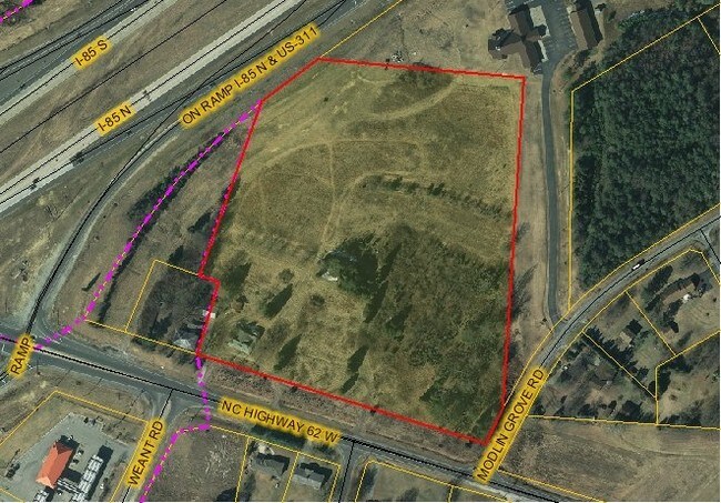
1768 Nc Highway 62 W
Greensboro-High Point, NC
A B Nelson Estate Prop 05
0161714
RECOMBINATION PLAT FOR HACKETT PROPERTIES INC LO:1 PL:212-65
Commercialnec
Guilford
X
North Carolina
3710772900K
1770
2024
13.95 AC
2025
High Point/SW Guilford Cty
016600
Greensboro/Winston-Salem
159,944 SF
DEMOGRAPHICS near 1768 Nc Highway 62 W
1 Mile
3 Mile
5 Mile
2024 Total Population
1,186
18,840
60,319
2029 Population
1,209
19,075
61,309
Pop Growth 2024-2029
+ 1.94%
+ 1.25%
+ 1.64%
Average Age
43
41
40
2024 Total Households
480
7,596
23,745
HH Growth 2024-2029
+ 2.08%
+ 1.32%
+ 1.68%
Median Household Inc
$58,999
$56,388
$47,809
Avg Household Size
2.40
2.40
2.40
2024 Avg HH Vehicles
2.00
2.00
2.00
Median Home Value
$183,571
$150,201
$144,980
Median Year Built
1980
1978
1975
Nearby Places
Map Layers
Map Styles
 Street
 Aerial
- Restaurants
- Banks
- Shops
- Fitness
- Groceries
PUBLIC TRANSPORTATION
COMMUTER RAIL
High Point Station (Piedmont - North Carolina by Train (NC Train))
DRIVE
WALK
Distance
High Point Station (Piedmont - North Carolina by Train (NC Train))
11 min
5.8 mi
AIRPORT
Piedmont Triad International
DRIVE
WALK
Distance
Piedmont Triad International
31 min
20.6 mi
Nearby Properties
Address
Land Use
TOTAL SIZE
Lot Size
Zoning
Address
Land Use
TOTAL SIZE
Lot Size
Zoning
107,417 SF
6.46 AC
RM-26
Address
Land Use
TOTAL SIZE
Lot Size
Zoning
101,612 SF
15.82 AC
RM-16
Address
Land Use
TOTAL SIZE
Lot Size
Zoning
299,394 SF
8.60 AC
M-2
Address
Land Use
TOTAL SIZE
Lot Size
Zoning
90,000 SF
15.36 AC
M-2
Address
Land Use
TOTAL SIZE
Lot Size
Zoning
89,183 SF
17.12 AC
GB
Address
Land Use
TOTAL SIZE
Lot Size
Zoning
170,516 SF
17.08 AC
RC
Address
Land Use
TOTAL SIZE
Lot Size
Zoning
7,680 SF
9.95 AC
GRD
Address
Land Use
TOTAL SIZE
Lot Size
Zoning
69,094 SF
5.47 AC
M-2
Address
Land Use
TOTAL SIZE
Lot Size
Zoning
98,287 SF
14.50 AC
RM-16
Address
Land Use
TOTAL SIZE
Lot Size
Zoning
7,168 SF
7.51 AC
GRD
Address
Land Use
TOTAL SIZE
Lot Size
Zoning
73,658 SF
8.45 AC
B-1
Address
Land Use
TOTAL SIZE
Lot Size
Zoning
13,311 SF
162.92 AC
HI
Address
Land Use
TOTAL SIZE
Lot Size
Zoning
48,913 SF
2.25 AC
B-1
Address
Land Use
TOTAL SIZE
Lot Size
Zoning
74,290 SF
7.31 AC
RC
Address
Land Use
TOTAL SIZE
Lot Size
Zoning
47,822 SF
5.76 AC
SU R-10
Address
Land Use
TOTAL SIZE
Lot Size
Zoning
35,620 SF
5.47 AC
M-2
Address
Land Use
TOTAL SIZE
Lot Size
Zoning
65,733 SF
124.36 AC
HI
Address
Land Use
TOTAL SIZE
Lot Size
Zoning
240,510 SF
3.76 AC
LI
Address
Land Use
TOTAL SIZE
Lot Size
Zoning
53,520 SF
5.48 AC
B-1
Address
Land Use
TOTAL SIZE
Lot Size
Zoning
66,487 SF
10.16 AC
LI
Address
Land Use
TOTAL SIZE
Lot Size
Zoning
8,927 SF
3.60 AC
OI
Address
Land Use
TOTAL SIZE
Lot Size
Zoning
40,275 SF
2.31 AC
B-1
Address
Land Use
TOTAL SIZE
Lot Size
Zoning
42,112 SF
6.41 AC
HB
Address
Land Use
TOTAL SIZE
Lot Size
Zoning
35,611 SF
8.92 AC
LI
Address
Land Use
TOTAL SIZE
Lot Size
Zoning
189,060 SF
17.64 AC
LI
Address
Land Use
TOTAL SIZE
Lot Size
Zoning
43,328 SF
2.11 AC
B-1
Address
Land Use
TOTAL SIZE
Lot Size
Zoning
33,470 SF
30.41 AC
HI
Address
Land Use
TOTAL SIZE
Lot Size
Zoning
37,680 SF
1.66 AC
CD HB
Address
Land Use
TOTAL SIZE
Lot Size
Zoning
105,208 SF
9 AC
CP
The World's #1 Commercial Real Estate Marketplace
Connect with us
© 2025 CoStar Group
The information above has been obtained from sources believed reliable. While we do not doubt its accuracy we have not verified it and make no guarantee, warranty or representation about it. It is your responsibility to independently confirm its accuracy and completeness. Any projections, opinions, assumptions, or estimates used are for example only and do not represent the current or future performance of the property. The value of this transaction to you depends on tax and other factors which should be evaluated by your tax, financial, and legal advisors. You and your advisors should conduct a careful, independent investigation of the property to determine to your satisfaction the suitability of the property for your needs.