Property Record
177 Main St, Sunfield, MI 48890
NEARBY LISTINGS FOR SALE OR LEASE
-
-
View all Sunfield listings for sale on LoopNet.com
Property Detail
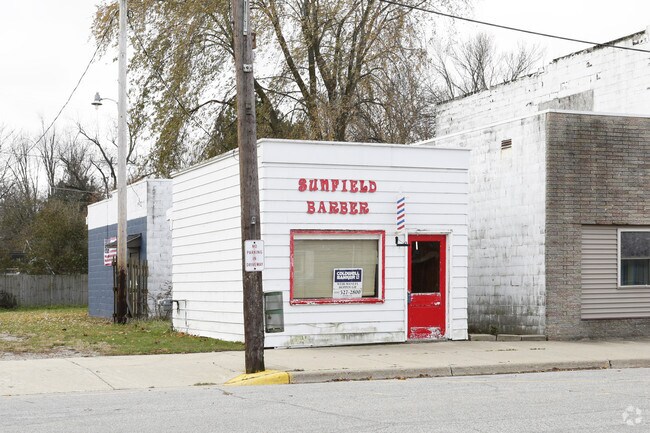
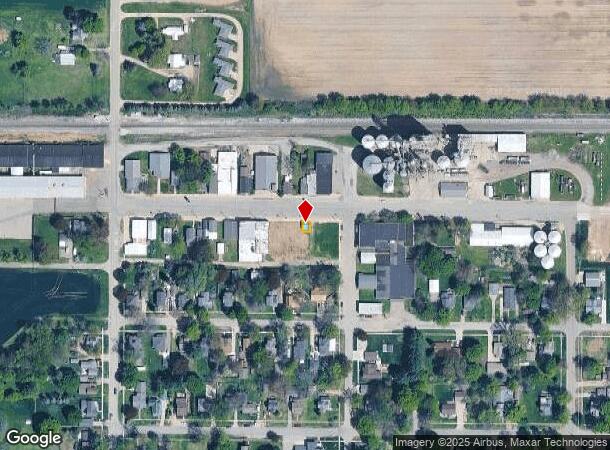
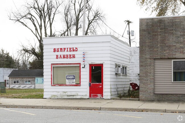
177 Main St
Lansing-East Lansing, MI
Village Of Sunfield
011-000-607-240-00
N 30 FEET OF LOT 24. O. P. BLOCK 7. VILLAGE OF SUNFIELD, SEC.2, T4N,R6W
Barberhairsalon
Eaton
X
Michigan
26067C0340D
24
2024
0.04 AC
2025
Outlying Eaton County
020700
West Michigan
280 SF
DEMOGRAPHICS near 177 Main St
1 mile
3 mile
5 mile
2024 Total Population
676
1,605
3,536
2029 Population
673
1,596
3,519
Pop Growth 2024-2029
(0.44%)
(0.56%)
(0.48%)
Average Age
41
41
42
2024 Total Households
264
625
1,382
HH Growth 2024-2029
(0.76%)
(0.64%)
(0.43%)
Median Household Inc
$67,749
$69,778
$71,465
Avg Household Size
2.50
2.50
2.50
2024 Avg HH Vehicles
2.00
2.00
2.00
Median Home Value
$178,888
$179,863
$178,367
Median Year Built
1970
1970
1969
Nearby Places
Map Layers
Map Styles
 Street
 Aerial
Transit
 Traffic
 Biking
Places
Listings with unknown addresses are not visible on the map
- Restaurants
- Banks
- Shops
- Fitness
- Groceries
PUBLIC TRANSPORTATION
AIRPORT
Capital Region International
Drive
Walk
Distance
Capital Region International
40 min
25.7 mi
Gerald R Ford International
Drive
Walk
Distance
Gerald R Ford International
55 min
41.4 mi
Nearby Properties
Address
Land Use
TOTAL SIZE
Lot Size
Zoning
Address
Land Use
TOTAL SIZE
Lot Size
Zoning
117,578 SF
19.90 AC
I
Address
Land Use
TOTAL SIZE
Lot Size
Zoning
9,830 SF
5.17 AC
Address
Land Use
TOTAL SIZE
Lot Size
Zoning
33,378 SF
68.25 AC
I
Address
Land Use
TOTAL SIZE
Lot Size
Zoning
60,148 SF
12.29 AC
Address
Land Use
TOTAL SIZE
Lot Size
Zoning
10,640 SF
1.78 AC
Address
Land Use
TOTAL SIZE
Lot Size
Zoning
1,800 SF
99.51 AC
LA
Address
Land Use
TOTAL SIZE
Lot Size
Zoning
2,016 SF
159 AC
Address
Land Use
TOTAL SIZE
Lot Size
Zoning
3,384 SF
4.95 AC
LA
Address
Land Use
TOTAL SIZE
Lot Size
Zoning
1,465 SF
159.12 AC
Address
Land Use
TOTAL SIZE
Lot Size
Zoning
3,576 SF
69.60 AC
Address
Land Use
TOTAL SIZE
Lot Size
Zoning
1,416 SF
100 AC
Address
Land Use
TOTAL SIZE
Lot Size
Zoning
6,023 SF
157.70 AC
LA
Address
Land Use
TOTAL SIZE
Lot Size
Zoning
5,034 SF
1.78 AC
LA
Address
Land Use
TOTAL SIZE
Lot Size
Zoning
159.19 AC
Address
Land Use
TOTAL SIZE
Lot Size
Zoning
14,040 SF
9.20 AC
RES-R1
Address
Land Use
TOTAL SIZE
Lot Size
Zoning
172.38 AC
Address
Land Use
TOTAL SIZE
Lot Size
Zoning
137.32 AC
Address
Land Use
TOTAL SIZE
Lot Size
Zoning
5,186 SF
1.20 AC
LA
Address
Land Use
TOTAL SIZE
Lot Size
Zoning
Address
Land Use
TOTAL SIZE
Lot Size
Zoning
156.15 AC
Address
Land Use
TOTAL SIZE
Lot Size
Zoning
154 AC
Address
Land Use
TOTAL SIZE
Lot Size
Zoning
4,892 SF
1.17 AC
LA
Address
Land Use
TOTAL SIZE
Lot Size
Zoning
156.25 AC
Address
Land Use
TOTAL SIZE
Lot Size
Zoning
2,160 SF
76.51 AC
LA
Address
Land Use
TOTAL SIZE
Lot Size
Zoning
2,944 SF
123 AC
LA
Address
Land Use
TOTAL SIZE
Lot Size
Zoning
1,981 SF
118 AC
LA
Address
Land Use
TOTAL SIZE
Lot Size
Zoning
1,914 SF
120 AC
LA
Address
Land Use
TOTAL SIZE
Lot Size
Zoning
72.72 AC
LA
Address
Land Use
TOTAL SIZE
Lot Size
Zoning
1,695 SF
79.24 AC
LA
Address
Land Use
TOTAL SIZE
Lot Size
Zoning
2,256 SF
58.97 AC
LA
The World's #1 Commercial Real Estate Marketplace
Connect with us
© 2026 CoStar Group
The information above has been obtained from sources believed reliable. While we do not doubt its accuracy we have not verified it and make no guarantee, warranty or representation about it. It is your responsibility to independently confirm its accuracy and completeness. Any projections, opinions, assumptions, or estimates used are for example only and do not represent the current or future performance of the property. The value of this transaction to you depends on tax and other factors which should be evaluated by your tax, financial, and legal advisors. You and your advisors should conduct a careful, independent investigation of the property to determine to your satisfaction the suitability of the property for your needs.