Property Record
1770 El Cerrito Pl, Los Angeles, CA 90028


NEARBY LISTINGS FOR SALE OR LEASE
Property Detail
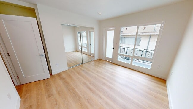
1770 El Cerrito Pl
Los Angeles-Long Beach-Glendale, CA
Hollywood Vista Tract
5548-002-027
HOLLYWOOD VISTA TRACT S 75 FT MEASURED ON E AND W LINES OF LOT 26
Multifamilydwelling
Los Angeles
X
California
06037C1605F
26
2024
0.25 AC
2025
Hollywood
190101
Los Angeles
10,166 SF
DEMOGRAPHICS near 1770 El Cerrito Pl
1 Mile
3 Mile
5 Mile
2024 Total Population
49,021
293,244
846,893
2029 Population
48,626
288,375
829,296
Pop Growth 2024-2029
(0.81%)
(1.66%)
(2.08%)
Average Age
40
41
40
2024 Total Households
28,619
150,476
387,034
HH Growth 2024-2029
(1.04%)
(1.84%)
(2.24%)
Median Household Inc
$65,293
$73,908
$70,958
Avg Household Size
1.60
1.90
2.10
2024 Avg HH Vehicles
1.00
1.00
1.00
Median Home Value
$1,046,532
$1,094,453
$1,071,702
Median Year Built
1971
1963
1961
Nearby Places
Map Layers
Map Styles
 Street
 Aerial
- Restaurants
- Banks
- Shops
- Fitness
- Groceries
PUBLIC TRANSPORTATION
TRANSIT/SUBWAY
Hollywood/Highland Station (Red Line - Los Angeles County Metropolitan Transportation Authority (Metro))
DRIVE
WALK
Distance
Hollywood/Highland Station (Red Line - Los Angeles County Metropolitan Transportation Authority (Metro))
2 min
9 min
0.5 mi
COMMUTER RAIL
Glendale (Antelope Valley Line - Southern California Regional Rail Authority (Metrolink), Ventura County Line - Southern California Regional Rail Authority (Metrolink))
DRIVE
WALK
Distance
Glendale (Antelope Valley Line - Southern California Regional Rail Authority (Metrolink), Ventura County Line - Southern California Regional Rail Authority (Metrolink))
14 min
6.1 mi
Downtown Burbank (Antelope Valley Line - Southern California Regional Rail Authority (Metrolink), Ventura County Line - Southern California Regional Rail Authority (Metrolink))
DRIVE
WALK
Distance
Downtown Burbank (Antelope Valley Line - Southern California Regional Rail Authority (Metrolink), Ventura County Line - Southern California Regional Rail Authority (Metrolink))
14 min
6.6 mi
AIRPORT
Bob Hope
DRIVE
WALK
Distance
Bob Hope
16 min
8.6 mi
Los Angeles International
DRIVE
WALK
Distance
Los Angeles International
28 min
13.5 mi
Long Beach (Daugherty Field)
DRIVE
WALK
Distance
Long Beach (Daugherty Field)
42 min
30.7 mi
Freight Ports
Port of Long Beach
DRIVE
WALK
Distance
Port of Long Beach
45 min
32.2 mi
SALE & LEASE HISTORY
LISTING DATE
SALE/LEASE

Oct 25, 2023
For Sale
Mar 10, 2021
For Sale
Jul 17, 2023
For Sale
Dec 07, 2022
For Sale
Nearby Properties
Address
Land Use
TOTAL SIZE
Lot Size
Zoning
Address
Land Use
TOTAL SIZE
Lot Size
Zoning
2,529,036 SF
8.48 AC
LAC2
Address
Land Use
TOTAL SIZE
Lot Size
Zoning
65,532 SF
67.90 AC
LAM11/2*
Address
Land Use
TOTAL SIZE
Lot Size
Zoning
21,585 SF
61.40 AC
LAM11/2*
Address
Land Use
TOTAL SIZE
Lot Size
Zoning
1,447,077 SF
10.63 AC
LAC2
Address
Land Use
TOTAL SIZE
Lot Size
Zoning
1,314,760 SF
33.64 AC
LAM11/2*
Address
Land Use
TOTAL SIZE
Lot Size
Zoning
436,774 SF
1.49 AC
LAC2
Address
Land Use
TOTAL SIZE
Lot Size
Zoning
1,002,990 SF
8.42 AC
LAC4
Address
Land Use
TOTAL SIZE
Lot Size
Zoning
1,426,324 SF
5.96 AC
LAC2
Address
Land Use
TOTAL SIZE
Lot Size
Zoning
252,523 SF
2.26 AC
LAC2
Address
Land Use
TOTAL SIZE
Lot Size
Zoning
709,584 SF
1.80 AC
LAPB
Address
Land Use
TOTAL SIZE
Lot Size
Zoning
161,046 SF
6.88 AC
LAM1
Address
Land Use
TOTAL SIZE
Lot Size
Zoning
12,827 SF
130.37 AC
LAM11/2*
Address
Land Use
TOTAL SIZE
Lot Size
Zoning
754,581 SF
3.75 AC
LAC1
Address
Land Use
TOTAL SIZE
Lot Size
Zoning
728,063 SF
2.08 AC
LAC4
Address
Land Use
TOTAL SIZE
Lot Size
Zoning
67,126 SF
48.09 AC
LAM1
Address
Land Use
TOTAL SIZE
Lot Size
Zoning
472,363 SF
3.24 AC
LAC4
Address
Land Use
TOTAL SIZE
Lot Size
Zoning
515,531 SF
14.65 AC
LAC2
Address
Land Use
TOTAL SIZE
Lot Size
Zoning
497,377 SF
3.29 AC
LAC4
Address
Land Use
TOTAL SIZE
Lot Size
Zoning
986,983 SF
105.50 AC
LARE40
Address
Land Use
TOTAL SIZE
Lot Size
Zoning
793,274 SF
7.80 AC
LAR4
Address
Land Use
TOTAL SIZE
Lot Size
Zoning
110,580 SF
6.88 AC
LAC2
Address
Land Use
TOTAL SIZE
Lot Size
Zoning
125,170 SF
Address
Land Use
TOTAL SIZE
Lot Size
Zoning
724,958 SF
5.88 AC
LAC2
Address
Land Use
TOTAL SIZE
Lot Size
Zoning
416,078 SF
2.88 AC
WDC4*
Address
Land Use
TOTAL SIZE
Lot Size
Zoning
289,633 SF
1.55 AC
LAP
Address
Land Use
TOTAL SIZE
Lot Size
Zoning
453,182 SF
2.76 AC
LAC4
Address
Land Use
TOTAL SIZE
Lot Size
Zoning
255,868 SF
9.58 AC
WDC2C*
Address
Land Use
TOTAL SIZE
Lot Size
Zoning
8.93 AC
LAC2
Address
Land Use
TOTAL SIZE
Lot Size
Zoning
679,557 SF
6.41 AC
LAC2
Address
Land Use
TOTAL SIZE
Lot Size
Zoning
556,235 SF
4.22 AC
LAC4
The World's #1 Commercial Real Estate Marketplace
Connect with us
© 2026 CoStar Group
The information above has been obtained from sources believed reliable. While we do not doubt its accuracy we have not verified it and make no guarantee, warranty or representation about it. It is your responsibility to independently confirm its accuracy and completeness. Any projections, opinions, assumptions, or estimates used are for example only and do not represent the current or future performance of the property. The value of this transaction to you depends on tax and other factors which should be evaluated by your tax, financial, and legal advisors. You and your advisors should conduct a careful, independent investigation of the property to determine to your satisfaction the suitability of the property for your needs.