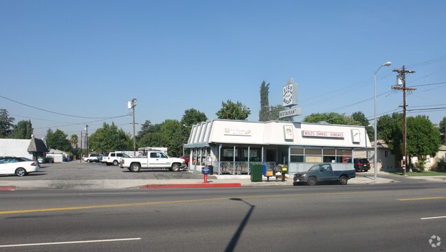
Property Record
17709 Vanowen St, Reseda, CA 91335


NEARBY LISTINGS FOR SALE OR LEASE
Property Detail
17709 Vanowen St
Los Angeles-Long Beach-Glendale, CA
15620
2122-002-001
TRACT # 15620 LOTS 1,2,3 AND LOT 4
Storemultistory
Los Angeles
X
California
06037C1285F
1
2024
1.36 AC
2025
Western SFV
132302
Los Angeles
24,322 SF
DEMOGRAPHICS near 17709 Vanowen St
1 mile
3 mile
5 mile
2024 Total Population
25,038
219,857
637,530
2029 Population
24,326
214,049
621,794
Pop Growth 2024-2029
(2.84%)
(2.64%)
(2.47%)
Average Age
40
40
39
2024 Total Households
8,212
75,598
218,080
HH Growth 2024-2029
(3.15%)
(2.82%)
(2.66%)
Median Household Inc
$82,435
$74,906
$73,710
Avg Household Size
3.00
2.80
2.80
2024 Avg HH Vehicles
2.00
2.00
2.00
Median Home Value
$727,935
$764,189
$782,101
Median Year Built
1958
1966
1970
Nearby Places
Map Layers
Map Styles
 Street
 Aerial
Transit
 Traffic
 Biking
Places
Listings with unknown addresses are not visible on the map
- Restaurants
- Banks
- Shops
- Fitness
- Groceries
PUBLIC TRANSPORTATION
COMMUTER RAIL
Northridge (Ventura County Line - Southern California Regional Rail Authority (Metrolink))
Drive
Walk
Distance
Northridge (Ventura County Line - Southern California Regional Rail Authority (Metrolink))
10 min
4.0 mi
Drive
Walk
Distance
10 min
4.1 mi
AIRPORT
Bob Hope
Drive
Walk
Distance
Bob Hope
19 min
10.7 mi
Los Angeles International
Drive
Walk
Distance
Los Angeles International
32 min
22.3 mi
Long Beach (Daugherty Field)
Drive
Walk
Distance
Long Beach (Daugherty Field)
51 min
39.8 mi
Freight Ports
Port of Long Beach
Drive
Walk
Distance
Port of Long Beach
54 min
41.6 mi
Nearby Properties
Address
Land Use
TOTAL SIZE
Lot Size
Zoning
Address
Land Use
TOTAL SIZE
Lot Size
Zoning
461,531 SF
11.22 AC
LAC2
Address
Land Use
TOTAL SIZE
Lot Size
Zoning
393,032 SF
70.93 AC
LAM2
Address
Land Use
TOTAL SIZE
Lot Size
Zoning
300,266 SF
7.29 AC
LAR4
Address
Land Use
TOTAL SIZE
Lot Size
Zoning
439,930 SF
22.16 AC
LAM2
Address
Land Use
TOTAL SIZE
Lot Size
Zoning
376,716 SF
3.72 AC
LAC4
Address
Land Use
TOTAL SIZE
Lot Size
Zoning
257,873 SF
2.52 AC
Address
Land Use
TOTAL SIZE
Lot Size
Zoning
191,058 SF
5.31 AC
LAR3
Address
Land Use
TOTAL SIZE
Lot Size
Zoning
273,911 SF
8.40 AC
LARA
Address
Land Use
TOTAL SIZE
Lot Size
Zoning
396,109 SF
3.45 AC
LAM1
Address
Land Use
TOTAL SIZE
Lot Size
Zoning
318,083 SF
2.36 AC
LAC2
Address
Land Use
TOTAL SIZE
Lot Size
Zoning
219,126 SF
6.06 AC
LAR1
Address
Land Use
TOTAL SIZE
Lot Size
Zoning
111,876 SF
3.72 AC
LAC2
Address
Land Use
TOTAL SIZE
Lot Size
Zoning
210,268 SF
3.82 AC
LAP
Address
Land Use
TOTAL SIZE
Lot Size
Zoning
290,244 SF
5.77 AC
LAR3
Address
Land Use
TOTAL SIZE
Lot Size
Zoning
116,961 SF
3.60 AC
LAR3
Address
Land Use
TOTAL SIZE
Lot Size
Zoning
117,604 SF
2.65 AC
LAR3
Address
Land Use
TOTAL SIZE
Lot Size
Zoning
173,231 SF
1.58 AC
LAR3
Address
Land Use
TOTAL SIZE
Lot Size
Zoning
169,636 SF
0.37 AC
LAC4
Address
Land Use
TOTAL SIZE
Lot Size
Zoning
290,254 SF
11.53 AC
LAM2
Address
Land Use
TOTAL SIZE
Lot Size
Zoning
140,861 SF
1.77 AC
LAC4
Address
Land Use
TOTAL SIZE
Lot Size
Zoning
127,774 SF
1.18 AC
LAC4
Address
Land Use
TOTAL SIZE
Lot Size
Zoning
221,153 SF
2 AC
LAC4
Address
Land Use
TOTAL SIZE
Lot Size
Zoning
138,260 SF
1.29 AC
LAC2
Address
Land Use
TOTAL SIZE
Lot Size
Zoning
250,462 SF
1.85 AC
LAP
Address
Land Use
TOTAL SIZE
Lot Size
Zoning
124,534 SF
7.47 AC
LAC2
Address
Land Use
TOTAL SIZE
Lot Size
Zoning
95,584 SF
4.27 AC
LAM1
Address
Land Use
TOTAL SIZE
Lot Size
Zoning
134,103 SF
1 AC
LAC2
Address
Land Use
TOTAL SIZE
Lot Size
Zoning
146,790 SF
1.85 AC
LAR3
Address
Land Use
TOTAL SIZE
Lot Size
Zoning
202,218 SF
2.72 AC
LAC2
The World's #1 Commercial Real Estate Marketplace
Connect with us
© 2026 CoStar Group
The information above has been obtained from sources believed reliable. While we do not doubt its accuracy we have not verified it and make no guarantee, warranty or representation about it. It is your responsibility to independently confirm its accuracy and completeness. Any projections, opinions, assumptions, or estimates used are for example only and do not represent the current or future performance of the property. The value of this transaction to you depends on tax and other factors which should be evaluated by your tax, financial, and legal advisors. You and your advisors should conduct a careful, independent investigation of the property to determine to your satisfaction the suitability of the property for your needs.