Property Record
17710 Road 24, Madera, CA 93638


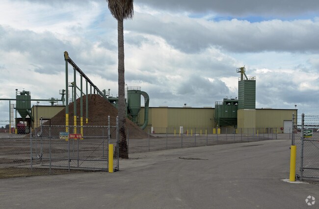
Property Detail
17710 Road 24
033-030-005
SEC 4 T11S R17E
Heavyindustrial
MADERA
IL
California
AO River or stream flood hazard areas, and areas with a 1% or greater chance of shallow flooding each year. These areas have a 26% chance of flooding over the life of a 30-year mortgage.
13.95 AC
2024
Madera
2025
Fresno
000506
Fresno, CA
19,250 SF
NEARBY LISTINGS FOR SALE OR LEASE
DEMOGRAPHICS near 17710 Road 24
1 mile
3 mile
5 mile
2025 Total Population
675
14,601
67,714
2030 Population
697
15,278
70,396
Pop Growth 2025-2030
+ 3.26%
+ 4.64%
+ 3.96%
Average Age
36
36
34
2025 Total Households
187
4,056
18,252
HH Growth 2025-2030
+ 3.21%
+ 4.39%
+ 3.81%
Median Household Inc
$67,343
$72,847
$58,709
Avg Household Size
3.50
3.50
3.60
2025 Avg HH Vehicles
3.00
3.00
2.00
Median Home Value
$374,999
$379,284
$365,735
Median Year Built
1992
1988
1987
Nearby Places
Map Layers
Map Styles
 Street
 Aerial
Layers
 Traffic
 Biking
Places
Listings with unknown addresses are not visible on the map
- Restaurants
- Banks
- Shops
- Fitness
- Groceries
PUBLIC TRANSPORTATION
AIRPORT
Fresno Yosemite International
Drive
Walk
Distance
Fresno Yosemite International
46 min
32.4 mi
Freight Ports
Port of Stockton
Drive
Walk
Distance
Port of Stockton
124 min
101.6 mi
Nearby Properties
Address
Land Use
TOTAL SIZE
Lot Size
Zoning
Address
Land Use
TOTAL SIZE
Lot Size
Zoning
144,050 SF
7.61 AC
Address
Land Use
TOTAL SIZE
Lot Size
Zoning
14,400 SF
181.61 AC
IL
Address
Land Use
TOTAL SIZE
Lot Size
Zoning
13.06 AC
Address
Land Use
TOTAL SIZE
Lot Size
Zoning
12.79 AC
Address
Land Use
TOTAL SIZE
Lot Size
Zoning
144,440 SF
12.63 AC
Address
Land Use
TOTAL SIZE
Lot Size
Zoning
1,836 SF
7.50 AC
Address
Land Use
TOTAL SIZE
Lot Size
Zoning
17,998 SF
11.24 AC
CRG
Address
Land Use
TOTAL SIZE
Lot Size
Zoning
27,500 SF
0.71 AC
Address
Land Use
TOTAL SIZE
Lot Size
Zoning
1,104 SF
189.04 AC
ARE-40
Address
Land Use
TOTAL SIZE
Lot Size
Zoning
123,750 SF
14.99 AC
Address
Land Use
TOTAL SIZE
Lot Size
Zoning
62,476 SF
13.17 AC
Address
Land Use
TOTAL SIZE
Lot Size
Zoning
58,499 SF
1.59 AC
Address
Land Use
TOTAL SIZE
Lot Size
Zoning
51,249 SF
1.58 AC
Address
Land Use
TOTAL SIZE
Lot Size
Zoning
2.77 AC
Address
Land Use
TOTAL SIZE
Lot Size
Zoning
2,832 SF
8.76 AC
IL
Address
Land Use
TOTAL SIZE
Lot Size
Zoning
82,314 SF
6.24 AC
Address
Land Use
TOTAL SIZE
Lot Size
Zoning
287.64 AC
ARE-40
Address
Land Use
TOTAL SIZE
Lot Size
Zoning
65,165 SF
5 AC
Address
Land Use
TOTAL SIZE
Lot Size
Zoning
2,332 SF
8.08 AC
AR-5
Address
Land Use
TOTAL SIZE
Lot Size
Zoning
1,575 SF
40.68 AC
ARE-40
Address
Land Use
TOTAL SIZE
Lot Size
Zoning
Address
Land Use
TOTAL SIZE
Lot Size
Zoning
114,563 SF
12.29 AC
Address
Land Use
TOTAL SIZE
Lot Size
Zoning
1.01 AC
Address
Land Use
TOTAL SIZE
Lot Size
Zoning
9.80 AC
Address
Land Use
TOTAL SIZE
Lot Size
Zoning
37,296 SF
1.38 AC
The World's #1 Commercial Real Estate Marketplace
Connect with us
© 2026 CoStar Group
The information above has been obtained from sources believed reliable. While we do not doubt its accuracy we have not verified it and make no guarantee, warranty or representation about it. It is your responsibility to independently confirm its accuracy and completeness. Any projections, opinions, assumptions, or estimates used are for example only and do not represent the current or future performance of the property. The value of this transaction to you depends on tax and other factors which should be evaluated by your tax, financial, and legal advisors. You and your advisors should conduct a careful, independent investigation of the property to determine to your satisfaction the suitability of the property for your needs.