Property Record
17716 Bothell Everett Hwy, Bothell, WA 98012

Property Detail
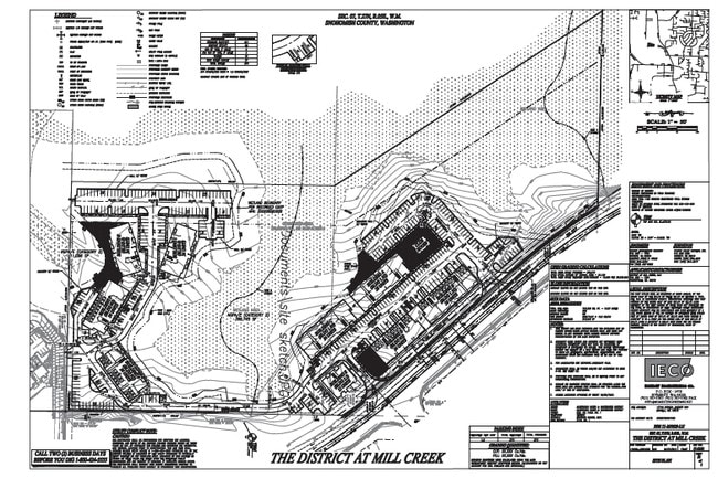
17716 Bothell Everett Hwy
Seattle-Tacoma-Bellevue, WA
Bla90-227
270507-004-017-00
SEC 07 TWP 27 RGE 05 E 575FT AS MEAS AT R/A OF S1/2 SW1/4 SE1/4 TGW TH PTN N1/2 SD SW1/4 SE1/4 LY WLY OF W MGN SR 527 CONVYD TO ST OF WA AF NO 8405100204 & LY ELY OF LN WH BEGINS AT NW COR OF AFORESAID E 575FT OF S1/2 SW1/4 SE1/4 & RUNS TH N33*09 20W
Multifamilydwelling
Snohomish
X
Washington
53061C1330F
17
2024
16.87 AC
2025
Mill Creek/Woodinville
051933
Seattle/Puget Sound
283,224 SF
NEARBY LISTINGS FOR SALE OR LEASE
DEMOGRAPHICS near 17716 Bothell Everett Hwy
1 mile
3 mile
5 mile
2024 Total Population
15,410
129,108
350,909
2029 Population
16,072
135,000
366,770
Pop Growth 2024-2029
+ 4.30%
+ 4.56%
+ 4.52%
Average Age
37
37
38
2024 Total Households
5,556
45,816
128,650
HH Growth 2024-2029
+ 4.39%
+ 4.67%
+ 4.62%
Median Household Inc
$137,590
$131,729
$111,440
Avg Household Size
2.70
2.70
2.70
2024 Avg HH Vehicles
2.00
2.00
2.00
Median Home Value
$712,484
$738,208
$708,277
Median Year Built
1991
1999
1993
Nearby Places
Map Layers
Map Styles
 Street
 Aerial
Transit
 Traffic
 Biking
Places
Listings with unknown addresses are not visible on the map
- Restaurants
- Banks
- Shops
- Fitness
- Groceries
PUBLIC TRANSPORTATION
AIRPORT
Seattle Paine Field International
Drive
Walk
Distance
Seattle Paine Field International
17 min
7.7 mi
Seattle-Tacoma International
Drive
Walk
Distance
Seattle-Tacoma International
48 min
33.6 mi
Freight Ports
Port of Everett
Drive
Walk
Distance
Port of Everett
22 min
11.7 mi
Nearby Properties
Address
Land Use
TOTAL SIZE
Lot Size
Zoning
Address
Land Use
TOTAL SIZE
Lot Size
Zoning
813,456 SF
30.76 AC
PRC
Address
Land Use
TOTAL SIZE
Lot Size
Zoning
581,232 SF
43.22 AC
UC
Address
Land Use
TOTAL SIZE
Lot Size
Zoning
329,964 SF
20.07 AC
MR
Address
Land Use
TOTAL SIZE
Lot Size
Zoning
426,238 SF
9.84 AC
UC
Address
Land Use
TOTAL SIZE
Lot Size
Zoning
619,673 SF
0.34 AC
UC
Address
Land Use
TOTAL SIZE
Lot Size
Zoning
524,803 SF
PRC
Address
Land Use
TOTAL SIZE
Lot Size
Zoning
375,816 SF
40.36 AC
MU/HDR
Address
Land Use
TOTAL SIZE
Lot Size
Zoning
372,073 SF
9.11 AC
UC
Address
Land Use
TOTAL SIZE
Lot Size
Zoning
217,071 SF
36.47 AC
R-9,600
Address
Land Use
TOTAL SIZE
Lot Size
Zoning
233,025 SF
3.97 AC
R-9,600
Address
Land Use
TOTAL SIZE
Lot Size
Zoning
285,554 SF
15 AC
HDR
Address
Land Use
TOTAL SIZE
Lot Size
Zoning
262,618 SF
7.05 AC
MU/HDR
Address
Land Use
TOTAL SIZE
Lot Size
Zoning
241,956 SF
20 AC
HDR
Address
Land Use
TOTAL SIZE
Lot Size
Zoning
421,873 SF
9.06 AC
PCD
Address
Land Use
TOTAL SIZE
Lot Size
Zoning
394,152 SF
18 AC
E-M
Address
Land Use
TOTAL SIZE
Lot Size
Zoning
386,535 SF
2.21 AC
UC
Address
Land Use
TOTAL SIZE
Lot Size
Zoning
181,008 SF
9.76 AC
E-L
Address
Land Use
TOTAL SIZE
Lot Size
Zoning
250,800 SF
11.69 AC
UC
Address
Land Use
TOTAL SIZE
Lot Size
Zoning
291,349 SF
12.42 AC
MU/HDR
Address
Land Use
TOTAL SIZE
Lot Size
Zoning
57.84 AC
R-9,600
Address
Land Use
TOTAL SIZE
Lot Size
Zoning
47,176 SF
38.88 AC
R 9,600
Address
Land Use
TOTAL SIZE
Lot Size
Zoning
864 SF
42.79 AC
LDR
Address
Land Use
TOTAL SIZE
Lot Size
Zoning
177,325 SF
20.54 AC
R-9,600
Address
Land Use
TOTAL SIZE
Lot Size
Zoning
213,689 SF
7.46 AC
UC
Address
Land Use
TOTAL SIZE
Lot Size
Zoning
236,844 SF
9.02 AC
CB
Address
Land Use
TOTAL SIZE
Lot Size
Zoning
19,041 SF
8.17 AC
MR
Address
Land Use
TOTAL SIZE
Lot Size
Zoning
195,366 SF
10.66 AC
MR
Address
Land Use
TOTAL SIZE
Lot Size
Zoning
189,700 SF
18.85 AC
OR-L
Address
Land Use
TOTAL SIZE
Lot Size
Zoning
173,130 SF
10.27 AC
E-L
The World's #1 Commercial Real Estate Marketplace
Connect with us
© 2026 CoStar Group
The information above has been obtained from sources believed reliable. While we do not doubt its accuracy we have not verified it and make no guarantee, warranty or representation about it. It is your responsibility to independently confirm its accuracy and completeness. Any projections, opinions, assumptions, or estimates used are for example only and do not represent the current or future performance of the property. The value of this transaction to you depends on tax and other factors which should be evaluated by your tax, financial, and legal advisors. You and your advisors should conduct a careful, independent investigation of the property to determine to your satisfaction the suitability of the property for your needs.